Bartlett Flat Campground
Community Reviews
Been here? Share the conditions.
Reviews, ratings & photos are added in the free Snoflo iOS app — rate a spot, tag the conditions, and your visit is verified by location. Add or manage your reviews from the app.
Bartlett Flat
Reservations are accepted at Bartlett Flat camping area, making it convenient for those who prefer to plan their trips in advance. However, it is recommended to make reservations early, especially during peak seasons, as availability may be limited. The campground is open year-round, but the best time to visit is during the spring and fall seasons when the weather is pleasant, and the temperatures are moderate. It is important to be cautious during the summer months as temperatures can rise significantly, making it uncomfortable for camping activities.
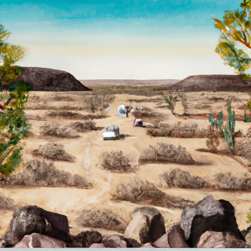
While camping at Bartlett Flat, visitors can enjoy recreational activities such as hiking, fishing, boating, and wildlife viewing. The camping area is surrounded by beautiful scenery, including stunning mountain views and a picturesque lake. However, campers should be cautious of potential wildlife encounters, such as snakes or coyotes, and take necessary precautions to ensure their safety. It is also important to pack essential items such as sunscreen, insect repellent, and sufficient water to stay hydrated during outdoor activities. Overall, Bartlett Flat camping area offers a serene and enjoyable camping experience for outdoor enthusiasts.
What's on-site at Bartlett Flat
Key facilities Snoflo tracks for this campground. Confirm with the operator before booking -- amenities can change seasonally.
Plan your trip down to the hour
Same weather feed Snoflo's iOS app uses -- updated continuously from NOAA / yr.no.
Next 5 days, hour by hour
Temperature line with weather symbols on top, snow + rain accumulation as columns, humidity as a dotted line.
5-day forecast table
Every 3 hours, broken out across temperature, snow, rain, humidity, and wind. Each cell is colour-coded relative to the column min/max so trends jump out at a glance.
| Time | Condition | Temp (°F) | Snow (in) | Rain (in) | Humidity (%) | Wind (mps) | Wind dir |
|---|---|---|---|---|---|---|---|
| Loading detailed forecast… | |||||||
15-day temperature & precipitation
Daily temperatures, snow, and rain projected over the next two weeks. Hover any point for the full breakdown.
Other campgrounds in the area
Snoflo-tracked campsites within driving distance of Bartlett Flat, with reservations status.
| Campground | Reservations | Toilets | View |
|---|---|---|---|
| Sb Cove Dispersed | ✗ | ✗ | → |
| Rverside | ✗ | ✗ | → |
| Bartlett Flat Dispersed | ✗ | ✗ | → |
| Box Bar Dispersed | ✗ | ✗ | → |
| Box Bar | ✗ | ✓ | → |
Nearby streamflow
USGS streamgauges within reach of Bartlett Flat -- pulled live from the National Water Information System.
| Streamgauge | Discharge | View |
|---|---|---|
| Verde River Blw Bartlett Dam | 181 cfs | → |
| Sycamore Creek Near Fort Mcdowell | 182 cfs | → |
| Verde R Blw Tangle Creek | 212 cfs | → |
| Cave Creek Blw Cottonwood Cr Near Cave Creek | · | → |
| Verde River Near Scottsdale | 108 cfs | → |
| Salt River Blw Stewart Mountain Dam | 475 cfs | → |
Nearby snow depths
NRCS SNOTEL stations within reach of Bartlett Flat -- relevant when planning a shoulder-season or alpine trip.
| SNOTEL station | Snowpack | 24h Snowfall | View |
|---|---|---|---|
| Fountain Hills 1.2 Nne | 0.0 in | 0.0 in | → |
| Workman Creek | 0.0 in | 0.0 in | → |
| Nohrsc Baker Butte Smt | 0.0 in | 0.0 in | → |
| Baker Butte | 1.0 in | 0.0 in | → |
| Baker Butte Smt | 0.0 in | 0.0 in | → |
Plan a longer trip
The closest parks, lakes, boat launches, and paddle runs so a camping night can grow into a full weekend.
Parks
- Wilderness Mazatzal
- George Doc Cavalliere Park
- Pinnacle Peak Park
- Mcdowell Mountain Park
- Florence Ely Nelson Desert Park
- Black Mountain Summit Park
Boat launches
- Bartlett Reservoir
- Boat Launch Road [Fsr 185] Maricopa County
- North Bartlett Dam Road Maricopa County
- Box Bar Shoreline Area And River Access Point
- Horseshoe Reservoir
- East Saguaro Del Norte Road 469, Maricopa County
Points of interest
- Sears-Kay Ruin
- Balanced Rock
- Marcus Landslide Loop Trailhead
- Marcus Landslide Loop
- Carefree Galleria
- Grace Renee Gallery
Paddle runs
- Lower Verde
- Southern Border Of Mazatzal Wilderness To Sheep Creek Bridge
- Red Creek To Southern Border Of Mazatzal Wilderness
- Boundary Of The Primary Jurisdiction Below Stewart Mountain Dam To Salt River Indian Reservation Boundary
- Salt River Indian Reservation Boundary To Immediately Above Granite Reef Dam Impoundment
- Lower Salt
Camping essentials & Leave No Trace
- Pack it in, pack it out
- Take all trash, food scraps, and gear back with you to keep campsites clean and protect wildlife.
- Respect wildlife
- Observe animals from a distance, store food securely, and never feed wildlife to maintain natural behavior and safety.
- Know before you go
- Check weather, fire restrictions, trail conditions, and permit requirements to ensure a safe and well-planned trip.
- Minimize campfire impact
- Use established fire rings, keep fires small, fully extinguish them, or opt for a camp stove when fires are restricted.
- Leave what you find
- Preserve natural and cultural features by avoiding removal of plants, rocks, artifacts, or other elements of the environment.
Set push alerts in the Snoflo app
Save Bartlett Flat as a favorite, set a custom threshold (precipitation, snowpack, freezing temperatures), and the iOS app will push the moment conditions cross.
About Bartlett Flat
Can I make reservations at Bartlett Flat?
This campground does not appear to accept reservations -- it's typically first-come, first-served. Arrive early on summer weekends.
How fresh is the weather data on this page?
The hourly forecast updates throughout the day from the NOAA / yr.no public feeds. Streamflow data is pulled live from USGS streamgauges and snowpack from the NRCS SNOTEL network.
What's the best time of year to visit?
Use the 15-day temperature & precipitation outlook on this page to plan -- pick a window with comfortable temperatures and low precipitation. For longer trips, the 5-day hourly meteogram shows snow + rain accumulation hour-by-hour.
How do I get to Bartlett Flat?
Tap Directions in the hero above to open driving directions in Google Maps, or Open in map to center the Snoflo interactive map on the campground.
Can I get alerts when conditions change?
Yes -- alerts are managed through the Snoflo iOS app. Favorite this campground, set a threshold (temperature, snowpack, precipitation), and you'll get a push the moment it crosses.
Other campgrounds near here
Snoflo-tracked campgrounds within driving distance of Bartlett Flat.