Eagle Cave Campground Campground
Community Reviews
Been here? Share the conditions.
Reviews, ratings & photos are added in the free Snoflo iOS app — rate a spot, tag the conditions, and your visit is verified by location. Add or manage your reviews from the app.
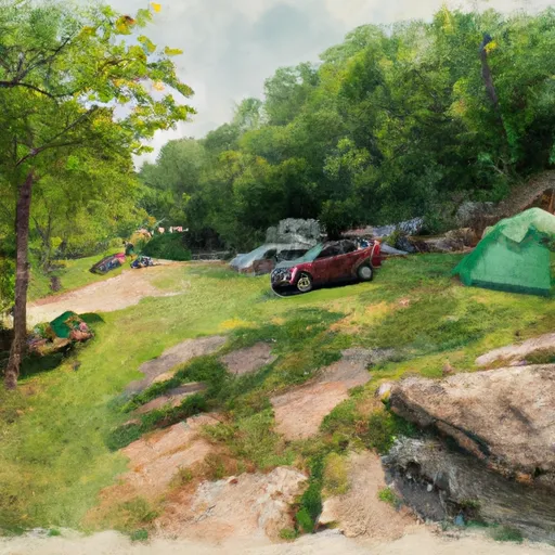
Eagle Cave Campground
What's on-site at Eagle Cave Campground
Key facilities Snoflo tracks for this campground. Confirm with the operator before booking -- amenities can change seasonally.
Plan your trip down to the hour
Same weather feed Snoflo's iOS app uses -- updated continuously from NOAA / yr.no.
Next 5 days, hour by hour
Temperature line with weather symbols on top, snow + rain accumulation as columns, humidity as a dotted line.
5-day forecast table
Every 3 hours, broken out across temperature, snow, rain, humidity, and wind. Each cell is colour-coded relative to the column min/max so trends jump out at a glance.
| Time | Condition | Temp (°F) | Snow (in) | Rain (in) | Humidity (%) | Wind (mps) | Wind dir |
|---|---|---|---|---|---|---|---|
| Loading detailed forecast… | |||||||
15-day temperature & precipitation
Daily temperatures, snow, and rain projected over the next two weeks. Hover any point for the full breakdown.
Other campgrounds in the area
Snoflo-tracked campsites within driving distance of Eagle Cave Campground, with reservations status.
| Campground | Reservations | Toilets | View |
|---|---|---|---|
| Muscoda Campground | ✗ | ✓ | → |
| Victoria Riverside Park - Muscoda | ✓ | ✓ | → |
| Avoca Lakeside City Campground | ✗ | ✗ | → |
| Jerome Kohout Private Property Camping | ✗ | ✗ | → |
| Beauford T. Anderson Park | ✗ | ✗ | → |
Nearby streamflow
USGS streamgauges within reach of Eagle Cave Campground -- pulled live from the National Water Information System.
| Streamgauge | Discharge | View |
|---|---|---|
| Wisconsin River At Muscoda | 4,730 cfs | → |
| Kickapoo River At Steuben | 578 cfs | → |
| Kickapoo River At La Farge | 192 cfs | → |
| Kickapoo River At State Highway 33 At Ontario | 149 cfs | → |
| Mississippi River At Mcgregor | 21,700 cfs | → |
| Platte River Near Rockville | 139 cfs | → |
Nearby snow depths
NRCS SNOTEL stations within reach of Eagle Cave Campground -- relevant when planning a shoulder-season or alpine trip.
| SNOTEL station | Snowpack | 24h Snowfall | View |
|---|---|---|---|
| Gays Mills | 0.0 in | 0.0 in | → |
| Hillsboro 2sw | 0.0 in | 0.0 in | → |
| Dodgeville | 0.0 in | 0.0 in | → |
| Cashton 3nnw | 0.0 in | 0.0 in | → |
| Genoa Dam 8 | 0.0 in | 0.0 in | → |
| Lock & Dam 10 | 0.0 in | 0.0 in | → |
Plan a longer trip
The closest parks, lakes, boat launches, and paddle runs so a camping night can grow into a full weekend.
Parks
- Krouskop Park
- Kickapoo Wildlife Area
- White Mound County Park
- Spring Green Preserve
- Tower Hill State Park
- Klondyke Park
Boat launches
- Wisconsin River -- Rice Lakes
- Wisconsin River -- Port Andrews Boat Landing
- Wisconsin River -- Blue River Landing
- Wisconsin River -- Eagle Corners Access
- Whites Slough -- Access - North Of W Pine Rd - Lower Wisconsin State Riverway
- Garner Lake -- Landing
Fishing spots
Points of interest
- Eagle Cave
- A. D. German Warehouse
- M60a3
- Steamboat Rock
- Elephant Trunk Rock
- Fennimore Railroad Historical Society Museum
Paddle runs
- Lone Rock To The Confluence Of The Green And Wisconsin Rivers
- The Big Green River To The River's Mouth At The Mississippi River
- Western Boundary Of Effigy Mounds National Monument To Boundary Of Effigy Mounds National Monument
- Honey Creek (County Road Y On The Southern Bank) To The State Route 130 Highway Bridge Crossing At Lone Rock
Camping essentials & Leave No Trace
- Pack it in, pack it out
- Take all trash, food scraps, and gear back with you to keep campsites clean and protect wildlife.
- Respect wildlife
- Observe animals from a distance, store food securely, and never feed wildlife to maintain natural behavior and safety.
- Know before you go
- Check weather, fire restrictions, trail conditions, and permit requirements to ensure a safe and well-planned trip.
- Minimize campfire impact
- Use established fire rings, keep fires small, fully extinguish them, or opt for a camp stove when fires are restricted.
- Leave what you find
- Preserve natural and cultural features by avoiding removal of plants, rocks, artifacts, or other elements of the environment.
Set push alerts in the Snoflo app
Save Eagle Cave Campground as a favorite, set a custom threshold (precipitation, snowpack, freezing temperatures), and the iOS app will push the moment conditions cross.
About Eagle Cave Campground
Can I make reservations at Eagle Cave Campground?
This campground does not appear to accept reservations -- it's typically first-come, first-served. Arrive early on summer weekends.
How fresh is the weather data on this page?
The hourly forecast updates throughout the day from the NOAA / yr.no public feeds. Streamflow data is pulled live from USGS streamgauges and snowpack from the NRCS SNOTEL network.
What's the best time of year to visit?
Use the 15-day temperature & precipitation outlook on this page to plan -- pick a window with comfortable temperatures and low precipitation. For longer trips, the 5-day hourly meteogram shows snow + rain accumulation hour-by-hour.
How do I get to Eagle Cave Campground?
Tap Directions in the hero above to open driving directions in Google Maps, or Open in map to center the Snoflo interactive map on the campground.
Can I get alerts when conditions change?
Yes -- alerts are managed through the Snoflo iOS app. Favorite this campground, set a threshold (temperature, snowpack, precipitation), and you'll get a push the moment it crosses.
Other campgrounds near here
Snoflo-tracked campgrounds within driving distance of Eagle Cave Campground.