Token Creek County Park Campground
Community Reviews
Been here? Share the conditions.
Reviews, ratings & photos are added in the free Snoflo iOS app — rate a spot, tag the conditions, and your visit is verified by location. Add or manage your reviews from the app.
Token Creek County Park
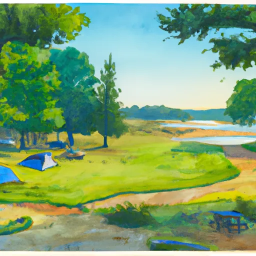
The campground amenities include picnic tables, fire rings, restrooms and showers, and a dump station. The park offers both reservation and first-come-first-serve campsites, with a total of 67 campsites available.
An interesting fact about the area is that it was once home to a Native American village over 1,000 years ago. Native American artifacts have been discovered in the area, and visitors can learn more about the history of the site through the park's educational programs.
The best time of year to visit Token Creek County Park is during the summer months from June through August, with average temperatures ranging from 70-80 degrees Fahrenheit. This is the peak season, so visitors should book their campsites in advance to ensure availability. Overall, Token Creek County Park is a great destination for those seeking a peaceful camping experience with breathtaking views and nearby attractions.
What's on-site at Token Creek County Park
Key facilities Snoflo tracks for this campground. Confirm with the operator before booking -- amenities can change seasonally.
Plan your trip down to the hour
Same weather feed Snoflo's iOS app uses -- updated continuously from NOAA / yr.no.
Next 5 days, hour by hour
Temperature line with weather symbols on top, snow + rain accumulation as columns, humidity as a dotted line.
5-day forecast table
Every 3 hours, broken out across temperature, snow, rain, humidity, and wind. Each cell is colour-coded relative to the column min/max so trends jump out at a glance.
| Time | Condition | Temp (°F) | Snow (in) | Rain (in) | Humidity (%) | Wind (mps) | Wind dir |
|---|---|---|---|---|---|---|---|
| Loading detailed forecast… | |||||||
15-day temperature & precipitation
Daily temperatures, snow, and rain projected over the next two weeks. Hover any point for the full breakdown.
Other campgrounds in the area
Snoflo-tracked campsites within driving distance of Token Creek County Park, with reservations status.
| Campground | Reservations | Toilets | View |
|---|---|---|---|
| Babcock County Park Campground | ✓ | ✗ | → |
| Eastern Lodi Marsh Dca | ✗ | ✗ | → |
| Jamison Town Park | ✗ | ✓ | → |
| Springfield Hill Dca | ✗ | ✗ | → |
| Badger Prairie Park Dca | ✗ | ✗ | → |
Nearby streamflow
USGS streamgauges within reach of Token Creek County Park -- pulled live from the National Water Information System.
| Streamgauge | Discharge | View |
|---|---|---|
| Yahara River At Windsor | 12 cfs | → |
| Yahara River At State Hwy 113 At Madison | 46 cfs | → |
| Yahara River At East Main Street At Madison | 1 cfs | → |
| Spring Creek Near Waunakee | 3 cfs | → |
| Pheasant Branch At Middleton | 2 cfs | → |
| Pheasant Branch At Airport Road Nr Middleton | · | → |
Nearby snow depths
NRCS SNOTEL stations within reach of Token Creek County Park -- relevant when planning a shoulder-season or alpine trip.
| SNOTEL station | Snowpack | 24h Snowfall | View |
|---|---|---|---|
| Madison | 0.0 in | 0.0 in | → |
| Nohrsc Fitchburg 1.1 Nw | 0.0 in | 0.0 in | → |
| Columbus | 0.0 in | 0.0 in | → |
| Baraboo Wwtp | 0.0 in | 0.0 in | → |
| Jefferson - Wwtp | 0.0 in | 0.0 in | → |
| Beaver Dam | 0.0 in | 0.0 in | → |
Plan a longer trip
The closest parks, lakes, boat launches, and paddle runs so a camping night can grow into a full weekend.
Parks
- Token Creek County Park
- Westchester Gardens Park
- Westchester Greenway Park
- Village Green East Park
- Oakridge Park
- Holiday Bluff Park
Boat launches
- Cherokee Marsh - South Boat Launch
- Cherokee Marsh -- Carry In Access
- Warner Park - Boat Launch
- Lake Mendota -- Governors Island
- Olbrich Park
- Tenney Park
Camping essentials & Leave No Trace
- Pack it in, pack it out
- Take all trash, food scraps, and gear back with you to keep campsites clean and protect wildlife.
- Respect wildlife
- Observe animals from a distance, store food securely, and never feed wildlife to maintain natural behavior and safety.
- Know before you go
- Check weather, fire restrictions, trail conditions, and permit requirements to ensure a safe and well-planned trip.
- Minimize campfire impact
- Use established fire rings, keep fires small, fully extinguish them, or opt for a camp stove when fires are restricted.
- Leave what you find
- Preserve natural and cultural features by avoiding removal of plants, rocks, artifacts, or other elements of the environment.
Set push alerts in the Snoflo app
Save Token Creek County Park as a favorite, set a custom threshold (precipitation, snowpack, freezing temperatures), and the iOS app will push the moment conditions cross.
About Token Creek County Park
Can I make reservations at Token Creek County Park?
Yes -- this campground accepts reservations. Snoflo recommends booking early for peak season; check the operator (Recreation.gov / state park system / private operator) for the booking window and cancellation policy.
How fresh is the weather data on this page?
The hourly forecast updates throughout the day from the NOAA / yr.no public feeds. Streamflow data is pulled live from USGS streamgauges and snowpack from the NRCS SNOTEL network.
What's the best time of year to visit?
Use the 15-day temperature & precipitation outlook on this page to plan -- pick a window with comfortable temperatures and low precipitation. For longer trips, the 5-day hourly meteogram shows snow + rain accumulation hour-by-hour.
How do I get to Token Creek County Park?
Tap Directions in the hero above to open driving directions in Google Maps, or Open in map to center the Snoflo interactive map on the campground.
Can I get alerts when conditions change?
Yes -- alerts are managed through the Snoflo iOS app. Favorite this campground, set a threshold (temperature, snowpack, precipitation), and you'll get a push the moment it crosses.
Other campgrounds near here
Snoflo-tracked campgrounds within driving distance of Token Creek County Park.