Tombigbee National Forest - Choctaw Lake Campground Campground
Community Reviews
Been here? Share the conditions.
Reviews, ratings & photos are added in the free Snoflo iOS app — rate a spot, tag the conditions, and your visit is verified by location. Add or manage your reviews from the app.
Tombigbee National Forest - Choctaw Lake Campground
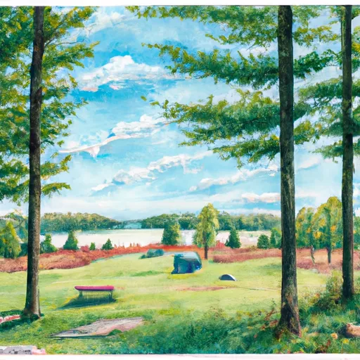
There are several points of interest nearby, including the Choctaw Lake Recreation Area, which offers hiking trails, fishing opportunities, and water-based activities. The campground is also located near the Tennessee-Tombigbee Waterway, a popular spot for boating enthusiasts.
The campground amenities include picnic tables, grills, and fire rings, as well as access to a nearby bathhouse with hot showers. The campground operates on a first-come, first-served basis and has a total of 26 campsites, making it an ideal spot for small groups or families.
An interesting fact about the area is that the forest is home to a variety of wildlife, including deer, coyotes, and black bears. Visitors are advised to take precautions when camping in bear country.
The best time of year to visit the Tombigbee National Forest Choctaw Lake Campground is during the spring and fall when temperatures are mild and the foliage is at its most vibrant. Average temperatures during these seasons range from the mid-60s to low 80s during the day and drop to the high 40s to mid-50s at night.
What's on-site at Tombigbee National Forest - Choctaw Lake Campground
Key facilities Snoflo tracks for this campground. Confirm with the operator before booking -- amenities can change seasonally.
Plan your trip down to the hour
Same weather feed Snoflo's iOS app uses -- updated continuously from NOAA / yr.no.
Next 5 days, hour by hour
Temperature line with weather symbols on top, snow + rain accumulation as columns, humidity as a dotted line.
5-day forecast table
Every 3 hours, broken out across temperature, snow, rain, humidity, and wind. Each cell is colour-coded relative to the column min/max so trends jump out at a glance.
| Time | Condition | Temp (°F) | Snow (in) | Rain (in) | Humidity (%) | Wind (mps) | Wind dir |
|---|---|---|---|---|---|---|---|
| Loading detailed forecast… | |||||||
15-day temperature & precipitation
Daily temperatures, snow, and rain projected over the next two weeks. Hover any point for the full breakdown.
Other campgrounds in the area
Snoflo-tracked campsites within driving distance of Tombigbee National Forest - Choctaw Lake Campground, with reservations status.
| Campground | Reservations | Toilets | View |
|---|---|---|---|
| Jeff Busby Campground | ✗ | ✗ | → |
| Kosciusko Bicycle-Only Campground, Milepost 160 | ✗ | ✗ | → |
| Kosciusko Welcome Center Bike Only Camping | ✗ | ✗ | → |
Nearby streamflow
USGS streamgauges within reach of Tombigbee National Forest - Choctaw Lake Campground -- pulled live from the National Water Information System.
| Streamgauge | Discharge | View |
|---|---|---|
| Yockanookany River Nr Kosciusko | 22 cfs | → |
| Pearl River At Burnside | 1,000 cfs | → |
| Catalpa Creek At Mayhew | 2,940 cfs | → |
| Pearl River At Edinburg | 74 cfs | → |
| Noxubee River At Macon | 63 cfs | → |
| Big Black River At West | 43 cfs | → |
Plan a longer trip
The closest parks, lakes, boat launches, and paddle runs so a camping night can grow into a full weekend.
Parks
- Tombigbee National Forest
- Legion State Park
- Sam D. Hamilton Noxubee National Wildlife Refuge
- Babe Ruth Park
- Niles Park
Camping essentials & Leave No Trace
- Pack it in, pack it out
- Take all trash, food scraps, and gear back with you to keep campsites clean and protect wildlife.
- Respect wildlife
- Observe animals from a distance, store food securely, and never feed wildlife to maintain natural behavior and safety.
- Know before you go
- Check weather, fire restrictions, trail conditions, and permit requirements to ensure a safe and well-planned trip.
- Minimize campfire impact
- Use established fire rings, keep fires small, fully extinguish them, or opt for a camp stove when fires are restricted.
- Leave what you find
- Preserve natural and cultural features by avoiding removal of plants, rocks, artifacts, or other elements of the environment.
Set push alerts in the Snoflo app
Save Tombigbee National Forest - Choctaw Lake Campground as a favorite, set a custom threshold (precipitation, snowpack, freezing temperatures), and the iOS app will push the moment conditions cross.
About Tombigbee National Forest - Choctaw Lake Campground
Can I make reservations at Tombigbee National Forest - Choctaw Lake Campground?
This campground does not appear to accept reservations -- it's typically first-come, first-served. Arrive early on summer weekends.
How fresh is the weather data on this page?
The hourly forecast updates throughout the day from the NOAA / yr.no public feeds. Streamflow data is pulled live from USGS streamgauges and snowpack from the NRCS SNOTEL network.
What's the best time of year to visit?
Use the 15-day temperature & precipitation outlook on this page to plan -- pick a window with comfortable temperatures and low precipitation. For longer trips, the 5-day hourly meteogram shows snow + rain accumulation hour-by-hour.
How do I get to Tombigbee National Forest - Choctaw Lake Campground?
Tap Directions in the hero above to open driving directions in Google Maps, or Open in map to center the Snoflo interactive map on the campground.
Can I get alerts when conditions change?
Yes -- alerts are managed through the Snoflo iOS app. Favorite this campground, set a threshold (temperature, snowpack, precipitation), and you'll get a push the moment it crosses.
Other campgrounds near here
Snoflo-tracked campgrounds within driving distance of Tombigbee National Forest - Choctaw Lake Campground.