4r2 - Ribbon Lake North Campground
Community Reviews
Been here? Share the conditions.
Reviews, ratings & photos are added in the free Snoflo iOS app — rate a spot, tag the conditions, and your visit is verified by location. Add or manage your reviews from the app.
4r2 - Ribbon Lake North
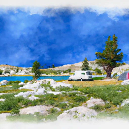
Reservations are not accepted at 4R2 - Ribbon Lake North camping area, making it a first-come, first-served destination. It is advisable to arrive early to secure a camping spot, especially during peak season when the campground tends to fill up quickly. The best time to visit this camping area is during the summer months, from June to August, when the weather is pleasant and suitable for various outdoor activities such as hiking, fishing, and wildlife viewing.
While exploring the camping area, campers should be cautious of potential wildlife encounters, as this part of Wyoming is home to various species, including bears. It is vital to store food properly and follow all recommended safety guidelines to ensure a safe camping experience. Moreover, visitors should be mindful of the natural surroundings and practice Leave No Trace principles, preserving the beauty and integrity of the camping area for future generations. Overall, 4R2 - Ribbon Lake North camping area provides a tranquil and well-equipped camping experience amidst the stunning natural beauty of Wyoming.
What's on-site at 4r2 - Ribbon Lake North
Key facilities Snoflo tracks for this campground. Confirm with the operator before booking -- amenities can change seasonally.
Plan your trip down to the hour
Same weather feed Snoflo's iOS app uses -- updated continuously from NOAA / yr.no.
Next 5 days, hour by hour
Temperature line with weather symbols on top, snow + rain accumulation as columns, humidity as a dotted line.
5-day forecast table
Every 3 hours, broken out across temperature, snow, rain, humidity, and wind. Each cell is colour-coded relative to the column min/max so trends jump out at a glance.
| Time | Condition | Temp (°F) | Snow (in) | Rain (in) | Humidity (%) | Wind (mps) | Wind dir |
|---|---|---|---|---|---|---|---|
| Loading detailed forecast… | |||||||
15-day temperature & precipitation
Daily temperatures, snow, and rain projected over the next two weeks. Hover any point for the full breakdown.
Other campgrounds in the area
Snoflo-tracked campsites within driving distance of 4r2 - Ribbon Lake North, with reservations status.
| Campground | Reservations | Toilets | View |
|---|---|---|---|
| 4r1 - Ribbon Lake West | ✓ | ✗ | → |
| Canyon - Yellowstone National Park | ✓ | ✓ | → |
| Old Seven Mile Hole | ✓ | ✗ | → |
| Yurt Winter Camp | ✗ | ✗ | → |
| Sulphur Creek | ✓ | ✗ | → |
Nearby streamflow
USGS streamgauges within reach of 4r2 - Ribbon Lake North -- pulled live from the National Water Information System.
| Streamgauge | Discharge | View |
|---|---|---|
| Yellowstone River At Yellowstone Lk Outlet Ynp | 2,550 cfs | → |
| Tantalus Creek At Norris Junction | 3 cfs | → |
| Lamar River Nr Tower Falls Ranger Station Ynp | 505 cfs | → |
| Gibbon River At Madison Jct | 90 cfs | → |
| Boiling River At Mammoth | 22 cfs | → |
| Firehole River Near West Yellowstone Mt | 208 cfs | → |
Nearby snow depths
NRCS SNOTEL stations within reach of 4r2 - Ribbon Lake North -- relevant when planning a shoulder-season or alpine trip.
| SNOTEL station | Snowpack | 24h Snowfall | View |
|---|---|---|---|
| Canyon | 0.0 in | 0.0 in | → |
| Nohrsc Canyon Snotel | 0.0 in | 0.0 in | → |
| Tower Falls Rs - Coop | 0.0 in | 0.0 in | → |
| Sylvan Lake | 0.0 in | 0.0 in | → |
| Nohrsc Sylvan Lake Snotel | 0.0 in | 0.0 in | → |
| Sylvan Road | 0.0 in | 0.0 in | → |
Plan a longer trip
The closest parks, lakes, boat launches, and paddle runs so a camping night can grow into a full weekend.
Fishing spots
Points of interest
- Point Sublime
- Inspiration Point
- Glacial Boulder
- Grand Canyon Of The Yellowstone
- Artist Point
- Lookout Point
Paddle runs
- Lower Falls To Ends 1/4 Mile Upstream From Northeast Enternace Road Bridge In The Area Of Tower Falls/ Roosevelt
- The Headwaters, In The Washburn Range To Ends Above Blanding Hill And The Road Access To Virginia Cascades
- Begins Above Blanding Hill And The Road Access To Virginia Cascades To The Confluence With Firehole River
- Outlet Of Yellowstone Lake At Fishing Bridge To Lower Falls
- Begins 1/4 Mile Upstream From Northeast Entrance Road Bridge In The Area Of Tower Falls/ Roosevelt To Ends 1/4 Mile Downstream From Northeast Entrance Road Bridge In The Area Of Tower Falls/ Roosevelt
- Begins 1/4 Mile Downstream From Northeast Entrance Road Bridge In The Area Of Tower Falls/ Roosevelt To Northern Park Boundary
Camping essentials & Leave No Trace
- Pack it in, pack it out
- Take all trash, food scraps, and gear back with you to keep campsites clean and protect wildlife.
- Respect wildlife
- Observe animals from a distance, store food securely, and never feed wildlife to maintain natural behavior and safety.
- Know before you go
- Check weather, fire restrictions, trail conditions, and permit requirements to ensure a safe and well-planned trip.
- Minimize campfire impact
- Use established fire rings, keep fires small, fully extinguish them, or opt for a camp stove when fires are restricted.
- Leave what you find
- Preserve natural and cultural features by avoiding removal of plants, rocks, artifacts, or other elements of the environment.
Set push alerts in the Snoflo app
Save 4r2 - Ribbon Lake North as a favorite, set a custom threshold (precipitation, snowpack, freezing temperatures), and the iOS app will push the moment conditions cross.
About 4r2 - Ribbon Lake North
Can I make reservations at 4r2 - Ribbon Lake North?
Yes -- this campground accepts reservations. Snoflo recommends booking early for peak season; check the operator (Recreation.gov / state park system / private operator) for the booking window and cancellation policy.
How fresh is the weather data on this page?
The hourly forecast updates throughout the day from the NOAA / yr.no public feeds. Streamflow data is pulled live from USGS streamgauges and snowpack from the NRCS SNOTEL network.
What's the best time of year to visit?
Use the 15-day temperature & precipitation outlook on this page to plan -- pick a window with comfortable temperatures and low precipitation. For longer trips, the 5-day hourly meteogram shows snow + rain accumulation hour-by-hour.
How do I get to 4r2 - Ribbon Lake North?
Tap Directions in the hero above to open driving directions in Google Maps, or Open in map to center the Snoflo interactive map on the campground.
Can I get alerts when conditions change?
Yes -- alerts are managed through the Snoflo iOS app. Favorite this campground, set a threshold (temperature, snowpack, precipitation), and you'll get a push the moment it crosses.
Other campgrounds near here
Snoflo-tracked campgrounds within driving distance of 4r2 - Ribbon Lake North.