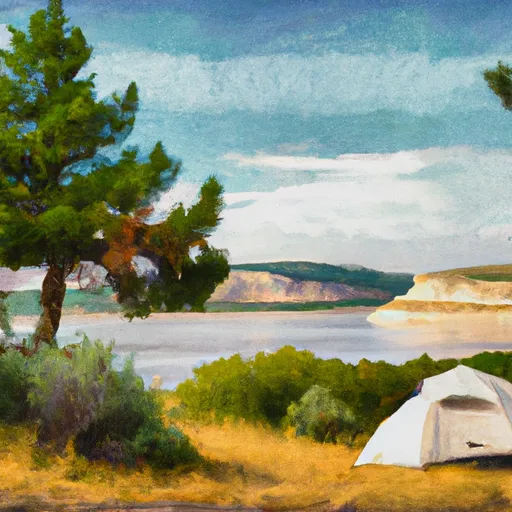
Grebe Lake Southeast Campground
Community Reviews
Been here? Share the conditions.
Reviews, ratings & photos are added in the free Snoflo iOS app — rate a spot, tag the conditions, and your visit is verified by location. Add or manage your reviews from the app.
Grebe Lake Southeast
Reservations are not accepted for the Grebe Lake Southeast camping area, as all sites are available on a first-come, first-served basis. As such, it is advisable to arrive early in the day to secure a spot, especially during the peak season. The best time of year to visit this camping area is generally from late spring to early fall when the weather is most favorable for outdoor activities. It is important to note that the campground is at a high elevation, so visitors should be prepared for cooler temperatures, even during the summer months.
For nature enthusiasts, Grebe Lake offers fantastic opportunities for fishing and wildlife viewing. The lake is known for its healthy trout population, making it a popular spot for anglers. Additionally, visitors can observe a variety of bird species, including grebes, herons, and ospreys. However, caution should be exercised in this area, as it is frequented by bears. Campers must properly store food and dispose of trash to avoid attracting wildlife. Overall, Grebe Lake Southeast camping area is a serene and picturesque destination for outdoor lovers seeking a peaceful camping experience in the beautiful state of Wyoming.
What's on-site at Grebe Lake Southeast
Key facilities Snoflo tracks for this campground. Confirm with the operator before booking -- amenities can change seasonally.
Plan your trip down to the hour
Same weather feed Snoflo's iOS app uses -- updated continuously from NOAA / yr.no.
Next 5 days, hour by hour
Temperature line with weather symbols on top, snow + rain accumulation as columns, humidity as a dotted line.
5-day forecast table
Every 3 hours, broken out across temperature, snow, rain, humidity, and wind. Each cell is colour-coded relative to the column min/max so trends jump out at a glance.
| Time | Condition | Temp (°F) | Snow (in) | Rain (in) | Humidity (%) | Wind (mps) | Wind dir |
|---|---|---|---|---|---|---|---|
| Loading detailed forecast… | |||||||
15-day temperature & precipitation
Daily temperatures, snow, and rain projected over the next two weeks. Hover any point for the full breakdown.
Other campgrounds in the area
Snoflo-tracked campsites within driving distance of Grebe Lake Southeast, with reservations status.
| Campground | Reservations | Toilets | View |
|---|---|---|---|
| Grebe Lake East | ✓ | ✗ | → |
| Grebe Lake North | ✓ | ✗ | → |
| Grebe Lake Outlet | ✓ | ✗ | → |
| Wolf Lake | ✓ | ✗ | → |
| Cascade Lake West | ✓ | ✗ | → |
Nearby streamflow
USGS streamgauges within reach of Grebe Lake Southeast -- pulled live from the National Water Information System.
| Streamgauge | Discharge | View |
|---|---|---|
| Tantalus Creek At Norris Junction | 3 cfs | → |
| Lamar River Nr Tower Falls Ranger Station Ynp | 505 cfs | → |
| Yellowstone River At Yellowstone Lk Outlet Ynp | 2,550 cfs | → |
| Gibbon River At Madison Jct | 90 cfs | → |
| Boiling River At Mammoth | 22 cfs | → |
| Firehole River Near West Yellowstone Mt | 208 cfs | → |
Nearby snow depths
NRCS SNOTEL stations within reach of Grebe Lake Southeast -- relevant when planning a shoulder-season or alpine trip.
| SNOTEL station | Snowpack | 24h Snowfall | View |
|---|---|---|---|
| Canyon | 0.0 in | 0.0 in | → |
| Nohrsc Canyon Snotel | 0.0 in | 0.0 in | → |
| Tower Falls Rs - Coop | 0.0 in | 0.0 in | → |
| Old Faithful Rs - Coop | 30.0 in | 0.0 in | → |
| Thumb Divide | 0.0 in | 0.0 in | → |
| Nohrsc Thumb Divide Snotel | 0.0 in | 0.0 in | → |
Plan a longer trip
The closest parks, lakes, boat launches, and paddle runs so a camping night can grow into a full weekend.
Fishing spots
Points of interest
- Canyon Visitor Education Center
- Canyon Horse Corral
- Lower Yellowstone Falls
- Brink Of The Upper Falls
- Upper Yellowstone Falls
- Lookout Point
Paddle runs
- The Headwaters, In The Washburn Range To Ends Above Blanding Hill And The Road Access To Virginia Cascades
- Lower Falls To Ends 1/4 Mile Upstream From Northeast Enternace Road Bridge In The Area Of Tower Falls/ Roosevelt
- Begins Above Blanding Hill And The Road Access To Virginia Cascades To The Confluence With Firehole River
- Begins 1/4 Mile Upstream From Northeast Entrance Road Bridge In The Area Of Tower Falls/ Roosevelt To Ends 1/4 Mile Downstream From Northeast Entrance Road Bridge In The Area Of Tower Falls/ Roosevelt
- Begins 1/4 Mile Downstream From Northeast Entrance Road Bridge In The Area Of Tower Falls/ Roosevelt To Northern Park Boundary
- Begins Downstream Of Osprey Falls To Confluence With Yellowstone River, At The Northern Park Boundary
Camping essentials & Leave No Trace
- Pack it in, pack it out
- Take all trash, food scraps, and gear back with you to keep campsites clean and protect wildlife.
- Respect wildlife
- Observe animals from a distance, store food securely, and never feed wildlife to maintain natural behavior and safety.
- Know before you go
- Check weather, fire restrictions, trail conditions, and permit requirements to ensure a safe and well-planned trip.
- Minimize campfire impact
- Use established fire rings, keep fires small, fully extinguish them, or opt for a camp stove when fires are restricted.
- Leave what you find
- Preserve natural and cultural features by avoiding removal of plants, rocks, artifacts, or other elements of the environment.
Set push alerts in the Snoflo app
Save Grebe Lake Southeast as a favorite, set a custom threshold (precipitation, snowpack, freezing temperatures), and the iOS app will push the moment conditions cross.
About Grebe Lake Southeast
Can I make reservations at Grebe Lake Southeast?
Yes -- this campground accepts reservations. Snoflo recommends booking early for peak season; check the operator (Recreation.gov / state park system / private operator) for the booking window and cancellation policy.
How fresh is the weather data on this page?
The hourly forecast updates throughout the day from the NOAA / yr.no public feeds. Streamflow data is pulled live from USGS streamgauges and snowpack from the NRCS SNOTEL network.
What's the best time of year to visit?
Use the 15-day temperature & precipitation outlook on this page to plan -- pick a window with comfortable temperatures and low precipitation. For longer trips, the 5-day hourly meteogram shows snow + rain accumulation hour-by-hour.
How do I get to Grebe Lake Southeast?
Tap Directions in the hero above to open driving directions in Google Maps, or Open in map to center the Snoflo interactive map on the campground.
Can I get alerts when conditions change?
Yes -- alerts are managed through the Snoflo iOS app. Favorite this campground, set a threshold (temperature, snowpack, precipitation), and you'll get a push the moment it crosses.
Other campgrounds near here
Snoflo-tracked campgrounds within driving distance of Grebe Lake Southeast.