Upper Bechler Canyon Ford Campground
Community Reviews
Been here? Share the conditions.
Reviews, ratings & photos are added in the free Snoflo iOS app — rate a spot, tag the conditions, and your visit is verified by location. Add or manage your reviews from the app.
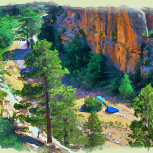
Upper Bechler Canyon Ford
The campground offers amenities such as fire pits, picnic tables, and access to potable water. The camping area is first-come-first-served and offers 16 campsites. An interesting fact about the area is that it is home to a geothermal feature known as the Bechler Meadows Hot Springs.
The best time of year to visit the Upper Bechler Canyon Ford camping area is during the summer months of June through September. During this time, temperatures range from the mid-70s during the day to the mid-40s at night. Visitors can enjoy hiking, fishing, and exploring the nearby natural landmarks during their stay.
What's on-site at Upper Bechler Canyon Ford
Key facilities Snoflo tracks for this campground. Confirm with the operator before booking -- amenities can change seasonally.
Plan your trip down to the hour
Same weather feed Snoflo's iOS app uses -- updated continuously from NOAA / yr.no.
Next 5 days, hour by hour
Temperature line with weather symbols on top, snow + rain accumulation as columns, humidity as a dotted line.
5-day forecast table
Every 3 hours, broken out across temperature, snow, rain, humidity, and wind. Each cell is colour-coded relative to the column min/max so trends jump out at a glance.
| Time | Condition | Temp (°F) | Snow (in) | Rain (in) | Humidity (%) | Wind (mps) | Wind dir |
|---|---|---|---|---|---|---|---|
| Loading detailed forecast… | |||||||
15-day temperature & precipitation
Daily temperatures, snow, and rain projected over the next two weeks. Hover any point for the full breakdown.
Other campgrounds in the area
Snoflo-tracked campsites within driving distance of Upper Bechler Canyon Ford, with reservations status.
| Campground | Reservations | Toilets | View |
|---|---|---|---|
| Albright Falls | ✓ | ✗ | → |
| 9b7 | ✗ | ✗ | → |
| Talus Spring | ✓ | ✗ | → |
| 9b6 | ✗ | ✗ | → |
| Lower Bechler Canyon Ford | ✓ | ✗ | → |
Nearby streamflow
USGS streamgauges within reach of Upper Bechler Canyon Ford -- pulled live from the National Water Information System.
| Streamgauge | Discharge | View |
|---|---|---|
| Snake River Ab Jackson Lake At Flagg Ranch Wy | 409 cfs | → |
| Falls River Ab Yellowstone Canal Nr Squirrel Id | 623 cfs | → |
| Falls River Nr Squirrel Id | 226 cfs | → |
| Big Springs At Big Springs Id | 128 cfs | → |
| Firehole River Near West Yellowstone Mt | 208 cfs | → |
| Henrys Fork Nr Island Park Id | 1,350 cfs | → |
Nearby snow depths
NRCS SNOTEL stations within reach of Upper Bechler Canyon Ford -- relevant when planning a shoulder-season or alpine trip.
| SNOTEL station | Snowpack | 24h Snowfall | View |
|---|---|---|---|
| Grassy Lake | 0.0 in | 0.0 in | → |
| Nohrsc Grassy Lake Snotel | 0.0 in | 0.0 in | → |
| Lewis Lake Divide | 0.0 in | 0.0 in | → |
| Nohrsc Lewis Lake Divide Snotel | 0.0 in | 0.0 in | → |
| Old Faithful Rs - Coop | 30.0 in | 0.0 in | → |
| Nohrsc South Entrance Ynp Snake River Station - Snotel | 0.0 in | 0.0 in | → |
Plan a longer trip
The closest parks, lakes, boat launches, and paddle runs so a camping night can grow into a full weekend.
Parks
- Yellowstone National Park
- Gallatin National Forest
- John D Rockefeller Jr Memorial Parkway
- Harriman State Park
- Henrys Lake State Park
Boat launches
Fishing spots
Points of interest
- Lone Star Geyser Basin
- Kepler Cascades
- Old Faithful Visitor Education Center
- Old Faithful Static Webcam
- Old Faithful Live Webcam
- Lewis Falls
Paddle runs
- The Headwaters To The Confluence With Falls River
- The Headwaters To Ends Approximately At Kepler Cascades
- The Headwaters To The Southern Yellowstone National Park Boundary
- Cave Falls Run
- Begins Approximately At Kepler Cascades To The Confluence With The Madison River
- Yellowstone Np To Targhee Nf Boundary
Camping essentials & Leave No Trace
- Pack it in, pack it out
- Take all trash, food scraps, and gear back with you to keep campsites clean and protect wildlife.
- Respect wildlife
- Observe animals from a distance, store food securely, and never feed wildlife to maintain natural behavior and safety.
- Know before you go
- Check weather, fire restrictions, trail conditions, and permit requirements to ensure a safe and well-planned trip.
- Minimize campfire impact
- Use established fire rings, keep fires small, fully extinguish them, or opt for a camp stove when fires are restricted.
- Leave what you find
- Preserve natural and cultural features by avoiding removal of plants, rocks, artifacts, or other elements of the environment.
Set push alerts in the Snoflo app
Save Upper Bechler Canyon Ford as a favorite, set a custom threshold (precipitation, snowpack, freezing temperatures), and the iOS app will push the moment conditions cross.
About Upper Bechler Canyon Ford
Can I make reservations at Upper Bechler Canyon Ford?
Yes -- this campground accepts reservations. Snoflo recommends booking early for peak season; check the operator (Recreation.gov / state park system / private operator) for the booking window and cancellation policy.
How fresh is the weather data on this page?
The hourly forecast updates throughout the day from the NOAA / yr.no public feeds. Streamflow data is pulled live from USGS streamgauges and snowpack from the NRCS SNOTEL network.
What's the best time of year to visit?
Use the 15-day temperature & precipitation outlook on this page to plan -- pick a window with comfortable temperatures and low precipitation. For longer trips, the 5-day hourly meteogram shows snow + rain accumulation hour-by-hour.
How do I get to Upper Bechler Canyon Ford?
Tap Directions in the hero above to open driving directions in Google Maps, or Open in map to center the Snoflo interactive map on the campground.
Can I get alerts when conditions change?
Yes -- alerts are managed through the Snoflo iOS app. Favorite this campground, set a threshold (temperature, snowpack, precipitation), and you'll get a push the moment it crosses.
Other campgrounds near here
Snoflo-tracked campgrounds within driving distance of Upper Bechler Canyon Ford.