Barnett

Climate Recreation Community Catastrophe

Barnett
Eden Index

Climate 8.3 Recreation 2.0 Community Safeguard

4.0/10

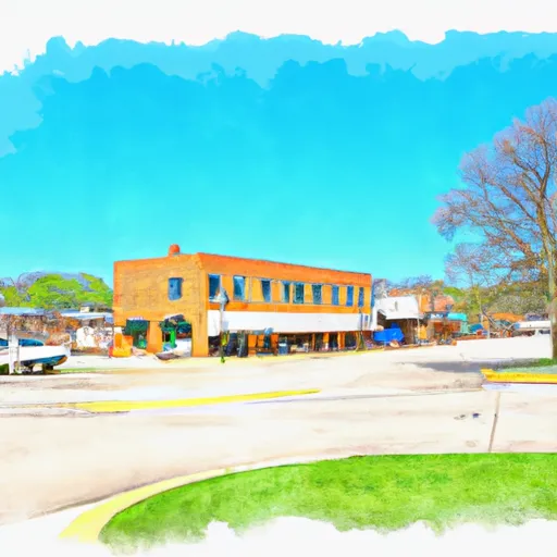
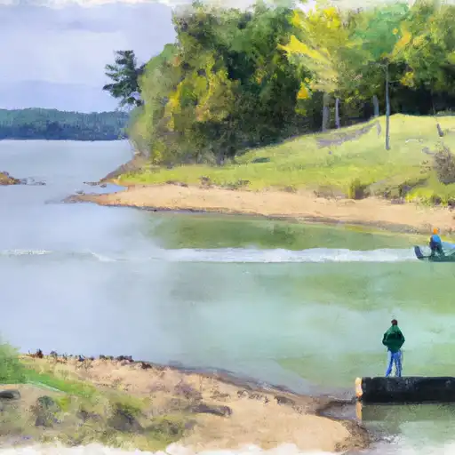
Barnett, Missouri is a small town with a population of around 200 people located in Morgan County. The climate in Barnett is classified as humid subtropical with hot summers and mild winters. The town is situated near the Lake of the Ozarks, which is a large reservoir that provides numerous aquatic recreational opportunities. The hydrology constituents in Barnett are primarily related to the lake, which is known for its excellent fishing and boating opportunities. Outdoor enthusiasts can enjoy activities such as hiking, camping, and wildlife viewing in the nearby state parks and conservation areas. Overall, Barnett is a great place to enjoy outdoor recreation in a beautiful natural setting.

What is the Eden Index?

The Snoflo Eden Index serves as a comprehensive rating system for regions, evaluating their desirability through a holistic assessment of climate health, outdoor recreation opportunities, and natural disaster risk, acknowledging the profound impact of these factors on livability and well-being.


Climate Health Indicator (CHI): 8.3


Barnett receives approximately 1089mm of rain per year, with humidity levels near 83% and air temperatures averaging around 13°C. Barnett has a plant hardyness factor of 6, meaning plants and agriculture in this region thrive during a short period during spring and early summer. Most plants will die off during the colder winter months. By considering the ideal temperature range, reliable water supplies, clean air, and stable seasonal rain or snowpacks, the Climate Health Indicator (CHI) underscores the significance of a healthy climate as the foundation for quality living.

A healthy climate is paramount for ensuring a high quality of life and livability in a region, fostering both physical well-being and environmental harmony. This can be characterized by ideal temperatures, reliable access to water supplies, clean air, and consistent seasonal rain or snowpacks.


Weather Forecast


Streamflow Conditions

Osage

Area Rivers

Osage


Snowpack Depths

Osage


Reservoir Storage Capacity

Osage


Groundwater Levels


Recreational Opportunity Index (ROI): 2.0


The Recreational Opportunity Index (ROI) recognizes the value of outdoor recreational options, such as parks, hiking trails, camping sites, and fishing spots, while acknowledging that climate plays a pivotal role in ensuring the comfort and consistency of these experiences. Access to outdoor recreational opportunities, encompassing activities such as parks, hiking, camping, and fishing, is crucial for overall well-being, and the climate plays a pivotal role in enabling and enhancing these experiences, ensuring that individuals can engage in nature-based activities comfortably and consistently.


Camping Areas

Campground Campsites Reservations Toilets Showers Elevation
Lake Keomah State Park 65 810 ft
Katy Roundhouse Campground None 601 ft
Eveland Access 26 679 ft
Lake of the Ozarks Military None 768 ft
Salisbury City Park None 714 ft
Versailles City Park None 990 ft
Thousand Hills State Park None 862 ft
Ozark Isle - Bull Shoals Lake None 689 ft
Lake Sylvia 27 704 ft
Stoehr Fishing Area None 1,064 ft
Oakland - Bull Shoals Lake None 722 ft
Lead Hill - Bull Shoals Lake None 678 ft
Point Return City Park 22 716 ft
Stump Island Park 12 618 ft
Theodosia None 691 ft
Sequoya Park 14 306 ft
Long Branch State Park None 841 ft
Wolf Creek Rec Area 22 963 ft
Pilot Grove City Park None 845 ft
Bennett Spring State Park None 880 ft
Pontiac None 796 ft
Maxwell Taylor Park None 702 ft
North Cedar Park 40 935 ft
Lake Wapello State Park 80 803 ft
Point Remove Park 16 281 ft
Riverview Park - Marshalltown None 868 ft
Union Grove State Park 26 1,022 ft
Glendale Access None 696 ft
Miami Lake Park None 918 ft
Rush Landing - Buffalo National River None 451 ft
Thunder Woman Park 190 878 ft
Cedar Creek Access None 704 ft
Buck Creek - Bull Shoals Lake None 724 ft
Cherokee None 277 ft
Thomas Hill Reservoir - Hwy T Campground - MDC 10 753 ft
Rock Creek State Park 200 902 ft
Lake Catherine State Park None 396 ft
Toad Suck Ferry None 274 ft
Shell Rock Rec Area 40 899 ft
Lakeview - Bull Shoals Lake None 757 ft
Richland Creek 13 1,034 ft
Lake of the Ozarks State Park 183 773 ft
Buffalo Point - Buffalo National River None 535 ft
Bull Shoals State Park None 516 ft
Roadman Roadside Park None 956 ft
Otter Creek Lake and Park 83 933 ft
Union Mills Access None 762 ft
Highway 125 - Bull Shoals Lake None 707 ft
Robertson Access None 758 ft
Diamond Lake County Park 100 910 ft
Quercus Wilderness Area 5 670 ft
Dam Site - Bull Shoals Lake None 681 ft
Tyler Bend - Buffalo National River None 614 ft

Catastrophe Safeguard Index (CSI):


The Catastrophe Safeguard Index (CSI) recognizes that natural disaster risk, encompassing floods, fires, hurricanes, and tornadoes, can drastically affect safety and the overall appeal of an area. The level of natural disaster risk in a region significantly affects safety and the overall livability, with climate change amplifying these risks by potentially increasing the frequency and intensity of events like floods, fires, hurricanes, and tornadoes, thereby posing substantial challenges to community resilience and well-being.


Community Resilience Indicator (CRI):


The Community Resilience Indicator (CRI) recognizes that education, healthcare, and socioeconomics are crucial to the well-being of a region. The CRI acknowledges the profound impact of these elements on residents' overall quality of life. By evaluating educational resources, healthcare accessibility, and economic inclusivity, the index captures the essential aspects that contribute to a thriving community, fostering resident satisfaction, equity, and social cohesion.


Log Your Visit

When was your last visit to ?

Add a Photo

How was it? How were conditions?

Rate the


Submit

Leave A Review


Submit

Upload an Image


Favorite Limit Reached