Cadron Creek Fishing
As of July 17, 2026, the nearest streamgauge to Cadron Creek — Cadron Creek Near Guy — reports 291 cfs. Source: USGS gauge data, refreshed throughout the day.
Community Reviews
Been here? Share the conditions.
Reviews, ratings & photos are added in the free Snoflo iOS app — rate a spot, tag the conditions, and your visit is verified by location. Add or manage your reviews from the app.
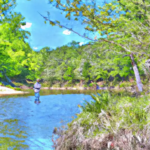
Cadron Creek
What's biting at Cadron Creek
Species commonly reported here -- tap any card for techniques, target seasons, and other waters where it's been caught.
Plan your trip down to the hour
Same weather feed Snoflo's iOS app uses -- updated continuously from NOAA / yr.no.
Next 5 days, hour by hour
Temperature line with weather symbols on top, snow + rain accumulation as columns, humidity as a dotted line.
5-day forecast table
Every 3 hours, broken out across temperature, snow, rain, humidity, and wind. Each cell is colour-coded relative to the column min/max so trends jump out at a glance.
| Time | Condition | Temp (°F) | Snow (in) | Rain (in) | Humidity (%) | Wind (mps) | Wind dir |
|---|---|---|---|---|---|---|---|
| Loading detailed forecast… | |||||||
15-day temperature & precipitation
Daily temperatures, snow, and rain projected over the next two weeks. Hover any point for the full breakdown.
Nearby streamflow
USGS streamgauges within reach of Cadron Creek -- updated continuously from the National Water Information System.
| Streamgauge | Discharge | View |
|---|---|---|
| Cadron Creek Near Guy | 291 cfs | → |
| Lake Maumelle At State Hwy 10 Near Wye | 293 cfs | → |
| Maumelle River At Maumelle Dam At Natural Steps | · | → |
| Maumelle River At Williams Junction | 3 cfs | → |
| West Fork Point Remove Creek Near Hattieville | 27 cfs | → |
| Fourche Lafave River Near Aplin | 143 cfs | → |
Plan a longer trip
The closest campgrounds, parks, boat launches, and reservoirs so a fishing run can grow into a weekend.
Campgrounds
- Toad Suck Ferry Campground
- Toad Suck Ferry
- Point Remove Park
- Camp Robinson Camping Area 1
- Sequoya Park
- Cherokee
Parks
- Ring Slough Wildlife Management Area
- Cove Creek Natural Area Wildlife Management Area
- Ed Gordon Point Remove Wildlife Management Area
- Sequoya Park
- Camp Robinson Wildlife Management Area
- Harris Brake Wildlife Management Area
Reservoirs
- Jones Lake Dam No 2
- Lake Carol-Dan Dam
- Arnoname 24
- Toad Suck Ferry Lock And Dam
- Ouachita Creek Wid Site 3
- Ouachita Creek Wid Site 2
Boat launches
- Yellow Mtb Trail Faulkner County
- Johnny Walker Road
- Taylor Creek
- Reservoir Road
- Simpson Street
- Gold Creek Landing
Paddle runs
- Forest Road 132c To Forest Raod 179
- Forest Road 179 To East Line Of Nw 1/4 Sec 22, T2n, R17w
- East Line Of Nw 1/4, Sec 22, T2n, R17w To West Line Of Sec 26, T2n, R17w
- Headwaters Sec 2, T2n, R18w To Forest Road 132c
- Lake Winona Dam To Southern Line Of Sec 16, T2n, R17w
- Headwaters Sec 2, T1n, R20w To Sec 7, T1n, R19w
Angling safety & ethics
- Know the regulations
- Check local fishing rules, seasons, size limits, and license requirements to ensure legal and sustainable angling.
- Handle fish responsibly
- Use wet hands, minimize air exposure, and release fish gently to improve survival rates when practicing catch-and-release.
- Choose the right gear
- Match your rod, line, and tackle to the species and conditions to increase success and reduce unnecessary harm to fish.
- Respect the waterway
- Avoid disturbing habitat, prevent bank erosion, and keep a safe distance from spawning areas to protect ecosystems.
- Keep it clean
- Pack out all line, hooks, bait containers, and trash. Discarded gear can injure wildlife and degrade waterways.
Set push alerts in the Snoflo app
Save Cadron Creek as a favorite, set a custom threshold (water temperature, streamflow, snowpack), and the iOS app will push the moment conditions cross.
About Cadron Creek
What fish species are found at Cadron Creek?
Snoflo tracks the species commonly reported at Cadron Creek -- see the Fish Species panel above for the live list with images and links to per-species pages.
How fresh is the weather data on this page?
The hourly forecast updates throughout the day from the NOAA / yr.no public feeds. Streamflow data comes live from USGS streamgauges, also refreshed continuously.
Can I get alerts when conditions change?
Yes -- alerts are managed through the Snoflo iOS app. Favorite this area, set a threshold (water temperature, streamflow, snowpack), and you'll get a push the moment it crosses.
Do I need a fishing license?
Yes. Check your state agency's regulations for license requirements, seasons, size limits, and any waterbody-specific rules before fishing Cadron Creek.
How do I get to Cadron Creek?
Tap Open in map in the hero above to center the Snoflo interactive map on this area, or grab the coordinates from the location facts panel.
Other angling spots near here
Snoflo-tracked fishing areas within driving distance of Cadron Creek.