-
Snoflo Premium
Get unlimited access to all our content
With no Ad interruptions! - Start Your Free Trial Login with existing account
Low-Moor
Eden Index
Climate
8.3
•
Recreation
4.2
•
Community
2.5
•
Safeguard
5.4/10
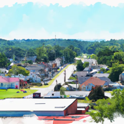
Low Moor is a small unincorporated community located in Alleghany County, Virginia. The climate in Low Moor is characterized as a humid subtropical climate, with hot summers and mild winters. Summers bring temperatures averaging in the upper 80s (°F), while winters are generally mild, with temperatures rarely dropping below freezing. Precipitation is evenly distributed throughout the year, with an average annual rainfall of around 40 inches.
Hydrologically, Low Moor is situated near the Jackson River, a tributary of the James River. The river provides opportunities for fishing, boating, and other water-based activities. The region is also known for its abundant groundwater resources, which contribute to the overall hydrology of the area.
Outdoor enthusiasts will find various recreation opportunities in and around Low Moor. The area offers scenic hiking trails, such as the Jackson River Scenic Trail and the Alleghany Highlands Blueway, which provide opportunities for nature exploration, bird-watching, and biking. There are also nearby national forests and state parks that offer camping, hunting, and wildlife viewing options. For those seeking relaxation, the nearby Hot Springs provides natural hot mineral baths and spa treatments. Whether you enjoy outdoor adventures or serene natural experiences, Low Moor and its surrounding area offer a range of opportunities to explore and enjoy the great outdoors.
What is the Eden Index?
The Snoflo Eden Index serves as a comprehensive rating system for regions, evaluating their desirability through a holistic assessment of climate health, outdoor recreation opportunities, and natural disaster risk, acknowledging the profound impact of these factors on livability and well-being.
Climate Health Indicator (CHI): 8.3
Low-Moor receives approximately
1043mm of rain per year,
with humidity levels near 82%
and air temperatures averaging around
13°C.
Low-Moor has a plant hardyness factor of
7, meaning
plants and agriculture in this region tend to thrive during the non-winter months.
By considering the ideal temperature range, reliable water supplies, clean air, and stable seasonal rain or snowpacks, the Climate Health Indicator (CHI) underscores the significance of a healthy climate as the foundation for quality living.
A healthy climate is paramount for ensuring a high quality of life and livability in a region, fostering both physical well-being and environmental harmony. This can be characterized by ideal temperatures, reliable access to water supplies, clean air, and consistent seasonal rain or snowpacks.
Weather Forecast
Streamflow Conditions
James
Area Rivers
James
Snowpack Depths
James
Reservoir Storage Capacity
James
Groundwater Levels
Recreational Opportunity Index (ROI): 4.2
The Recreational Opportunity Index (ROI) recognizes the value of outdoor recreational options, such as parks, hiking trails, camping sites, and fishing spots, while acknowledging that climate plays a pivotal role in ensuring the comfort and consistency of these experiences.
Access to outdoor recreational opportunities, encompassing activities such as parks, hiking, camping, and fishing, is crucial for overall well-being, and the climate plays a pivotal role in enabling and enhancing these experiences, ensuring that individuals can engage in nature-based activities comfortably and consistently.
Camping Areas
Campground | Campsites | Reservations | Toilets | Showers | Elevation |
---|---|---|---|---|---|
Goose Point - Philpott Lake | None | 1,155 ft | |||
Mcclintic Point | 57 | 1,593 ft | |||
Bird Run | 10 | 2,707 ft | |||
Meadow Creek - Lake Sherwood | 38 | 2,692 ft | |||
Bolar Mountain | 90 | 1,592 ft | |||
Kumbrabow State Forest | None | 3,006 ft | |||
Seneca State Forest | None | 2,683 ft | |||
Pine Run - Lake Sherwood | 36 | 2,687 ft | |||
Jamison Mill Park - Philpott Lake | None | 1,042 ft | |||
Roanoke Mountain - Blue Ridge Parkway | None | 1,458 ft | |||
Pocahontas | 9 | 2,488 ft | |||
Blowing Springs | 40 | 1,710 ft | |||
Goose Dam | None | 1,309 ft | |||
West Shore - Lake Sherwood | 155 | 2,687 ft | |||
Laurel Fork | 14 | 3,108 ft | |||
Salthouse Branch - Philpott Lake | None | 1,042 ft | |||
Horseshoe Point - Philpott Lake | None | 1,107 ft |
Nearby Ski Areas
Catastrophe Safeguard Index (CSI):
The Catastrophe Safeguard Index (CSI) recognizes that natural disaster risk, encompassing floods, fires, hurricanes, and tornadoes, can drastically affect safety and the overall appeal of an area.
The level of natural disaster risk in a region significantly affects safety and the overall livability, with climate change amplifying these risks by potentially increasing the frequency and intensity of events like floods, fires, hurricanes, and tornadoes, thereby posing substantial challenges to community resilience and well-being.
Community Resilience Indicator (CRI): 2.5
The Community Resilience Indicator (CRI) recognizes that education, healthcare, and socioeconomics are crucial to the well-being of a region. The CRI acknowledges the profound impact of these elements on residents' overall quality of life. By evaluating educational resources, healthcare accessibility, and economic inclusivity, the index captures the essential aspects that contribute to a thriving community, fostering resident satisfaction, equity, and social cohesion.