-
Snoflo Premium
Get unlimited access to all our content
With no Ad interruptions! - Start Your Free Trial Login with existing account
Red-Oak
Eden Index
Climate
9.7
•
Recreation
4.0
•
Community
•
Safeguard
5.3/10
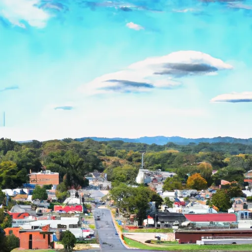
Red-Oak, Virginia is a picturesque town located in the southern region of the state. The climate in Red-Oak can be described as a humid subtropical climate, characterized by hot and humid summers and mild winters. Average temperatures range from the mid-80s Fahrenheit in summer to the mid-40s in winter, making it an ideal destination for outdoor enthusiasts throughout the year.
The town is blessed with abundant water resources, including several rivers and lakes. The hydrology constituents in Red-Oak consist of the Red-Oak River, which flows through the town, and nearby lakes and reservoirs. These water bodies offer excellent opportunities for fishing, boating, and water sports. Anglers can try their luck at catching bass, catfish, and various other freshwater fish species.
Red-Oak's scenic landscapes and natural beauty make it a great place for outdoor recreation. The town boasts numerous parks and trails for hiking, biking, and wildlife viewing. Nature enthusiasts can explore the lush forests and enjoy the vibrant colors during the fall season. Nearby state parks provide additional opportunities for camping, picnicking, and birdwatching.
Overall, Red-Oak, Virginia offers a pleasant climate, abundant water resources, and a variety of outdoor activities, making it an appealing destination for nature lovers and adventure seekers.
What is the Eden Index?
The Snoflo Eden Index serves as a comprehensive rating system for regions, evaluating their desirability through a holistic assessment of climate health, outdoor recreation opportunities, and natural disaster risk, acknowledging the profound impact of these factors on livability and well-being.
Climate Health Indicator (CHI): 9.7
Red-Oak receives approximately
1113mm of rain per year,
with humidity levels near 79%
and air temperatures averaging around
14°C.
Red-Oak has a plant hardyness factor of
7, meaning
plants and agriculture in this region tend to thrive during the non-winter months.
By considering the ideal temperature range, reliable water supplies, clean air, and stable seasonal rain or snowpacks, the Climate Health Indicator (CHI) underscores the significance of a healthy climate as the foundation for quality living.
A healthy climate is paramount for ensuring a high quality of life and livability in a region, fostering both physical well-being and environmental harmony. This can be characterized by ideal temperatures, reliable access to water supplies, clean air, and consistent seasonal rain or snowpacks.
Weather Forecast
Streamflow Conditions
Roanoke
Area Rivers
Roanoke
Snowpack Depths
Roanoke
Reservoir Storage Capacity
Roanoke
Groundwater Levels
Recreational Opportunity Index (ROI): 4.0
The Recreational Opportunity Index (ROI) recognizes the value of outdoor recreational options, such as parks, hiking trails, camping sites, and fishing spots, while acknowledging that climate plays a pivotal role in ensuring the comfort and consistency of these experiences.
Access to outdoor recreational opportunities, encompassing activities such as parks, hiking, camping, and fishing, is crucial for overall well-being, and the climate plays a pivotal role in enabling and enhancing these experiences, ensuring that individuals can engage in nature-based activities comfortably and consistently.
Camping Areas
Campground | Campsites | Reservations | Toilets | Showers | Elevation |
---|---|---|---|---|---|
Holly Point - Falls Lake | 62 | 360 ft | |||
Rolling View - Falls Lake | None | 345 ft | |||
James River State Park | None | 592 ft | |||
Staunton River State Park | None | 369 ft | |||
Longwood Rec Area - Kerr Reservoir | None | 344 ft | |||
William B. Umstead State Park | None | 250 ft | |||
Holliday Lake State Park | None | 509 ft | |||
Buffalo Landing - Kerr Reservoir | None | 350 ft | |||
Rudds Creek - Kerr Reservoir | None | 316 ft | |||
Ivy Hill Rec Area - Kerr Reservoir | None | 436 ft | |||
Occoneechee State Park | None | 431 ft |
Nearby Ski Areas
Catastrophe Safeguard Index (CSI):
The Catastrophe Safeguard Index (CSI) recognizes that natural disaster risk, encompassing floods, fires, hurricanes, and tornadoes, can drastically affect safety and the overall appeal of an area.
The level of natural disaster risk in a region significantly affects safety and the overall livability, with climate change amplifying these risks by potentially increasing the frequency and intensity of events like floods, fires, hurricanes, and tornadoes, thereby posing substantial challenges to community resilience and well-being.
Community Resilience Indicator (CRI):
The Community Resilience Indicator (CRI) recognizes that education, healthcare, and socioeconomics are crucial to the well-being of a region. The CRI acknowledges the profound impact of these elements on residents' overall quality of life. By evaluating educational resources, healthcare accessibility, and economic inclusivity, the index captures the essential aspects that contribute to a thriving community, fostering resident satisfaction, equity, and social cohesion.