Richland

Climate Recreation Community Catastrophe

Richland
Eden Index

Climate 8.3 Recreation 1.3 Community 1.5 Safeguard

4.1/10

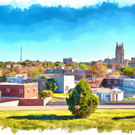
Richland, Missouri is a small town located in Pulaski County, in the central part of the state. The climate in Richland is generally humid subtropical, characterized by hot summers and mild winters. The average temperature in summer ranges from 75°F to 90°F, while in winter it ranges from 20°F to 40°F. The area receives moderate precipitation throughout the year.

Richland is blessed with abundant water resources, including several lakes and rivers. The Big Piney River and Gasconade River flow nearby, offering opportunities for fishing, boating, and kayaking. These waterways are home to various species of fish, including bass, catfish, and sunfish. Additionally, there are numerous streams and creeks in the area, providing additional options for outdoor water activities.

Outdoor enthusiasts can explore the Mark Twain National Forest, which surrounds Richland. This vast forest offers a range of recreational opportunities, such as hiking, camping, hunting, and birdwatching. The forest is also known for its scenic beauty, with rolling hills, lush greenery, and diverse wildlife.

In summary, Richland, Missouri boasts a pleasant climate, abundant water resources, and ample outdoor recreation opportunities, making it an attractive destination for nature lovers and adventure seekers.

What is the Eden Index?

The Snoflo Eden Index serves as a comprehensive rating system for regions, evaluating their desirability through a holistic assessment of climate health, outdoor recreation opportunities, and natural disaster risk, acknowledging the profound impact of these factors on livability and well-being.


Climate Health Indicator (CHI): 8.3


Richland receives approximately 1110mm of rain per year, with humidity levels near 83% and air temperatures averaging around 13°C. Richland has a plant hardyness factor of 6, meaning plants and agriculture in this region thrive during a short period during spring and early summer. Most plants will die off during the colder winter months. By considering the ideal temperature range, reliable water supplies, clean air, and stable seasonal rain or snowpacks, the Climate Health Indicator (CHI) underscores the significance of a healthy climate as the foundation for quality living.

A healthy climate is paramount for ensuring a high quality of life and livability in a region, fostering both physical well-being and environmental harmony. This can be characterized by ideal temperatures, reliable access to water supplies, clean air, and consistent seasonal rain or snowpacks.


Weather Forecast


Streamflow Conditions

Gasconade

Area Rivers

Gasconade


Snowpack Depths

Gasconade


Reservoir Storage Capacity

Gasconade


Groundwater Levels


Recreational Opportunity Index (ROI): 1.3


The Recreational Opportunity Index (ROI) recognizes the value of outdoor recreational options, such as parks, hiking trails, camping sites, and fishing spots, while acknowledging that climate plays a pivotal role in ensuring the comfort and consistency of these experiences. Access to outdoor recreational opportunities, encompassing activities such as parks, hiking, camping, and fishing, is crucial for overall well-being, and the climate plays a pivotal role in enabling and enhancing these experiences, ensuring that individuals can engage in nature-based activities comfortably and consistently.


Camping Areas

Campground Campsites Reservations Toilets Showers Elevation
Toad Suck Ferry None 274 ft
Hickory Hills Park - La Porte City 80 911 ft
Thomas Hill Reservoir - Hwy T Campground - MDC 10 753 ft
Diamond Lake County Park 100 910 ft
Shell Rock Rec Area 40 899 ft
Old Lock and Dam 8 5 91 ft
Rush Landing - Buffalo National River None 451 ft
Cranfield - Norfolk Lake None 566 ft
Woolly Hollow State Park None 483 ft
Moro Bay State Park None 90 ft
Pontiac None 796 ft
Macon Co Park None 873 ft
Buffalo Point - Buffalo National River None 535 ft
Dam Site - Bull Shoals Lake None 681 ft
Rothwell Park None 858 ft
North Cedar Park 40 935 ft
Point Return City Park 22 716 ft
Long Branch State Park None 841 ft
Maumelle None 281 ft
Drakesville City Park 6 886 ft
Jordan - Norfolk Lake None 683 ft
Burns Park 38 280 ft
Roubidoux Springs None 775 ft
Bull Shoals State Park None 516 ft
Yenruogis County Park None 799 ft
Cedar Bend Park 40 975 ft
Lake Keomah State Park 65 810 ft
Bidwell Point - Norfolk Lake None 549 ft
Deerwood City Park None 838 ft
Big Woods Lake None 859 ft
Robinson Point - Norfolk Lake None 605 ft
Lake Fisher 6 840 ft
Lake DArbonne State Park None 191 ft
Lake of the Ozarks Military None 768 ft
Rippee Conserrvation Area - MDC None 793 ft
Downtown Riverside RV Park 69 250 ft
Lakeview - Bull Shoals Lake None 757 ft
Woods Point - Norfolk Lake 11 548 ft
T. F. Clark Co Park 13 891 ft
Henderson - Norfolk Lake None 590 ft
Lake of the Ozarks State Park 183 773 ft
Finger Lakes State Park None 725 ft
Binder Park 17 655 ft
Patrick Bridge Access - MDC 12 613 ft
Alcock Park 40 1,018 ft
Union Mills Access None 762 ft
Chacauqua River Access None 721 ft
Black Hawk County Park None 858 ft
Split Rock County Park 54 1,069 ft
Camp Robinson RV Military None 512 ft
Gunner Pool 40 492 ft
Gamaliel - Norfolk Lake None 648 ft
Otter Creek Lake and Park 83 933 ft
Thunder Woman Park 190 878 ft
Lake Wapello State Park 80 803 ft
Panther Bay - Norfolk Lake None 639 ft
Barkshed 6 559 ft
Glendale Access None 696 ft
George Wyth State Park 70 849 ft
Quarry Cove - Norfolk Lake None 628 ft
McGowen Rec Area 12 857 ft

Catastrophe Safeguard Index (CSI):


The Catastrophe Safeguard Index (CSI) recognizes that natural disaster risk, encompassing floods, fires, hurricanes, and tornadoes, can drastically affect safety and the overall appeal of an area. The level of natural disaster risk in a region significantly affects safety and the overall livability, with climate change amplifying these risks by potentially increasing the frequency and intensity of events like floods, fires, hurricanes, and tornadoes, thereby posing substantial challenges to community resilience and well-being.


Community Resilience Indicator (CRI): 1.5


The Community Resilience Indicator (CRI) recognizes that education, healthcare, and socioeconomics are crucial to the well-being of a region. The CRI acknowledges the profound impact of these elements on residents' overall quality of life. By evaluating educational resources, healthcare accessibility, and economic inclusivity, the index captures the essential aspects that contribute to a thriving community, fostering resident satisfaction, equity, and social cohesion.


Log Your Visit

When was your last visit to ?

Add a Photo

How was it? How were conditions?

Rate the


Submit

Leave A Review


Submit

Upload an Image


Favorite Limit Reached