-
Snoflo Premium
Get unlimited access to all our content
With no Ad interruptions! - Start Your Free Trial Login with existing account
Saucier
Eden Index
Climate
6.8
•
Recreation
3.7
•
Community
0.9
•
Safeguard
4.2/10
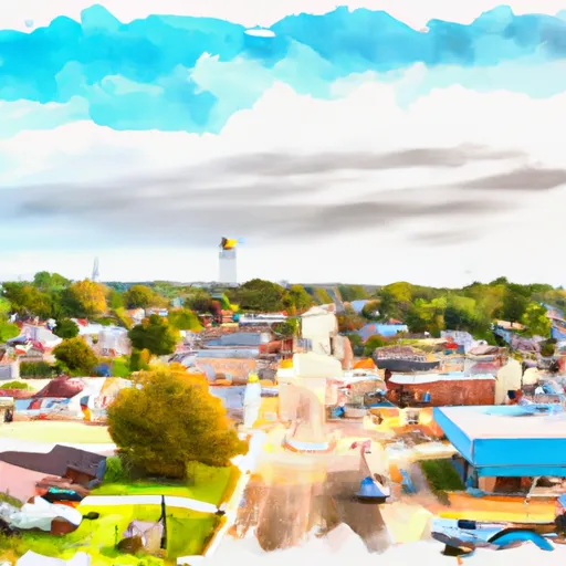
Saucier is a small town located in Harrison County, Mississippi. Situated in the southeastern region of the state, Saucier experiences a humid subtropical climate. Summers are hot and humid, with temperatures often exceeding 90°F (32°C), while winters are mild with average temperatures around 50°F (10°C). The area receives ample rainfall throughout the year, which contributes to the lush greenery and diverse hydrology constituents.
Saucier benefits from its proximity to the Biloxi River and the Big Biloxi Wildlife Management Area, offering numerous outdoor recreation opportunities. Anglers can enjoy fishing for a variety of freshwater species in the river, while bird watchers can observe the rich avian diversity found in the surrounding wetlands. The Big Biloxi Wildlife Management Area provides opportunities for hiking, camping, and wildlife viewing, allowing visitors to immerse themselves in the natural beauty of the area.
Overall, Saucier's favorable climate, abundant water resources, and diverse outdoor recreation opportunities make it an attractive destination for nature enthusiasts and those seeking to experience the tranquility of Mississippi's coastal region.
What is the Eden Index?
The Snoflo Eden Index serves as a comprehensive rating system for regions, evaluating their desirability through a holistic assessment of climate health, outdoor recreation opportunities, and natural disaster risk, acknowledging the profound impact of these factors on livability and well-being.
Climate Health Indicator (CHI): 6.8
Saucier receives approximately
1742mm of rain per year,
with humidity levels near 85%
and air temperatures averaging around
20°C.
Saucier has a plant hardyness factor of
8, meaning
plants and agriculture in this region tend to thrive here all year round.
By considering the ideal temperature range, reliable water supplies, clean air, and stable seasonal rain or snowpacks, the Climate Health Indicator (CHI) underscores the significance of a healthy climate as the foundation for quality living.
A healthy climate is paramount for ensuring a high quality of life and livability in a region, fostering both physical well-being and environmental harmony. This can be characterized by ideal temperatures, reliable access to water supplies, clean air, and consistent seasonal rain or snowpacks.
Weather Forecast
Streamflow Conditions
Pascagoula. Mississippi
Area Rivers
Pascagoula. Mississippi
Snowpack Depths
Pascagoula. Mississippi
Reservoir Storage Capacity
Pascagoula. Mississippi
Groundwater Levels
Recreational Opportunity Index (ROI): 3.7
The Recreational Opportunity Index (ROI) recognizes the value of outdoor recreational options, such as parks, hiking trails, camping sites, and fishing spots, while acknowledging that climate plays a pivotal role in ensuring the comfort and consistency of these experiences.
Access to outdoor recreational opportunities, encompassing activities such as parks, hiking, camping, and fishing, is crucial for overall well-being, and the climate plays a pivotal role in enabling and enhancing these experiences, ensuring that individuals can engage in nature-based activities comfortably and consistently.
Camping Areas
Campground | Campsites | Reservations | Toilets | Showers | Elevation |
---|---|---|---|---|---|
Lake Taylorville City Campground | None | 605 ft | |||
Flint Creek Waterpark | 156 | 246 ft | |||
Janice Rec.Area | 7 | 116 ft | |||
Lake Boque Homa | None | 238 ft | |||
Big Creek Waterpark | None | 254 ft | |||
Lake De Pue City Park | 25 | 466 ft | |||
Paul B Johnson State Park | None | 245 ft | |||
Ramsey Lake State Park | 160 | 628 ft | |||
Eldon Hazlet State Park | 350 | 455 ft | |||
Airey Lake | None | 170 ft | |||
Keesler AFB Military | 52 | 22 ft | |||
Coles Creek - Lake Carlyle | 150 | 459 ft | |||
Boulder - Lake Carlyle | 90 | 457 ft | |||
Lake Claude Bennett | 31 | 414 ft | |||
Moodys Landing | 7 | 135 ft | |||
Shields RV Military - Gulfport NCB | None | 26 ft | |||
Fairley Bridge Landing | 6 | 88 ft | |||
Cypress Creek Landing | 17 | 103 ft | |||
Comlara County Park | 137 | 756 ft | |||
Big Biloxi Rec Area | 31 | 50 ft | |||
Lake Walker Military - Camp Shelby | None | 239 ft | |||
Weldon Springs State Park | 75 | 717 ft | |||
Lake Perry | 20 | 157 ft | |||
Starved Rock State Park | 135 | 511 ft | |||
Turkey Creek Water Park | 22 | 434 ft |
Nearby Fishing
Catastrophe Safeguard Index (CSI):
The Catastrophe Safeguard Index (CSI) recognizes that natural disaster risk, encompassing floods, fires, hurricanes, and tornadoes, can drastically affect safety and the overall appeal of an area.
The level of natural disaster risk in a region significantly affects safety and the overall livability, with climate change amplifying these risks by potentially increasing the frequency and intensity of events like floods, fires, hurricanes, and tornadoes, thereby posing substantial challenges to community resilience and well-being.
Community Resilience Indicator (CRI): 0.9
The Community Resilience Indicator (CRI) recognizes that education, healthcare, and socioeconomics are crucial to the well-being of a region. The CRI acknowledges the profound impact of these elements on residents' overall quality of life. By evaluating educational resources, healthcare accessibility, and economic inclusivity, the index captures the essential aspects that contribute to a thriving community, fostering resident satisfaction, equity, and social cohesion.