Throckmorton

Climate Recreation Community Catastrophe

Throckmorton
Eden Index

Climate 9.7 Recreation 0.3 Community 0.9 Safeguard

4.2/10

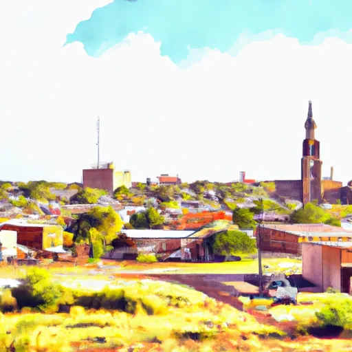
Throckmorton is a small town located in Throckmorton County, Texas. Situated in the northern part of the state, Throckmorton experiences a humid subtropical climate with hot summers and mild winters. Summers are typically hot and dry with temperatures averaging in the high 90s°F (36°C), while winters are cool with temperatures ranging from the 30s°F (0°C) to the 50s°F (10°C). The area receives an average annual precipitation of around 24 inches, mainly occurring during the spring and fall months.

Hydrologically, Throckmorton is surrounded by various small rivers and creeks, including the Brazos River, Hubbard Creek, and Clear Fork. These water bodies provide opportunities for boating, fishing, and water sports enthusiasts. Anglers can find a variety of fish species in these waters, including bass, catfish, and crappie.

Outdoor recreation opportunities in Throckmorton also extend beyond water activities. The town is surrounded by picturesque landscapes, making it a popular destination for hiking, camping, and wildlife observation. Visitors can explore nearby parks and nature reserves, such as Copper Breaks State Park and the T.P. Hill Wildlife Management Area, where they can experience the beauty of the Texas wilderness and encounter diverse flora and fauna.

In summary, Throckmorton offers a humid subtropical climate, with hot summers and mild winters. Its hydrology constituents include several rivers and creeks, providing opportunities for water-based activities like fishing and boating. Additionally, the town's natural surroundings offer various outdoor recreational opportunities such as hiking, camping, and wildlife observation.

What is the Eden Index?

The Snoflo Eden Index serves as a comprehensive rating system for regions, evaluating their desirability through a holistic assessment of climate health, outdoor recreation opportunities, and natural disaster risk, acknowledging the profound impact of these factors on livability and well-being.


Climate Health Indicator (CHI): 9.7


Throckmorton receives approximately 671mm of rain per year, with humidity levels near 78% and air temperatures averaging around 18°C. Throckmorton has a plant hardyness factor of 7, meaning plants and agriculture in this region tend to thrive during the non-winter months. By considering the ideal temperature range, reliable water supplies, clean air, and stable seasonal rain or snowpacks, the Climate Health Indicator (CHI) underscores the significance of a healthy climate as the foundation for quality living.

A healthy climate is paramount for ensuring a high quality of life and livability in a region, fostering both physical well-being and environmental harmony. This can be characterized by ideal temperatures, reliable access to water supplies, clean air, and consistent seasonal rain or snowpacks.


Weather Forecast


Streamflow Conditions

Middle Brazos-Clear Fork

Area Rivers

Middle Brazos-Clear Fork


Snowpack Depths

Middle Brazos-Clear Fork


Reservoir Storage Capacity

Middle Brazos-Clear Fork


Groundwater Levels


Recreational Opportunity Index (ROI): 0.3


The Recreational Opportunity Index (ROI) recognizes the value of outdoor recreational options, such as parks, hiking trails, camping sites, and fishing spots, while acknowledging that climate plays a pivotal role in ensuring the comfort and consistency of these experiences. Access to outdoor recreational opportunities, encompassing activities such as parks, hiking, camping, and fishing, is crucial for overall well-being, and the climate plays a pivotal role in enabling and enhancing these experiences, ensuring that individuals can engage in nature-based activities comfortably and consistently.


Catastrophe Safeguard Index (CSI):


The Catastrophe Safeguard Index (CSI) recognizes that natural disaster risk, encompassing floods, fires, hurricanes, and tornadoes, can drastically affect safety and the overall appeal of an area. The level of natural disaster risk in a region significantly affects safety and the overall livability, with climate change amplifying these risks by potentially increasing the frequency and intensity of events like floods, fires, hurricanes, and tornadoes, thereby posing substantial challenges to community resilience and well-being.


Community Resilience Indicator (CRI): 0.9


The Community Resilience Indicator (CRI) recognizes that education, healthcare, and socioeconomics are crucial to the well-being of a region. The CRI acknowledges the profound impact of these elements on residents' overall quality of life. By evaluating educational resources, healthcare accessibility, and economic inclusivity, the index captures the essential aspects that contribute to a thriving community, fostering resident satisfaction, equity, and social cohesion.


Log Your Visit

When was your last visit to ?

Add a Photo

How was it? How were conditions?

Rate the


Submit

Leave A Review


Submit

Upload an Image


Favorite Limit Reached