

-
 Snoflo Premium
Get unlimited access to all our content
With no Ad interruptions! - Start Your Free Trial Login with existing account
Underwood
Eden Index
Climate
8.0
•
Recreation
7.0
•
Community
3.6
•
Safeguard
6.6/10
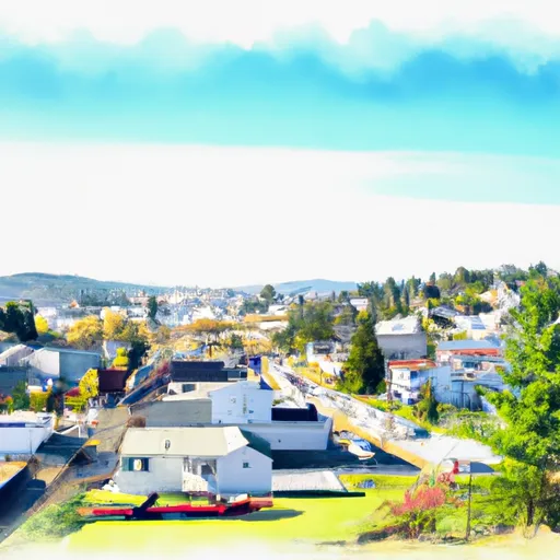
Underwood is a small community located in the Columbia River Gorge in Washington state. The climate in Underwood is classified as a Mediterranean climate, characterized by hot, dry summers and mild, wet winters. Summers are typically sunny with temperatures ranging from the mid-70s to low 90s Fahrenheit, while winters are cooler with temperatures ranging from the high 30s to mid-40s Fahrenheit.
Hydrologically, Underwood is surrounded by the Columbia River and its tributaries. These waterways offer numerous recreational opportunities such as fishing, boating, and kayaking. The Columbia River Gorge is also known for its strong winds, making it a popular destination for windsurfing and kiteboarding enthusiasts.
Apart from water-based activities, Underwood also provides opportunities for hiking, camping, and birdwatching. Nearby trails, including the famous Pacific Crest Trail, offer breathtaking views of the surrounding landscape, showcasing the region's diverse flora and fauna.
Overall, Underwood, Washington offers a Mediterranean climate, abundant hydrological constituents in the form of rivers and tributaries, and various outdoor recreation opportunities centered around water-based activities, hiking, and camping.
What is the Eden Index?
The Snoflo Eden Index serves as a comprehensive rating system for regions, evaluating their desirability through a holistic assessment of climate health, outdoor recreation opportunities, and natural disaster risk, acknowledging the profound impact of these factors on livability and well-being.
Climate Health Indicator (CHI): 8.0
Underwood receives approximately
816mm of rain per year,
with humidity levels near 82%
and air temperatures averaging around
10°C.
Underwood has a plant hardyness factor of
7, meaning
plants and agriculture in this region tend to thrive during the non-winter months.
By considering the ideal temperature range, reliable water supplies, clean air, and stable seasonal rain or snowpacks, the Climate Health Indicator (CHI) underscores the significance of a healthy climate as the foundation for quality living.
A healthy climate is paramount for ensuring a high quality of life and livability in a region, fostering both physical well-being and environmental harmony. This can be characterized by ideal temperatures, reliable access to water supplies, clean air, and consistent seasonal rain or snowpacks.
Weather Forecast
Streamflow Conditions
Middle Columbia
Area Rivers
Middle Columbia
Snowpack Depths
Middle Columbia
Reservoir Storage Capacity
Middle Columbia
Groundwater Levels
Recreational Opportunity Index (ROI): 7.0
The Recreational Opportunity Index (ROI) recognizes the value of outdoor recreational options, such as parks, hiking trails, camping sites, and fishing spots, while acknowledging that climate plays a pivotal role in ensuring the comfort and consistency of these experiences.
Access to outdoor recreational opportunities, encompassing activities such as parks, hiking, camping, and fishing, is crucial for overall well-being, and the climate plays a pivotal role in enabling and enhancing these experiences, ensuring that individuals can engage in nature-based activities comfortably and consistently.
Camping Areas
| Campground | Campsites | Reservations | Toilets | Showers | Elevation |
|---|---|---|---|---|---|
| South | 8 | 4,070 ft | |||
| Peterson Prairie | 35 | 3,000 ft | |||
| Tillicum | 15 | 3,885 ft | |||
| Bird Lake | None | 5,590 ft | |||
| Morrison Creek | 12 | 4,683 ft | |||
| Forlorn Lakes | 27 | 3,706 ft | |||
| Surprise Lakes Indian | 10 | 4,209 ft | |||
| Guler - Mt. Adams Park | None | 1,932 ft | |||
| Little Goose | 5 | 4,002 ft | |||
| Cold Spring Indian | 7 | 3,902 ft |
Nearby Fishing
Nearby Ski Areas
Catastrophe Safeguard Index (CSI):
The Catastrophe Safeguard Index (CSI) recognizes that natural disaster risk, encompassing floods, fires, hurricanes, and tornadoes, can drastically affect safety and the overall appeal of an area.
The level of natural disaster risk in a region significantly affects safety and the overall livability, with climate change amplifying these risks by potentially increasing the frequency and intensity of events like floods, fires, hurricanes, and tornadoes, thereby posing substantial challenges to community resilience and well-being.
Community Resilience Indicator (CRI): 3.6
The Community Resilience Indicator (CRI) recognizes that education, healthcare, and socioeconomics are crucial to the well-being of a region. The CRI acknowledges the profound impact of these elements on residents' overall quality of life. By evaluating educational resources, healthcare accessibility, and economic inclusivity, the index captures the essential aspects that contribute to a thriving community, fostering resident satisfaction, equity, and social cohesion.