

-
 Snoflo Premium
Get unlimited access to all our content
With no Ad interruptions! - Start Your Free Trial Login with existing account
Vail
Eden Index
Climate
9.0
•
Recreation
4.3
•
Community
2.9
•
Safeguard
5.8/10
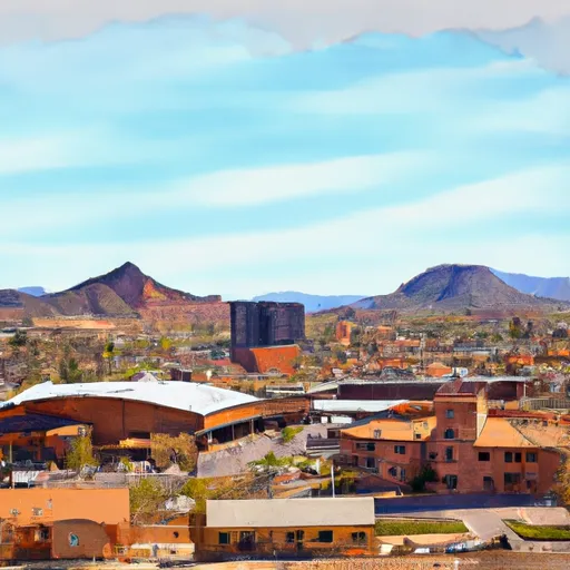
Vail, Arizona is a small community located southeast of Tucson. The area enjoys a desert climate with hot summers and mild winters. Summers can reach temperatures of 100°F (38°C) or higher, while winters experience average temperatures in the 60s°F (15-20°C). The region receives very little rainfall, with an annual average of around 12 inches (30 cm). However, during the monsoon season (July to September), short, intense thunderstorms can bring heavy rainfall.
Hydrologically, Vail sits within the Upper Santa Cruz River Basin. The area is characterized by its arid conditions, with limited surface water and most water supplies coming from underground sources. The Santa Cruz River flows intermittently through the region, and several washes and tributaries can be found.
Vail offers numerous outdoor recreational activities due to its natural surroundings. The nearby Rincon Mountains and Coronado National Forest provide opportunities for hiking, mountain biking, and wildlife viewing. The area is also popular for birdwatching, with over 200 species of birds inhabiting the region. Additionally, there are several golf courses, horseback riding trails, and opportunities for camping and fishing in nearby lakes and reservoirs. Overall, Vail offers a range of outdoor activities for nature enthusiasts to experience and enjoy.
What is the Eden Index?
The Snoflo Eden Index serves as a comprehensive rating system for regions, evaluating their desirability through a holistic assessment of climate health, outdoor recreation opportunities, and natural disaster risk, acknowledging the profound impact of these factors on livability and well-being.
Climate Health Indicator (CHI): 9.0
Vail receives approximately
382mm of rain per year,
with humidity levels near 47%
and air temperatures averaging around
19°C.
Vail has a plant hardyness factor of
9, meaning
plants and agriculture in this region tend to thrive here all year round.
By considering the ideal temperature range, reliable water supplies, clean air, and stable seasonal rain or snowpacks, the Climate Health Indicator (CHI) underscores the significance of a healthy climate as the foundation for quality living.
A healthy climate is paramount for ensuring a high quality of life and livability in a region, fostering both physical well-being and environmental harmony. This can be characterized by ideal temperatures, reliable access to water supplies, clean air, and consistent seasonal rain or snowpacks.
Weather Forecast
Streamflow Conditions
Santa Cruz
Area Rivers
Santa Cruz
Snowpack Depths
Santa Cruz
Reservoir Storage Capacity
Santa Cruz
Groundwater Levels
Recreational Opportunity Index (ROI): 4.3
The Recreational Opportunity Index (ROI) recognizes the value of outdoor recreational options, such as parks, hiking trails, camping sites, and fishing spots, while acknowledging that climate plays a pivotal role in ensuring the comfort and consistency of these experiences.
Access to outdoor recreational opportunities, encompassing activities such as parks, hiking, camping, and fishing, is crucial for overall well-being, and the climate plays a pivotal role in enabling and enhancing these experiences, ensuring that individuals can engage in nature-based activities comfortably and consistently.
Camping Areas
| Campground | Campsites | Reservations | Toilets | Showers | Elevation |
|---|---|---|---|---|---|
| Las Cienegas Dispersed | 6 | 4,605 ft | |||
| Spencer Canyon | 60 | 7,858 ft | |||
| General Hitchcock | 11 | 5,971 ft | |||
| Rose Canyon | 74 | 7,034 ft | |||
| Bog Springs | 13 | 5,019 ft | |||
| Patagonia Lake State Park | 72 | 3,892 ft | |||
| Peppersauce | 17 | 4,602 ft | |||
| Molino Basin | 37 | 4,338 ft | |||
| Agave Gulch Military | 193 | 2,676 ft |
Nearby Fishing
Catastrophe Safeguard Index (CSI):
The Catastrophe Safeguard Index (CSI) recognizes that natural disaster risk, encompassing floods, fires, hurricanes, and tornadoes, can drastically affect safety and the overall appeal of an area.
The level of natural disaster risk in a region significantly affects safety and the overall livability, with climate change amplifying these risks by potentially increasing the frequency and intensity of events like floods, fires, hurricanes, and tornadoes, thereby posing substantial challenges to community resilience and well-being.
Community Resilience Indicator (CRI): 2.9
The Community Resilience Indicator (CRI) recognizes that education, healthcare, and socioeconomics are crucial to the well-being of a region. The CRI acknowledges the profound impact of these elements on residents' overall quality of life. By evaluating educational resources, healthcare accessibility, and economic inclusivity, the index captures the essential aspects that contribute to a thriving community, fostering resident satisfaction, equity, and social cohesion.