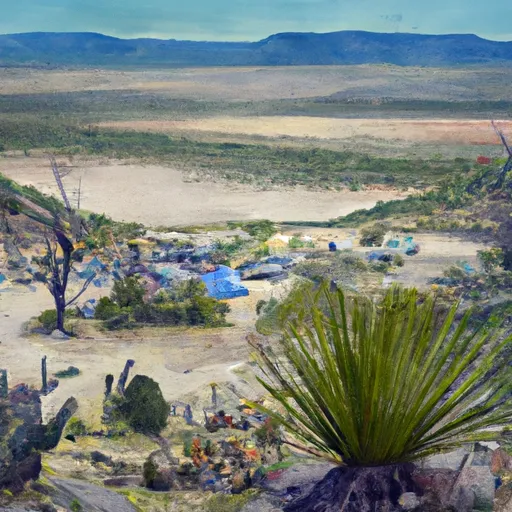
Agave Gulch Military Campground
Community Reviews
Been here? Share the conditions.
Reviews, ratings & photos are added in the free Snoflo iOS app — rate a spot, tag the conditions, and your visit is verified by location. Add or manage your reviews from the app.
Agave Gulch Military
Reservations are not accepted at Agave Gulch Military camping area. The campground operates on a first-come, first-served basis, so it's recommended to arrive early to secure a spot, especially during peak seasons. The best time to visit the camping area is during the cooler months, from late fall to early spring when temperatures are more moderate. Summers in Arizona can be extremely hot, so it's advisable to avoid visiting during this time.
Campers at Agave Gulch Military camping area can enjoy various activities, such as hiking, biking, and wildlife viewing. The surrounding area also offers numerous trails for exploration. However, it's crucial to be cautious of local wildlife, including snakes and scorpions, which can be encountered in the desert environment. It is recommended to stay on designated trails, bring appropriate gear, and be prepared for sudden weather changes. By considering these factors, visitors can have a safe and enjoyable camping experience at Agave Gulch Military camping area in Arizona.
What's on-site at Agave Gulch Military
Key facilities Snoflo tracks for this campground. Confirm with the operator before booking -- amenities can change seasonally.
Plan your trip down to the hour
Same weather feed Snoflo's iOS app uses -- updated continuously from NOAA / yr.no.
Next 5 days, hour by hour
Temperature line with weather symbols on top, snow + rain accumulation as columns, humidity as a dotted line.
5-day forecast table
Every 3 hours, broken out across temperature, snow, rain, humidity, and wind. Each cell is colour-coded relative to the column min/max so trends jump out at a glance.
| Time | Condition | Temp (°F) | Snow (in) | Rain (in) | Humidity (%) | Wind (mps) | Wind dir |
|---|---|---|---|---|---|---|---|
| Loading detailed forecast… | |||||||
15-day temperature & precipitation
Daily temperatures, snow, and rain projected over the next two weeks. Hover any point for the full breakdown.
Other campgrounds in the area
Snoflo-tracked campsites within driving distance of Agave Gulch Military, with reservations status.
| Campground | Reservations | Toilets | View |
|---|---|---|---|
| Juniper Basin Campground | ✗ | ✗ | → |
| Gordon Hirabayashi Campground | ✗ | ✗ | → |
| Molino Basin | ✗ | ✓ | → |
| Molino Basin Campground | ✗ | ✗ | → |
| Snyder Hill Dispersed | ✗ | ✗ | → |
Nearby streamflow
USGS streamgauges within reach of Agave Gulch Military -- pulled live from the National Water Information System.
| Streamgauge | Discharge | View |
|---|---|---|
| Pantano Wash At Broadway Blvd. At Tucson | 0 cfs | → |
| Tanque Verde Creek At Tucson | · | → |
| Rillito Creek At Dodge Boulevard | · | → |
| Santa Cruz River At Tucson | 254 cfs | → |
| Sabino Creek Near Tucson | 75 cfs | → |
| Rillito Creek At La Cholla Blvd Near Tucson | · | → |
Plan a longer trip
The closest parks, lakes, boat launches, and paddle runs so a camping night can grow into a full weekend.
Parks
- Vista Del Prado Park
- Tierra Del Sol Park
- Cedar Groves Park
- Harriet Johnson Park
- Freedom Center Park
- The Groves Park
Paddle runs
- Pusch Ridge Wilderness Boundary To Confluence With Cañada Del Oro
- Headwaters To Pusch Ridge Wilderness Boundary
- Wilderness Boundary To Coronado National Forest Boundary
- Marshall Gulch Recreation Area To Wilderness Boundary
- Headwaters To 1/4 Mile South Of Forest Road 736
- 1/4 Mile South Of Forest Road 736 To Coronado National Forest Boundary
Camping essentials & Leave No Trace
- Pack it in, pack it out
- Take all trash, food scraps, and gear back with you to keep campsites clean and protect wildlife.
- Respect wildlife
- Observe animals from a distance, store food securely, and never feed wildlife to maintain natural behavior and safety.
- Know before you go
- Check weather, fire restrictions, trail conditions, and permit requirements to ensure a safe and well-planned trip.
- Minimize campfire impact
- Use established fire rings, keep fires small, fully extinguish them, or opt for a camp stove when fires are restricted.
- Leave what you find
- Preserve natural and cultural features by avoiding removal of plants, rocks, artifacts, or other elements of the environment.
Set push alerts in the Snoflo app
Save Agave Gulch Military as a favorite, set a custom threshold (precipitation, snowpack, freezing temperatures), and the iOS app will push the moment conditions cross.
About Agave Gulch Military
Can I make reservations at Agave Gulch Military?
This campground does not appear to accept reservations -- it's typically first-come, first-served. Arrive early on summer weekends.
How fresh is the weather data on this page?
The hourly forecast updates throughout the day from the NOAA / yr.no public feeds. Streamflow data is pulled live from USGS streamgauges and snowpack from the NRCS SNOTEL network.
What's the best time of year to visit?
Use the 15-day temperature & precipitation outlook on this page to plan -- pick a window with comfortable temperatures and low precipitation. For longer trips, the 5-day hourly meteogram shows snow + rain accumulation hour-by-hour.
How do I get to Agave Gulch Military?
Tap Directions in the hero above to open driving directions in Google Maps, or Open in map to center the Snoflo interactive map on the campground.
Can I get alerts when conditions change?
Yes -- alerts are managed through the Snoflo iOS app. Favorite this campground, set a threshold (temperature, snowpack, precipitation), and you'll get a push the moment it crosses.
Other campgrounds near here
Snoflo-tracked campgrounds within driving distance of Agave Gulch Military.