

-
 Snoflo Premium
Get unlimited access to all our content
With no Ad interruptions! - Start Your Free Trial Login with existing account
Young
Eden Index
Climate
9.5
•
Recreation
4.1
•
Community
1.4
•
Safeguard
5.6/10
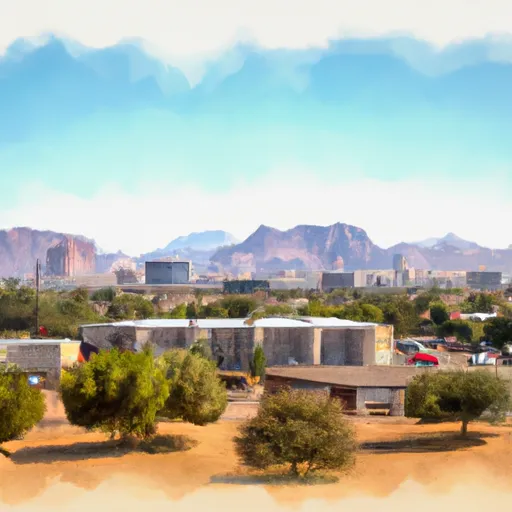
Young, Arizona is a charming rural community located in Gila County, nestled in the central part of the state. The area boasts a moderate climate, with warm summers and mild winters. Summers are typically dry with temperatures reaching the 90s°F, while winters are mild with temperatures averaging around 50°F. The region is known for its abundant sunshine, making it a haven for outdoor enthusiasts throughout the year.
Hydrologically, Young is surrounded by the Tonto National Forest and is home to the upper portion of the Salt River. This river system not only provides a scenic backdrop but also offers opportunities for fishing, swimming, and boating. The nearby forests and mountains are rich in springs and streams, creating a diverse hydrology that supports a variety of wildlife and plant species.
Outdoor recreation opportunities in Young are abundant. The area is a paradise for hikers, with numerous trails winding through scenic landscapes, including the nearby Sierra Ancha Mountains. Camping, horseback riding, and off-roading are popular activities. Furthermore, the surrounding forests offer ample hunting opportunities during the appropriate seasons.
In summary, Young, Arizona offers a moderate climate, diverse hydrology, and a plethora of outdoor activities. Whether you enjoy fishing, hiking, or simply immersing yourself in nature, Young provides a serene and adventurous escape.
What is the Eden Index?
The Snoflo Eden Index serves as a comprehensive rating system for regions, evaluating their desirability through a holistic assessment of climate health, outdoor recreation opportunities, and natural disaster risk, acknowledging the profound impact of these factors on livability and well-being.
Climate Health Indicator (CHI): 9.5
Young receives approximately
585mm of rain per year,
with humidity levels near 46%
and air temperatures averaging around
13°C.
Young has a plant hardyness factor of
7, meaning
plants and agriculture in this region tend to thrive during the non-winter months.
By considering the ideal temperature range, reliable water supplies, clean air, and stable seasonal rain or snowpacks, the Climate Health Indicator (CHI) underscores the significance of a healthy climate as the foundation for quality living.
A healthy climate is paramount for ensuring a high quality of life and livability in a region, fostering both physical well-being and environmental harmony. This can be characterized by ideal temperatures, reliable access to water supplies, clean air, and consistent seasonal rain or snowpacks.
Weather Forecast
Streamflow Conditions
Salt
Area Rivers
Salt
Snowpack Depths
Salt
Reservoir Storage Capacity
Salt
Groundwater Levels
Recreational Opportunity Index (ROI): 4.1
The Recreational Opportunity Index (ROI) recognizes the value of outdoor recreational options, such as parks, hiking trails, camping sites, and fishing spots, while acknowledging that climate plays a pivotal role in ensuring the comfort and consistency of these experiences.
Access to outdoor recreational opportunities, encompassing activities such as parks, hiking, camping, and fishing, is crucial for overall well-being, and the climate plays a pivotal role in enabling and enhancing these experiences, ensuring that individuals can engage in nature-based activities comfortably and consistently.
Camping Areas
| Campground | Campsites | Reservations | Toilets | Showers | Elevation |
|---|---|---|---|---|---|
| Workman Creek Falls | 5 | 6,240 ft | |||
| Haigler Canyon | 14 | 5,314 ft | |||
| Valentine Ridge | 10 | 6,656 ft | |||
| Upper Canyon Creek | 10 | 6,522 ft | |||
| Schoolhouse | 211 | 2,192 ft | |||
| Sawmill Flats | 5 | 5,560 ft | |||
| Ponderosa | 61 | 5,680 ft | |||
| Rose Creek | 5 | 5,460 ft | |||
| Grapevine Bay | 40 | 2,309 ft | |||
| Windy Hill | 347 | 2,167 ft |
Catastrophe Safeguard Index (CSI):
The Catastrophe Safeguard Index (CSI) recognizes that natural disaster risk, encompassing floods, fires, hurricanes, and tornadoes, can drastically affect safety and the overall appeal of an area.
The level of natural disaster risk in a region significantly affects safety and the overall livability, with climate change amplifying these risks by potentially increasing the frequency and intensity of events like floods, fires, hurricanes, and tornadoes, thereby posing substantial challenges to community resilience and well-being.
Community Resilience Indicator (CRI): 1.4
The Community Resilience Indicator (CRI) recognizes that education, healthcare, and socioeconomics are crucial to the well-being of a region. The CRI acknowledges the profound impact of these elements on residents' overall quality of life. By evaluating educational resources, healthcare accessibility, and economic inclusivity, the index captures the essential aspects that contribute to a thriving community, fostering resident satisfaction, equity, and social cohesion.