Caloosa Lake fishing
As of July 15, 2026, the nearest streamgauge to Caloosa Lake — Whiskey Creek At Ft. Myers — reports 6 cfs. Source: USGS gauge data, refreshed throughout the day.
Community Reviews
Been here? Share the conditions.
Reviews, ratings & photos are added in the free Snoflo iOS app — rate a spot, tag the conditions, and your visit is verified by location. Add or manage your reviews from the app.
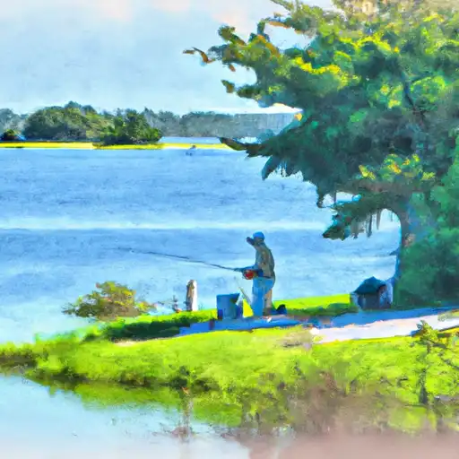
Caloosa Lake
What's biting at Caloosa Lake
Species commonly reported here -- tap any card for techniques, target seasons, and other waters where it's been caught.
Plan your trip down to the hour
Same weather feed Snoflo's iOS app uses -- updated continuously from NOAA / yr.no.
Next 5 days, hour by hour
Temperature line with weather symbols on top, snow + rain accumulation as columns, humidity as a dotted line.
5-day forecast table
Every 3 hours, broken out across temperature, snow, rain, humidity, and wind. Each cell is colour-coded relative to the column min/max so trends jump out at a glance.
| Time | Condition | Temp (°F) | Snow (in) | Rain (in) | Humidity (%) | Wind (mps) | Wind dir |
|---|---|---|---|---|---|---|---|
| Loading detailed forecast… | |||||||
15-day temperature & precipitation
Daily temperatures, snow, and rain projected over the next two weeks. Hover any point for the full breakdown.
Nearby streamflow
USGS streamgauges within reach of Caloosa Lake -- updated continuously from the National Water Information System.
| Streamgauge | Discharge | View |
|---|---|---|
| Whiskey Creek At Ft. Myers | 6 cfs | → |
| San Carlos Canal At Cape Coral | 0 cfs | → |
| Courtney Canal At Cape Coral | 12 cfs | → |
| Sixmile Cypress Creek North Fort Myers | 0 cfs | → |
| Meade Canal At Cape Coral | 3 cfs | → |
| Tenmile Canal At Control Near Estero | 158 cfs | → |
Plan a longer trip
The closest campgrounds, parks, boat launches, and reservoirs so a fishing run can grow into a weekend.
Campgrounds
- Gulf Waters Rv Resort
- Gulf Air Mhp
- San Carlos Rv Park And Island Resort
- Sunnyland Trailer Court
- Gulf Cove Mobile Home Park
- Koreshan Historic State Park
Parks
- Ruttenberg Community Park
- Yacht Club Municipal Park
- Four Freedoms Park
- Deep Lagoon Preserve
- Jerry Brooks Park
- Harlem Heights Park
Reservoirs
- W.P. Franklin Lock And Dam
- Alligator Creek Salinity Barrier
- St. Road 846 Land Trust Imp
- Hendrickson Dam
- Cha01
- Cha03
Boat launches
- Yacht Club Park Public Boat Ramp
- Horton Park
- Lakes Park Rv Villas
- Four Mile Cove Parkway 1783, Cape Coral
- Ramp Caloosahatchee
- City Of Cape Coral - 720 Sw 31st Terrace (Primitive)
Points of interest
- Cape Coral Bridge
- Midpoint Memorial Bridge
- David Mccreary's House
- Railroad Museum Of South Florida
- Castle Golf
- Smugglers Cove - Adventure Golf
Paddle runs
- A Point Approximately 1/2 Mile South Of Sr 771 At El Jobean To The River's Mouth In The Vicinity Of Hog Island
- A Point Just Upriver Of The Us 41 Highway Crossing To The Sarasota/Charlotte County Line
- Approximately River Mile 18 To A Point Just Upriver Of The Us 41 Highway Crossing
- Approximately At River Mile 23 Where Riverfront Residential Development Begins To The Vicinity Of Snook Haven Fish Camp At Approximately River Mile 18
- The Southern Boundary Of The Myakka River State Park To Ends Approximately At River Mile 23 Where Riverfront Residential Development Begins
- Begins Downstream Of The State Road 72 Bridge To The Southern Boundary Of Myakka River State Park
Angling safety & ethics
- Know the regulations
- Check local fishing rules, seasons, size limits, and license requirements to ensure legal and sustainable angling.
- Handle fish responsibly
- Use wet hands, minimize air exposure, and release fish gently to improve survival rates when practicing catch-and-release.
- Choose the right gear
- Match your rod, line, and tackle to the species and conditions to increase success and reduce unnecessary harm to fish.
- Respect the waterway
- Avoid disturbing habitat, prevent bank erosion, and keep a safe distance from spawning areas to protect ecosystems.
- Keep it clean
- Pack out all line, hooks, bait containers, and trash. Discarded gear can injure wildlife and degrade waterways.
Set push alerts in the Snoflo app
Save Caloosa Lake as a favorite, set a custom threshold (water temperature, streamflow, snowpack), and the iOS app will push the moment conditions cross.
About Caloosa Lake
What fish species are found at Caloosa Lake?
Snoflo tracks the species commonly reported at Caloosa Lake -- see the Fish Species panel above for the live list with images and links to per-species pages.
How fresh is the weather data on this page?
The hourly forecast updates throughout the day from the NOAA / yr.no public feeds. Streamflow data comes live from USGS streamgauges, also refreshed continuously.
Can I get alerts when conditions change?
Yes -- alerts are managed through the Snoflo iOS app. Favorite this area, set a threshold (water temperature, streamflow, snowpack), and you'll get a push the moment it crosses.
Do I need a fishing license?
Yes. Check your state agency's regulations for license requirements, seasons, size limits, and any waterbody-specific rules before fishing Caloosa Lake.
How do I get to Caloosa Lake?
Tap Open in map in the hero above to center the Snoflo interactive map on this area, or grab the coordinates from the location facts panel.
Other angling spots near here
Snoflo-tracked fishing areas within driving distance of Caloosa Lake.