Dockery Lake Fishing
As of July 20, 2026, the nearest streamgauge to Dockery Lake — Chestatee River Near Dahlonega — reports 139 cfs. Source: USGS gauge data, refreshed throughout the day.
Community Reviews
Been here? Share the conditions.
Reviews, ratings & photos are added in the free Snoflo iOS app — rate a spot, tag the conditions, and your visit is verified by location. Add or manage your reviews from the app.
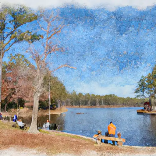
Dockery Lake
What's biting at Dockery Lake
Species commonly reported here -- tap any card for techniques, target seasons, and other waters where it's been caught.
Plan your trip down to the hour
Same weather feed Snoflo's iOS app uses -- updated continuously from NOAA / yr.no.
Next 5 days, hour by hour
Temperature line with weather symbols on top, snow + rain accumulation as columns, humidity as a dotted line.
5-day forecast table
Every 3 hours, broken out across temperature, snow, rain, humidity, and wind. Each cell is colour-coded relative to the column min/max so trends jump out at a glance.
| Time | Condition | Temp (°F) | Snow (in) | Rain (in) | Humidity (%) | Wind (mps) | Wind dir |
|---|---|---|---|---|---|---|---|
| Loading detailed forecast… | |||||||
15-day temperature & precipitation
Daily temperatures, snow, and rain projected over the next two weeks. Hover any point for the full breakdown.
Nearby streamflow
USGS streamgauges within reach of Dockery Lake -- updated continuously from the National Water Information System.
| Streamgauge | Discharge | View |
|---|---|---|
| Chestatee River Near Dahlonega | 139 cfs | → |
| Nottely River Near Blairsville | 73 cfs | → |
| Chattahoochee River At Helen | 50 cfs | → |
| Toccoa River Near Dial | 250 cfs | → |
| Chattahoochee River Near Leaf | 148 cfs | → |
| Amicalola Creek Near Dawsonville | 94 cfs | → |
Plan a longer trip
The closest campgrounds, parks, boat launches, and reservoirs so a fishing run can grow into a weekend.
Campgrounds
- Dockery Lake
- Dockery Lake Recreation Area
- Miller Gap Campsite
- Lance Creek Campsite
- Jarrard Gap Campsite
- Desoto Falls Recreation Area
Parks
- Wilderness Blood Mountain
- Vogel State Park
- Wilderness Raven Cliffs
- Dahlonega Gold Museum Historic Site
- Lumpkin County Park
- Camp Appalachian Wilderness
Reservoirs
Boat launches
- Morrison Moore Parkway East Dahlonega
- Mountain Shadows Drive White County
- Canal Lake
- Doucette Circle 2647, 30512
- Lumpkin County Park
- Jack's Creek Boat Ramp
Points of interest
- Tasting Room
- The Cottage Vineyard & Winery Tasting Room
- Consolidated Gold Mine
- Yahoola Cherokee Museum
- Paradise Valley Resort Tasting Room
- World's Largest Amish Chair
Paddle runs
- Martin Branch Bridge To Robertsontown Bridge On Ga Highway 356
- Old Turnpike Crossing To Martin Branch Bridge
- Mark Trail Wilderness Boundry To Old Turnpike Crossing Near Vandiver Branch
- Source Near Chattahoochee Gap To Mark Trail Wilderness Boundary
- Confluence Of Brasstown Creek And Little Brasstown Creek Just South Of Brasstown Falls Road (Fs 751) To Confluence Of Mill Branch, Brasstown Creek And Boatwright Creek Near Boatwright Road (Fs 753)
- Headwaters In Standing Indian Basin To Slackwater Of Natahala Lake
Angling safety & ethics
- Know the regulations
- Check local fishing rules, seasons, size limits, and license requirements to ensure legal and sustainable angling.
- Handle fish responsibly
- Use wet hands, minimize air exposure, and release fish gently to improve survival rates when practicing catch-and-release.
- Choose the right gear
- Match your rod, line, and tackle to the species and conditions to increase success and reduce unnecessary harm to fish.
- Respect the waterway
- Avoid disturbing habitat, prevent bank erosion, and keep a safe distance from spawning areas to protect ecosystems.
- Keep it clean
- Pack out all line, hooks, bait containers, and trash. Discarded gear can injure wildlife and degrade waterways.
Set push alerts in the Snoflo app
Save Dockery Lake as a favorite, set a custom threshold (water temperature, streamflow, snowpack), and the iOS app will push the moment conditions cross.
About Dockery Lake
What fish species are found at Dockery Lake?
Snoflo tracks the species commonly reported at Dockery Lake -- see the Fish Species panel above for the live list with images and links to per-species pages.
How fresh is the weather data on this page?
The hourly forecast updates throughout the day from the NOAA / yr.no public feeds. Streamflow data comes live from USGS streamgauges, also refreshed continuously.
Can I get alerts when conditions change?
Yes -- alerts are managed through the Snoflo iOS app. Favorite this area, set a threshold (water temperature, streamflow, snowpack), and you'll get a push the moment it crosses.
Do I need a fishing license?
Yes. Check your state agency's regulations for license requirements, seasons, size limits, and any waterbody-specific rules before fishing Dockery Lake.
How do I get to Dockery Lake?
Tap Open in map in the hero above to center the Snoflo interactive map on this area, or grab the coordinates from the location facts panel.
Other angling spots near here
Snoflo-tracked fishing areas within driving distance of Dockery Lake.