Big Sable River Fishing
As of July 17, 2026, the nearest streamgauge to Big Sable River — Pere Marquette River At Scottville — reports 523 cfs. Source: USGS gauge data, refreshed throughout the day.
Community Reviews
Been here? Share the conditions.
Reviews, ratings & photos are added in the free Snoflo iOS app — rate a spot, tag the conditions, and your visit is verified by location. Add or manage your reviews from the app.
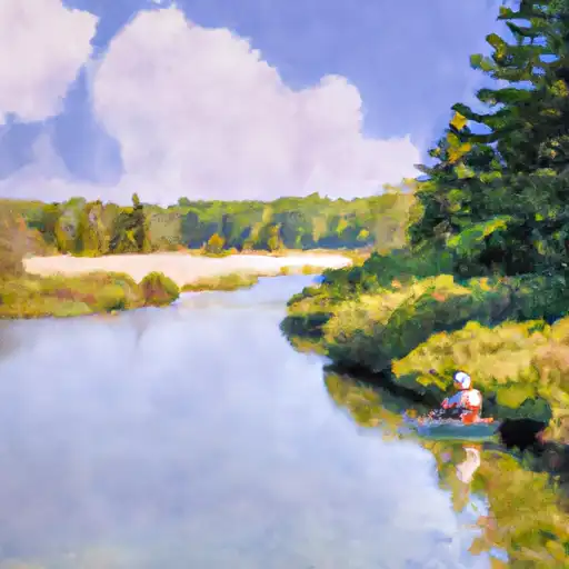
Big Sable River
What's biting at Big Sable River
Species commonly reported here -- tap any card for techniques, target seasons, and other waters where it's been caught.
Plan your trip down to the hour
Same weather feed Snoflo's iOS app uses -- updated continuously from NOAA / yr.no.
Next 5 days, hour by hour
Temperature line with weather symbols on top, snow + rain accumulation as columns, humidity as a dotted line.
5-day forecast table
Every 3 hours, broken out across temperature, snow, rain, humidity, and wind. Each cell is colour-coded relative to the column min/max so trends jump out at a glance.
| Time | Condition | Temp (°F) | Snow (in) | Rain (in) | Humidity (%) | Wind (mps) | Wind dir |
|---|---|---|---|---|---|---|---|
| Loading detailed forecast… | |||||||
15-day temperature & precipitation
Daily temperatures, snow, and rain projected over the next two weeks. Hover any point for the full breakdown.
Nearby streamflow
USGS streamgauges within reach of Big Sable River -- updated continuously from the National Water Information System.
| Streamgauge | Discharge | View |
|---|---|---|
| Pere Marquette River At Scottville | 523 cfs | → |
| Manistee River Near Wellston | 1,810 cfs | → |
| Pine River At High School Bridge Nr Hoxeyville | 238 cfs | → |
| Manistee River Near Mesick | 1,180 cfs | → |
| White River Near Whitehall | 271 cfs | → |
| Manistee River Near Sherman | 1,110 cfs | → |
Plan a longer trip
The closest campgrounds, parks, boat launches, and reservoirs so a fishing run can grow into a weekend.
Campgrounds
- Pines Campground
- Cedars Campground
- Beechwood Campground
- Jack Pine Walk-In Campground
- Cartier Park Campground
- Lake Michigan Recreation Area
Parks
- Natural Area Big Sable Dunes And Swales
- Ludington State Park
- Nordhouse Dunes Wilderness
- Cartier Park
- Peter Copeyon Park
- Rietz Park
Reservoirs
- Hamlin Lake Dam
- West Shore Community College Dam
- Ludington
- Peters Bayou Dam
- Whiskey Creek Dam #2
- Crystal Valley Dam
Boat launches
- Sable River Trail Hamlin Township
- Hamlin Lake -W, 5350 Acres, Mason County
- Hamlin Lake -S, 5350 Acres, Mason County
- Carter Park Campground
- Stearns Drive Ludington
- Co Rd To Twp Park 5499, Victory Township
Points of interest
- Big Sable Point Lighthouse
- North Breakwater Light
- Golden Key Art Gallery
- Ss Spartan
- Historic White Pine Village
- North Pierhead Light
Paddle runs
- Kings Road Bridge (2 Miles West Of Town Of Luther In T19n, R12w To Slackwater Of The State Fish Weir In T21n, R16w
- South Branch From Forest Boundary East Of Hesperia At West Section Line Of Sec 22, T14n, R14w To Echo Drive In Sec 6, T13n, R12w
- North Branch From Its Confluence With South Branch In Sec 22, T13n, R16 W To Mclaren Lake In Sec 11, T14n, R15w
- Mainstem To Forest Boundary At North Section Line Of Sec 2, T13n, R15w (1.5 Miles West Of Herperia)
- Southern Boundary Of Sleeping Bear Dunes National Lakeshore To Mouth At Lake Michigan
- Croton Dam In T12n, R11w To City Of Newaygo In T12n, R12w
Angling safety & ethics
- Know the regulations
- Check local fishing rules, seasons, size limits, and license requirements to ensure legal and sustainable angling.
- Handle fish responsibly
- Use wet hands, minimize air exposure, and release fish gently to improve survival rates when practicing catch-and-release.
- Choose the right gear
- Match your rod, line, and tackle to the species and conditions to increase success and reduce unnecessary harm to fish.
- Respect the waterway
- Avoid disturbing habitat, prevent bank erosion, and keep a safe distance from spawning areas to protect ecosystems.
- Keep it clean
- Pack out all line, hooks, bait containers, and trash. Discarded gear can injure wildlife and degrade waterways.
Set push alerts in the Snoflo app
Save Big Sable River as a favorite, set a custom threshold (water temperature, streamflow, snowpack), and the iOS app will push the moment conditions cross.
About Big Sable River
What fish species are found at Big Sable River?
Snoflo tracks the species commonly reported at Big Sable River -- see the Fish Species panel above for the live list with images and links to per-species pages.
How fresh is the weather data on this page?
The hourly forecast updates throughout the day from the NOAA / yr.no public feeds. Streamflow data comes live from USGS streamgauges, also refreshed continuously.
Can I get alerts when conditions change?
Yes -- alerts are managed through the Snoflo iOS app. Favorite this area, set a threshold (water temperature, streamflow, snowpack), and you'll get a push the moment it crosses.
Do I need a fishing license?
Yes. Check your state agency's regulations for license requirements, seasons, size limits, and any waterbody-specific rules before fishing Big Sable River.
How do I get to Big Sable River?
Tap Open in map in the hero above to center the Snoflo interactive map on this area, or grab the coordinates from the location facts panel.
Other angling spots near here
Snoflo-tracked fishing areas within driving distance of Big Sable River.