Peavy Pond Fishing
As of August 3, 2026, the nearest streamgauge to Peavy Pond — Paint River Nr Alpha — reports 292 cfs. Source: USGS gauge data, refreshed throughout the day.
Community Reviews
Been here? Share the conditions.
Reviews, ratings & photos are added in the free Snoflo iOS app — rate a spot, tag the conditions, and your visit is verified by location. Add or manage your reviews from the app.
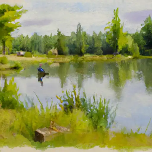
Peavy Pond
What's biting at Peavy Pond
Species commonly reported here -- tap any card for techniques, target seasons, and other waters where it's been caught.
Plan your trip down to the hour
Same weather feed Snoflo's iOS app uses -- updated continuously from NOAA / yr.no.
Next 5 days, hour by hour
Temperature line with weather symbols on top, snow + rain accumulation as columns, humidity as a dotted line.
5-day forecast table
Every 3 hours, broken out across temperature, snow, rain, humidity, and wind. Each cell is colour-coded relative to the column min/max so trends jump out at a glance.
| Time | Condition | Temp (°F) | Snow (in) | Rain (in) | Humidity (%) | Wind (mps) | Wind dir |
|---|---|---|---|---|---|---|---|
| Loading detailed forecast… | |||||||
15-day temperature & precipitation
Daily temperatures, snow, and rain projected over the next two weeks. Hover any point for the full breakdown.
Nearby streamflow
USGS streamgauges within reach of Peavy Pond -- updated continuously from the National Water Information System.
| Streamgauge | Discharge | View |
|---|---|---|
| Paint River Nr Alpha | 292 cfs | → |
| Menominee River Near Florence | 940 cfs | → |
| Brule River Near Commonwealth | 610 cfs | → |
| Brule River At Us Highway 2 Near Florence | 266 cfs | → |
| Michigamme River Near Crystal Falls | 575 cfs | → |
| Pine River Below Pine R Powerplant Nr Florence | 310 cfs | → |
Plan a longer trip
The closest campgrounds, parks, boat launches, and reservoirs so a fishing run can grow into a weekend.
Campgrounds
- Glidden Lake State Forest Campground
- Paint River Hills Campground
- Lake Ellen Camp
- Summer Breeze Campground
- River Bends Campground
- Pentoga Park (Iron County Park)
Parks
- County Fair Park
- Florence County Fair Park
- Bewabic State Park
- Menomonee Road Park
- Wilderness Whisker Lake
Reservoirs
Boat launches
- Lake Mary
- Brule River Flowage Landing (Nr Brule Landing Rd In Florence Co.)
- Lake Mary Road Mastodon Township
- Brule River/Menominee River -- Access
- Stager Lake
- Fisher Lake -- Access
Points of interest
- Crystal Falls Power Plant
- Crystal Falls Dam
- Twin Falls Road
- Upper Twin Falls Bridge
- Whisker Lake Wilderness
- Upper Peninsula Sports Hall Of Fame
Paddle runs
- Mainstem, Easternforest Boundary In Sec 1, T44n, R35w To City Of Crystal Falls
- Brule Lake In Ne1/4 Sec 15, T41n, R13e To Forest Boundary In Se1/4 Sec 31, T41n, R17e
- Forest Road 2156 To Eastern Forest Boundary
- Forest Road 2133 To Forest Road 2156
- Forest Road 2169 To Forest Road 2133
- Forest Road 2398 To Eastern Forest Boundary
Angling safety & ethics
- Know the regulations
- Check local fishing rules, seasons, size limits, and license requirements to ensure legal and sustainable angling.
- Handle fish responsibly
- Use wet hands, minimize air exposure, and release fish gently to improve survival rates when practicing catch-and-release.
- Choose the right gear
- Match your rod, line, and tackle to the species and conditions to increase success and reduce unnecessary harm to fish.
- Respect the waterway
- Avoid disturbing habitat, prevent bank erosion, and keep a safe distance from spawning areas to protect ecosystems.
- Keep it clean
- Pack out all line, hooks, bait containers, and trash. Discarded gear can injure wildlife and degrade waterways.
Set push alerts in the Snoflo app
Save Peavy Pond as a favorite, set a custom threshold (water temperature, streamflow, snowpack), and the iOS app will push the moment conditions cross.
About Peavy Pond
What fish species are found at Peavy Pond?
Snoflo tracks the species commonly reported at Peavy Pond -- see the Fish Species panel above for the live list with images and links to per-species pages.
How fresh is the weather data on this page?
The hourly forecast updates throughout the day from the NOAA / yr.no public feeds. Streamflow data comes live from USGS streamgauges, also refreshed continuously.
Can I get alerts when conditions change?
Yes -- alerts are managed through the Snoflo iOS app. Favorite this area, set a threshold (water temperature, streamflow, snowpack), and you'll get a push the moment it crosses.
Do I need a fishing license?
Yes. Check your state agency's regulations for license requirements, seasons, size limits, and any waterbody-specific rules before fishing Peavy Pond.
How do I get to Peavy Pond?
Tap Open in map in the hero above to center the Snoflo interactive map on this area, or grab the coordinates from the location facts panel.
Other angling spots near here
Snoflo-tracked fishing areas within driving distance of Peavy Pond.