The Headwaters Of The West Arm To Confluence With The Colorado River River Run
Community Reviews
Been here? Share the conditions.
Reviews, ratings & photos are added in the free Snoflo iOS app — rate a spot, tag the conditions, and your visit is verified by location. Add or manage your reviews from the app.
The Headwaters Of The West Arm To Confluence With The Colorado River
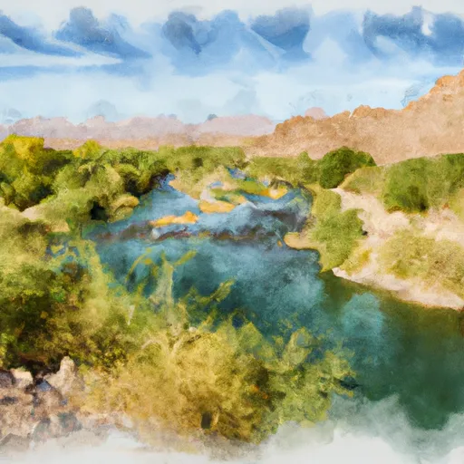
The Whitewater River Run in Arizona is a popular destination for outdoor enthusiasts seeking a thrilling whitewater experience. The ideal streamflow range for this run is between 1000 and 4000 cubic feet per second (cfs), which typically occurs during the spring months. The river is rated as a Class III-IV, with rapids ranging from moderate to difficult. The run is divided into several segments, with a total mileage of approximately 18 miles.
One of the most challenging sections of the Whitewater River Run is the West Arm, which features a series of steep drops and technical rapids. Another notable feature of the run is the Confluence Rapid, where the Whitewater River meets the Colorado River. This rapid is known for its large waves and powerful currents, making it a thrilling and challenging section of the run.
In terms of regulations, all boaters are required to obtain a permit from the Bureau of Land Management (BLM) in order to access the Whitewater River. Additionally, various safety regulations are in place to ensure that boaters are adequately prepared for the challenges of the run. These regulations include requirements for personal flotation devices, safety equipment, and other necessary gear.
Overall, the Whitewater River Run is a challenging and exhilarating adventure for experienced whitewater enthusiasts. With its ideal streamflow range, challenging rapids, and beautiful scenery, it is a must-visit destination for anyone looking to experience the thrill of whitewater rafting in Arizona.
Plan your run down to the hour
Same weather feed Snoflo's iOS app uses -- updated continuously from NOAA / yr.no. Watch the precipitation column on the meteogram; rain ahead of a run typically lifts flows 12-48 hours later depending on the basin.
Next 5 days, hour by hour
Temperature line with weather symbols on top, snow + rain accumulation as columns, humidity as a dotted line.
5-day forecast table
Every 3 hours, broken out across temperature, snow, rain, humidity, and wind. Each cell is colour-coded relative to the column min/max.
| Time | Condition | Temp (°F) | Snow (in) | Rain (in) | Humidity (%) | Wind (mps) | Wind dir |
|---|---|---|---|---|---|---|---|
| Loading detailed forecast… | |||||||
15-day temperature & precipitation
Daily temperatures, snow, and rain projected over the next two weeks -- the upstream story that drives next week's flows.
Regional streamflow levels
USGS streamgauges around The Headwaters Of The West Arm To Confluence With The Colorado River -- useful for spotting upstream pulses and gauging which tributary is contributing what.
| Streamgauge | Discharge | View |
|---|---|---|
| Havasu Creek At Supai | 76 cfs | → |
| Kanab Creek Abv Mouth Nr Supai | 55 cfs | → |
| Havasu Creek Abv Mouth Nr Supai | 76 cfs | → |
| Colorado River Near Grand Canyon | 8,060 cfs | → |
| Little Colorado River Abv Mouth Nr Desert View | 655 cfs | → |
| Little Colorado River Near Cameron | 2,090 cfs | → |
Plan a longer trip
The closest boat launches, other paddle runs, and campgrounds so a day on the water can grow into a full weekend.
Other river runs
- The Base Of The Redwall To Confluence With The Colorado River
- Confluence With White Creek To Confluence With The Colorado River
- Begins 1.5 Miles Upstream From Confluence With Topaz Canyon Creek To Confluence With The Colorado River
Whitewater safety
- Check the flow before you run
- Use the linked-gauge card and Regional Flow panel above. Class ratings change with flow -- a Class III at low water can become Class IV+ at high water.
- Know your skill ceiling
- Pick runs comfortably below your ceiling. Cold-water and big-water runs raise the consequences of any mistake.
- Wear the right gear
- Helmet, PFD, drysuit / wetsuit when water is below 60°F. Throw bag, knife, and whistle on your person, not in the boat.
- Scout, set safety, and run with a team
- Scout new rapids on foot, set safety with throw bags above the consequence pool, and run with at least one other competent paddler.
- Respect the river
- Strainers, undercuts, low-head dams, and wood can kill at any class rating. When in doubt, portage.
Set push alerts in the Snoflo app
Save The Headwaters Of The West Arm To Confluence With The Colorado River as a favorite, set a discharge threshold (e.g. "alert me when flow hits 600 cfs"), and the iOS app pushes the moment the linked gauge crosses.
About The Headwaters Of The West Arm To Confluence With The Colorado River
What's the optimal flow for The Headwaters Of The West Arm To Confluence With The Colorado River?
The optimal flow depends on the section and the craft. Check the Run Details panel for the linked gauge and current status.
How fresh is the cfs reading on this page?
The linked USGS streamgauge reports continuously (every 15 minutes); Snoflo refreshes throughout the day. Hover the streamflow sparkline to read individual datapoints.
What's the whitewater class?
See the Run Details panel for the class rating Snoflo tracks for this run. Class ratings change with flow -- a Class III at low water can become Class IV in high water.
Where do I put in / take out?
Tap Directions in the hero above to open driving directions to the put-in. For shuttle planning, check the Nearby Boat Launches panel and the river run operator's site.
Can I get alerts when flows hit the optimal range?
Yes -- alerts are managed in the Snoflo iOS app. Favorite this run, set a discharge threshold, and you'll get a push the moment the gauge crosses.
Other runs near here
Snoflo-tracked paddle runs within driving distance of The Headwaters Of The West Arm To Confluence With The Colorado River.