West Boundary Of San Carlos Indian Reservation To Northeast Boundary Of Salt River Canyon Wilderness River Run
Community Reviews
Been here? Share the conditions.
Reviews, ratings & photos are added in the free Snoflo iOS app — rate a spot, tag the conditions, and your visit is verified by location. Add or manage your reviews from the app.
West Boundary Of San Carlos Indian Reservation To Northeast Boundary Of Salt River Canyon Wilderness
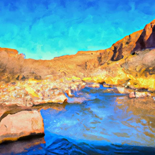
The segment mileage for this river run is approximately 13 miles, starting at the West Boundary of the San Carlos Indian Reservation and ending at the Northeast Boundary of Salt River Canyon Wilderness. Along the way, paddlers will encounter several challenging rapids, including the "Meat Grinder" and "House Rock."
It is important to note that the Whitewater River Run is located within the San Carlos Apache Indian Reservation, and visitors must obtain a permit and adhere to specific regulations. Visitors are required to pay a daily fee and comply with all regulations, including a ban on alcohol and drugs. Additionally, visitors are advised to respect cultural and environmental resources within the reservation.
Overall, the Whitewater River Run offers an exciting adventure for experienced paddlers seeking a challenging whitewater experience. It is important to plan accordingly and obtain the necessary permits and adhere to all regulations to ensure a safe and enjoyable trip.
Plan your run down to the hour
Same weather feed Snoflo's iOS app uses -- updated continuously from NOAA / yr.no. Watch the precipitation column on the meteogram; rain ahead of a run typically lifts flows 12-48 hours later depending on the basin.
Next 5 days, hour by hour
Temperature line with weather symbols on top, snow + rain accumulation as columns, humidity as a dotted line.
5-day forecast table
Every 3 hours, broken out across temperature, snow, rain, humidity, and wind. Each cell is colour-coded relative to the column min/max.
| Time | Condition | Temp (°F) | Snow (in) | Rain (in) | Humidity (%) | Wind (mps) | Wind dir |
|---|---|---|---|---|---|---|---|
| Loading detailed forecast… | |||||||
15-day temperature & precipitation
Daily temperatures, snow, and rain projected over the next two weeks -- the upstream story that drives next week's flows.
Regional streamflow levels
USGS streamgauges around West Boundary Of San Carlos Indian Reservation To Northeast Boundary Of Salt River Canyon Wilderness -- useful for spotting upstream pulses and gauging which tributary is contributing what.
| Streamgauge | Discharge | View |
|---|---|---|
| Salt River Near Chrysotile | 112 cfs | → |
| Cibecue Creek Near Chysotile | 32 cfs | → |
| Carrizo Creek Near Show Low | 3 cfs | → |
| Cherry Creek Near Globe | 2 cfs | → |
| Black River Near Fort Apache | 33 cfs | → |
| White River Near Fort Apache | 23 cfs | → |
Plan a longer trip
The closest boat launches, other paddle runs, and campgrounds so a day on the water can grow into a full weekend.
Other river runs
- Upper Salt Daily
- Northeast Boundary Of Salt River Canyon Wildernes To West Boundary Of Fort Apache Indian Reservation
- Billy Lawrence Creek To North Property Boundary Of Ellison Ranch
- West Boundary Of Fort Apache Indian Reservation To Southwest Boundary Of Salt River Canyon Wilderness
- Workman Falls To Salome Wilderness Boundary
Whitewater safety
- Check the flow before you run
- Use the linked-gauge card and Regional Flow panel above. Class ratings change with flow -- a Class III at low water can become Class IV+ at high water.
- Know your skill ceiling
- Pick runs comfortably below your ceiling. Cold-water and big-water runs raise the consequences of any mistake.
- Wear the right gear
- Helmet, PFD, drysuit / wetsuit when water is below 60°F. Throw bag, knife, and whistle on your person, not in the boat.
- Scout, set safety, and run with a team
- Scout new rapids on foot, set safety with throw bags above the consequence pool, and run with at least one other competent paddler.
- Respect the river
- Strainers, undercuts, low-head dams, and wood can kill at any class rating. When in doubt, portage.
Set push alerts in the Snoflo app
Save West Boundary Of San Carlos Indian Reservation To Northeast Boundary Of Salt River Canyon Wilderness as a favorite, set a discharge threshold (e.g. "alert me when flow hits 600 cfs"), and the iOS app pushes the moment the linked gauge crosses.
About West Boundary Of San Carlos Indian Reservation To Northeast Boundary Of Salt River Canyon Wilderness
What's the optimal flow for West Boundary Of San Carlos Indian Reservation To Northeast Boundary Of Salt River Canyon Wilderness?
The optimal flow depends on the section and the craft. Check the Run Details panel for the linked gauge and current status.
How fresh is the cfs reading on this page?
The linked USGS streamgauge reports continuously (every 15 minutes); Snoflo refreshes throughout the day. Hover the streamflow sparkline to read individual datapoints.
What's the whitewater class?
See the Run Details panel for the class rating Snoflo tracks for this run. Class ratings change with flow -- a Class III at low water can become Class IV in high water.
Where do I put in / take out?
Tap Directions in the hero above to open driving directions to the put-in. For shuttle planning, check the Nearby Boat Launches panel and the river run operator's site.
Can I get alerts when flows hit the optimal range?
Yes -- alerts are managed in the Snoflo iOS app. Favorite this run, set a discharge threshold, and you'll get a push the moment the gauge crosses.
Other runs near here
Snoflo-tracked paddle runs within driving distance of West Boundary Of San Carlos Indian Reservation To Northeast Boundary Of Salt River Canyon Wilderness.