San Pedro River River Run
Community Reviews
Been here? Share the conditions.
Reviews, ratings & photos are added in the free Snoflo iOS app — rate a spot, tag the conditions, and your visit is verified by location. Add or manage your reviews from the app.
San Pedro River
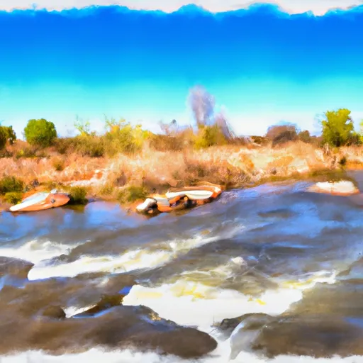
The river is rated as a class II-III, with rapids ranging from easy to moderate difficulty. The segment of the river most commonly run by rafters is a 10-mile stretch between the towns of Dudleyville and Winkelman. This section of the river features several rapids, including Pinball, Rollercoaster, and Roostertail.
One of the main obstacles on the San Pedro River is the presence of strainers, fallen trees or debris that create dangerous conditions for boaters. It is important for paddlers to be aware of these hazards and to take caution when navigating the river.
There are specific regulations in place for the San Pedro River, including a ban on glass containers and a limit on the number of people allowed on each raft. Additionally, all boaters are required to wear personal flotation devices (PFDs) at all times while on the river.
Overall, the San Pedro River offers a thrilling whitewater experience for paddlers, but it is important to be aware of the ideal streamflow range, class rating, specific rapids and obstacles, and regulations before embarking on a trip.
Plan your run down to the hour
Same weather feed Snoflo's iOS app uses -- updated continuously from NOAA / yr.no. Watch the precipitation column on the meteogram; rain ahead of a run typically lifts flows 12-48 hours later depending on the basin.
Next 5 days, hour by hour
Temperature line with weather symbols on top, snow + rain accumulation as columns, humidity as a dotted line.
5-day forecast table
Every 3 hours, broken out across temperature, snow, rain, humidity, and wind. Each cell is colour-coded relative to the column min/max.
| Time | Condition | Temp (°F) | Snow (in) | Rain (in) | Humidity (%) | Wind (mps) | Wind dir |
|---|---|---|---|---|---|---|---|
| Loading detailed forecast… | |||||||
15-day temperature & precipitation
Daily temperatures, snow, and rain projected over the next two weeks -- the upstream story that drives next week's flows.
Regional streamflow levels
USGS streamgauges around San Pedro River -- useful for spotting upstream pulses and gauging which tributary is contributing what.
| Streamgauge | Discharge | View |
|---|---|---|
| San Pedro River At Palominas | · | → |
| Ramsey Canyon Near Sierra Vista | · | → |
| Banning Creek Near Bisbee | 1 cfs | → |
| Garden Canyon Near Fort Huachuca | · | → |
| Huachuca Canyon Near Fort Huachuca | · | → |
| San Pedro River At Charleston | 7 cfs | → |
Plan a longer trip
The closest boat launches, other paddle runs, and campgrounds so a day on the water can grow into a full weekend.
Other river runs
- Babocomari River
- Cienega Creek
- Headwaters Within Wilderness To Wilderness Boundary
- Headwaters To Wilderness Boundary
- Cima Creek - Headwaters To Wilderness Boundary
Campgrounds
- Reef Townsite
- Reef Townsite Campground
- Ramsey Vista
- Ramsey Vista Campground
- Rv Campground
- Garden Canyon Military - Fort Huachuca
Whitewater safety
- Check the flow before you run
- Use the linked-gauge card and Regional Flow panel above. Class ratings change with flow -- a Class III at low water can become Class IV+ at high water.
- Know your skill ceiling
- Pick runs comfortably below your ceiling. Cold-water and big-water runs raise the consequences of any mistake.
- Wear the right gear
- Helmet, PFD, drysuit / wetsuit when water is below 60°F. Throw bag, knife, and whistle on your person, not in the boat.
- Scout, set safety, and run with a team
- Scout new rapids on foot, set safety with throw bags above the consequence pool, and run with at least one other competent paddler.
- Respect the river
- Strainers, undercuts, low-head dams, and wood can kill at any class rating. When in doubt, portage.
Set push alerts in the Snoflo app
Save San Pedro River as a favorite, set a discharge threshold (e.g. "alert me when flow hits 600 cfs"), and the iOS app pushes the moment the linked gauge crosses.
About San Pedro River
What's the optimal flow for San Pedro River?
The optimal flow depends on the section and the craft. Check the Run Details panel for the linked gauge and current status.
How fresh is the cfs reading on this page?
The linked USGS streamgauge reports continuously (every 15 minutes); Snoflo refreshes throughout the day. Hover the streamflow sparkline to read individual datapoints.
What's the whitewater class?
See the Run Details panel for the class rating Snoflo tracks for this run. Class ratings change with flow -- a Class III at low water can become Class IV in high water.
Where do I put in / take out?
Tap Directions in the hero above to open driving directions to the put-in. For shuttle planning, check the Nearby Boat Launches panel and the river run operator's site.
Can I get alerts when flows hit the optimal range?
Yes -- alerts are managed in the Snoflo iOS app. Favorite this run, set a discharge threshold, and you'll get a push the moment the gauge crosses.
Other runs near here
Snoflo-tracked paddle runs within driving distance of San Pedro River.