Nf Boundary At Pine Ridge, Ar To Highway 298 Bridge Near Sims, Ar River Run
Community Reviews
Been here? Share the conditions.
Reviews, ratings & photos are added in the free Snoflo iOS app — rate a spot, tag the conditions, and your visit is verified by location. Add or manage your reviews from the app.
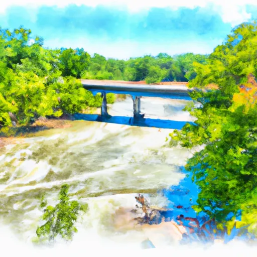
Nf Boundary At Pine Ridge, Ar To Highway 298 Bridge Near Sims, Ar
The river rapids and obstacles on this run include "The Chute," a Class III rapid that requires precise maneuvering, and "The Narrows," a section with several large boulders that create challenging technical moves. There are also several smaller rapids and riffles throughout the run. It is important for paddlers to be aware of underwater hazards such as strainers and sweepers.
Specific regulations for this area include a required permit from the US Forest Service and a limit of six people per permit. Campfires are prohibited, and all trash must be carried out. Additionally, all participants must wear a properly fitting personal flotation device (PFD) and a helmet.
Plan your run down to the hour
Same weather feed Snoflo's iOS app uses -- updated continuously from NOAA / yr.no. Watch the precipitation column on the meteogram; rain ahead of a run typically lifts flows 12-48 hours later depending on the basin.
Next 5 days, hour by hour
Temperature line with weather symbols on top, snow + rain accumulation as columns, humidity as a dotted line.
5-day forecast table
Every 3 hours, broken out across temperature, snow, rain, humidity, and wind. Each cell is colour-coded relative to the column min/max.
| Time | Condition | Temp (°F) | Snow (in) | Rain (in) | Humidity (%) | Wind (mps) | Wind dir |
|---|---|---|---|---|---|---|---|
| Loading detailed forecast… | |||||||
15-day temperature & precipitation
Daily temperatures, snow, and rain projected over the next two weeks -- the upstream story that drives next week's flows.
Regional streamflow levels
USGS streamgauges around Nf Boundary At Pine Ridge, Ar To Highway 298 Bridge Near Sims, Ar -- useful for spotting upstream pulses and gauging which tributary is contributing what.
| Streamgauge | Discharge | View |
|---|---|---|
| Ouachita River Near Mount Ida | 9 cfs | → |
| Little Missouri River Near Langley | 7 cfs | → |
| Cossatot River Near Vandervoort | 8 cfs | → |
| Caddo River Near Caddo Gap | 24 cfs | → |
| Fourche Lafave River Near Gravelly | 22 cfs | → |
| Poteau River At Cauthron | 5 cfs | → |
Plan a longer trip
The closest boat launches, other paddle runs, and campgrounds so a day on the water can grow into a full weekend.
Other river runs
- Sec 30, T3s, R27w To Sec 19, T4s, R24w
- Headwaters In Sec 8, T1s, R31w To Nf Boundary At Acorn, Ar
- Highway 298 Bridge Near Sims, Ar To Slackwater Of Lake Ouachita
- State Highway 4 To Broken Bow Lake
- Headwaters Sec 2, T1n, R20w To Sec 7, T1n, R19w
Campgrounds
Fishing spots
- Big Brushy Creek Day Use
- Irons Fork Reservoir
- Rocky Shoals Day Use
- South Fork Saline River
- Shady Lake
- Saline River
Parks
- Caney Creek National Game Refuge
- National Wild And Scenic River Little Missouri, Arkansas
- Caney Creek Wilderness
- Caney Creek Wildlife Management Area
- Mark Green Memorial Park
- Lee Mcmillan Memorial Park
Points of interest
Whitewater safety
- Check the flow before you run
- Use the linked-gauge card and Regional Flow panel above. Class ratings change with flow -- a Class III at low water can become Class IV+ at high water.
- Know your skill ceiling
- Pick runs comfortably below your ceiling. Cold-water and big-water runs raise the consequences of any mistake.
- Wear the right gear
- Helmet, PFD, drysuit / wetsuit when water is below 60°F. Throw bag, knife, and whistle on your person, not in the boat.
- Scout, set safety, and run with a team
- Scout new rapids on foot, set safety with throw bags above the consequence pool, and run with at least one other competent paddler.
- Respect the river
- Strainers, undercuts, low-head dams, and wood can kill at any class rating. When in doubt, portage.
Set push alerts in the Snoflo app
Save Nf Boundary At Pine Ridge, Ar To Highway 298 Bridge Near Sims, Ar as a favorite, set a discharge threshold (e.g. "alert me when flow hits 600 cfs"), and the iOS app pushes the moment the linked gauge crosses.
About Nf Boundary At Pine Ridge, Ar To Highway 298 Bridge Near Sims, Ar
What's the optimal flow for Nf Boundary At Pine Ridge, Ar To Highway 298 Bridge Near Sims, Ar?
The optimal flow depends on the section and the craft. Check the Run Details panel for the linked gauge and current status.
How fresh is the cfs reading on this page?
The linked USGS streamgauge reports continuously (every 15 minutes); Snoflo refreshes throughout the day. Hover the streamflow sparkline to read individual datapoints.
What's the whitewater class?
See the Run Details panel for the class rating Snoflo tracks for this run. Class ratings change with flow -- a Class III at low water can become Class IV in high water.
Where do I put in / take out?
Tap Directions in the hero above to open driving directions to the put-in. For shuttle planning, check the Nearby Boat Launches panel and the river run operator's site.
Can I get alerts when flows hit the optimal range?
Yes -- alerts are managed in the Snoflo iOS app. Favorite this run, set a discharge threshold, and you'll get a push the moment the gauge crosses.
Other runs near here
Snoflo-tracked paddle runs within driving distance of Nf Boundary At Pine Ridge, Ar To Highway 298 Bridge Near Sims, Ar.