Sec 30, T3s, R27w To Sec 19, T4s, R24w River Run
Community Reviews
Been here? Share the conditions.
Reviews, ratings & photos are added in the free Snoflo iOS app — rate a spot, tag the conditions, and your visit is verified by location. Add or manage your reviews from the app.
Sec 30, T3s, R27w To Sec 19, T4s, R24w
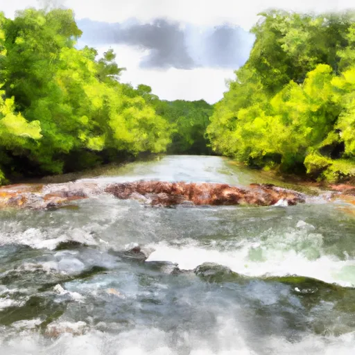
The Whitewater River Run features several notable rapids and obstacles, including Big Rock, Devil's Backbone, and Roaring Rapids. These rapids range in difficulty from class II to class III. Other challenges on the river include strainers and sweepers, which can be hazardous if not navigated properly.
There are specific regulations to the area that visitors should be aware of. The Arkansas Game and Fish Commission requires that all boaters have a valid Arkansas Boating Education Card or equivalent certification from another state. Additionally, all boaters must wear a personal flotation device (PFD) while on the river. It is also important to note that the river is closed to boating during flood stages, which are typically above 10 feet.
Overall, the Whitewater River Run is a challenging and exciting adventure for experienced boaters. It is important to check the streamflow levels before embarking on the trip and to adhere to all regulations set forth by the Arkansas Game and Fish Commission for the safety of all visitors.
Plan your run down to the hour
Same weather feed Snoflo's iOS app uses -- updated continuously from NOAA / yr.no. Watch the precipitation column on the meteogram; rain ahead of a run typically lifts flows 12-48 hours later depending on the basin.
Next 5 days, hour by hour
Temperature line with weather symbols on top, snow + rain accumulation as columns, humidity as a dotted line.
5-day forecast table
Every 3 hours, broken out across temperature, snow, rain, humidity, and wind. Each cell is colour-coded relative to the column min/max.
| Time | Condition | Temp (°F) | Snow (in) | Rain (in) | Humidity (%) | Wind (mps) | Wind dir |
|---|---|---|---|---|---|---|---|
| Loading detailed forecast… | |||||||
15-day temperature & precipitation
Daily temperatures, snow, and rain projected over the next two weeks -- the upstream story that drives next week's flows.
Regional streamflow levels
USGS streamgauges around Sec 30, T3s, R27w To Sec 19, T4s, R24w -- useful for spotting upstream pulses and gauging which tributary is contributing what.
| Streamgauge | Discharge | View |
|---|---|---|
| Little Missouri River Near Langley | 7 cfs | → |
| Ouachita River Near Mount Ida | 12 cfs | → |
| Cossatot River Near Vandervoort | 9 cfs | → |
| Caddo River Near Caddo Gap | 26 cfs | → |
| Fourche Lafave River Near Gravelly | 29 cfs | → |
| Saline River Near Lockesburg | 29 cfs | → |
Plan a longer trip
The closest boat launches, other paddle runs, and campgrounds so a day on the water can grow into a full weekend.
Boat launches
- Highway 70 Landing And Marina
- Arrowhead Point
- Irons Fork Lake
- Self Creek Ramp Road Daisy
- Daisy State Park Area B
- Daisy State Park - Area C Daisy
Other river runs
- Nf Boundary At Pine Ridge, Ar To Highway 298 Bridge Near Sims, Ar
- Headwaters In Sec 8, T1s, R31w To Nf Boundary At Acorn, Ar
- Highway 298 Bridge Near Sims, Ar To Slackwater Of Lake Ouachita
- State Highway 4 To Broken Bow Lake
- Headwaters Sec 2, T1n, R20w To Sec 7, T1n, R19w
Campgrounds
- Albert Pike
- Bard Springs Recreation Area
- Bard Springs
- Shady Lake
- Shirley Creek
- Star Of The West - Lake Greeson
Fishing spots
- South Fork Saline River
- Shady Lake
- Saline River
- Rocky Shoals Day Use
- Big Brushy Creek Day Use
- Irons Fork Reservoir
Whitewater safety
- Check the flow before you run
- Use the linked-gauge card and Regional Flow panel above. Class ratings change with flow -- a Class III at low water can become Class IV+ at high water.
- Know your skill ceiling
- Pick runs comfortably below your ceiling. Cold-water and big-water runs raise the consequences of any mistake.
- Wear the right gear
- Helmet, PFD, drysuit / wetsuit when water is below 60°F. Throw bag, knife, and whistle on your person, not in the boat.
- Scout, set safety, and run with a team
- Scout new rapids on foot, set safety with throw bags above the consequence pool, and run with at least one other competent paddler.
- Respect the river
- Strainers, undercuts, low-head dams, and wood can kill at any class rating. When in doubt, portage.
Set push alerts in the Snoflo app
Save Sec 30, T3s, R27w To Sec 19, T4s, R24w as a favorite, set a discharge threshold (e.g. "alert me when flow hits 600 cfs"), and the iOS app pushes the moment the linked gauge crosses.
About Sec 30, T3s, R27w To Sec 19, T4s, R24w
What's the optimal flow for Sec 30, T3s, R27w To Sec 19, T4s, R24w?
The optimal flow depends on the section and the craft. Check the Run Details panel for the linked gauge and current status.
How fresh is the cfs reading on this page?
The linked USGS streamgauge reports continuously (every 15 minutes); Snoflo refreshes throughout the day. Hover the streamflow sparkline to read individual datapoints.
What's the whitewater class?
See the Run Details panel for the class rating Snoflo tracks for this run. Class ratings change with flow -- a Class III at low water can become Class IV in high water.
Where do I put in / take out?
Tap Directions in the hero above to open driving directions to the put-in. For shuttle planning, check the Nearby Boat Launches panel and the river run operator's site.
Can I get alerts when flows hit the optimal range?
Yes -- alerts are managed in the Snoflo iOS app. Favorite this run, set a discharge threshold, and you'll get a push the moment the gauge crosses.
Other runs near here
Snoflo-tracked paddle runs within driving distance of Sec 30, T3s, R27w To Sec 19, T4s, R24w.