Headwaters To Ends One Quarter Mile South Of Bear Valley Road Bridge Segment 1: Ends 1/4 Mile South Of Bear Valley Road Bridge Segment 2: Caltrans Corporation Yard At Point Reyes Staton. River Run
Community Reviews
Been here? Share the conditions.
Reviews, ratings & photos are added in the free Snoflo iOS app — rate a spot, tag the conditions, and your visit is verified by location. Add or manage your reviews from the app.
Headwaters To Ends One Quarter Mile South Of Bear Valley Road Bridge Segment 1: Ends 1/4 Mile South Of Bear Valley Road Bridge Segment 2: Caltrans Corporation Yard At Point Reyes Staton.
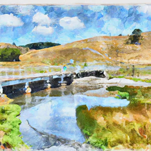
Headwaters To Ends One Quarter Mile South Of Bear Valley Road Bridge Segment 1: Ends 1/4 Mile South Of Bear Valley Road Bridge Segment 2: Caltrans Corporation Yard At Point Reyes Staton. is a paddle run on the Olema Creek in California tracked by Snoflo. This page pairs the linked USGS streamgauge with weather forecasts, regional flow context, and nearby boat launches so you can scout the run without leaving the screen.
Use the linked-gauge card above to gauge current conditions, the Run Details panel for class / length / gradient, and the 15-day outlook to pick a window when flows hit the optimal range.
Plan your run down to the hour
Same weather feed Snoflo's iOS app uses -- updated continuously from NOAA / yr.no. Watch the precipitation column on the meteogram; rain ahead of a run typically lifts flows 12-48 hours later depending on the basin.
Next 5 days, hour by hour
Temperature line with weather symbols on top, snow + rain accumulation as columns, humidity as a dotted line.
5-day forecast table
Every 3 hours, broken out across temperature, snow, rain, humidity, and wind. Each cell is colour-coded relative to the column min/max.
| Time | Condition | Temp (°F) | Snow (in) | Rain (in) | Humidity (%) | Wind (mps) | Wind dir |
|---|---|---|---|---|---|---|---|
| Loading detailed forecast… | |||||||
15-day temperature & precipitation
Daily temperatures, snow, and rain projected over the next two weeks -- the upstream story that drives next week's flows.
Regional streamflow levels
USGS streamgauges around Headwaters To Ends One Quarter Mile South Of Bear Valley Road Bridge Segment 1: Ends 1/4 Mile South Of Bear Valley Road Bridge Segment 2: Caltrans Corporation Yard At Point Reyes Staton. -- useful for spotting upstream pulses and gauging which tributary is contributing what.
| Streamgauge | Discharge | View |
|---|---|---|
| Lagunitas C A Sp Taylor State Pk Ca | 9 cfs | → |
| Olema C A Vedanta Bridge A Olema Ca | 0 cfs | → |
| Corte Madera C A Ross Ca | 0 cfs | → |
| Lagunitas C Nr Pt Reyes Station Ca | 8 cfs | → |
| Redwood C A Hwy 1 Bridge A Muir Beach Ca | 0 cfs | → |
| Novato C A Novato Ca | 1 cfs | → |
Plan a longer trip
The closest boat launches, other paddle runs, and campgrounds so a day on the water can grow into a full weekend.
Boat launches
- Steven Way 98, Marin County
- Buck's Landing
- Safe Harbor Loch Lomond Marina
- Tomales Bay Resort
- Marin Rod And Gun Club Pier 2675, San Rafael
- Calypso Shores 23, Marin County
Other river runs
- Olema Ranch Campground To Caltrans Corporation Yard At Point Reyes Station
- Headwaters To Mouth
- Cache Creek
Campgrounds
- Camp Taylor
- Madrone Group Camp
- Five Brooks Horse Camp
- Orchard Hill Campground
- Glen Campground
- Olema Campground
Fishing spots
- Lake Lagunitas
- Berkeley Yacht Harbor
- San Pablo Reservoir
- Lake Temescal
- 9th Street Boat Ramp
- City Of Benicia Fishing Pier
Whitewater safety
- Check the flow before you run
- Use the linked-gauge card and Regional Flow panel above. Class ratings change with flow -- a Class III at low water can become Class IV+ at high water.
- Know your skill ceiling
- Pick runs comfortably below your ceiling. Cold-water and big-water runs raise the consequences of any mistake.
- Wear the right gear
- Helmet, PFD, drysuit / wetsuit when water is below 60°F. Throw bag, knife, and whistle on your person, not in the boat.
- Scout, set safety, and run with a team
- Scout new rapids on foot, set safety with throw bags above the consequence pool, and run with at least one other competent paddler.
- Respect the river
- Strainers, undercuts, low-head dams, and wood can kill at any class rating. When in doubt, portage.
Set push alerts in the Snoflo app
Save Headwaters To Ends One Quarter Mile South Of Bear Valley Road Bridge Segment 1: Ends 1/4 Mile South Of Bear Valley Road Bridge Segment 2: Caltrans Corporation Yard At Point Reyes Staton. as a favorite, set a discharge threshold (e.g. "alert me when flow hits 600 cfs"), and the iOS app pushes the moment the linked gauge crosses.
About Headwaters To Ends One Quarter Mile South Of Bear Valley Road Bridge Segment 1: Ends 1/4 Mile South Of Bear Valley Road Bridge Segment 2: Caltrans Corporation Yard At Point Reyes Staton.
What's the optimal flow for Headwaters To Ends One Quarter Mile South Of Bear Valley Road Bridge Segment 1: Ends 1/4 Mile South Of Bear Valley Road Bridge Segment 2: Caltrans Corporation Yard At Point Reyes Staton.?
The optimal flow depends on the section and the craft. Check the Run Details panel for the linked gauge and current status.
How fresh is the cfs reading on this page?
The linked USGS streamgauge reports continuously (every 15 minutes); Snoflo refreshes throughout the day. Hover the streamflow sparkline to read individual datapoints.
What's the whitewater class?
See the Run Details panel for the class rating Snoflo tracks for this run. Class ratings change with flow -- a Class III at low water can become Class IV in high water.
Where do I put in / take out?
Tap Directions in the hero above to open driving directions to the put-in. For shuttle planning, check the Nearby Boat Launches panel and the river run operator's site.
Can I get alerts when flows hit the optimal range?
Yes -- alerts are managed in the Snoflo iOS app. Favorite this run, set a discharge threshold, and you'll get a push the moment the gauge crosses.
Other runs near here
Snoflo-tracked paddle runs within driving distance of Headwaters To Ends One Quarter Mile South Of Bear Valley Road Bridge Segment 1: Ends 1/4 Mile South Of Bear Valley Road Bridge Segment 2: Caltrans Corporation Yard At Point Reyes Staton..