Chicago Ravine To Confluence With Middle Fork Feather Wsr river run
Community Reviews
Been here? Share the conditions.
Reviews, ratings & photos are added in the free Snoflo iOS app — rate a spot, tag the conditions, and your visit is verified by location. Add or manage your reviews from the app.
Chicago Ravine To Confluence With Middle Fork Feather Wsr
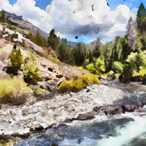
The Whitewater River Run Chicago Ravine to Confluence with Middle Fork Feather WSR is a popular whitewater destination in California. The ideal streamflow range for this run is between 500 and 1,500 cubic feet per second (cfs). The segment mileage for this run is approximately 8 miles, with a class rating of III-IV.
Some of the specific rapids and obstacles on this run include Chicago Ravine, which is a steep and technical section with several large drops and boulder gardens. Other notable rapids include Charlie's, Double Drop, and Pigeon Shoot. The run also features beautiful scenery, including deep canyons and rock formations.
There are several regulations that visitors to this area should be aware of. The use of motorized vehicles is prohibited within the river corridor, and camping is only allowed in designated areas. Visitors should also be aware of potential hazards, including strong currents and underwater obstacles.
Overall, the Whitewater River Run Chicago Ravine to Confluence with Middle Fork Feather WSR is a thrilling and challenging whitewater destination that offers beautiful scenery and exciting rapids. Visitors should come prepared with proper gear and knowledge of the area's regulations and potential hazards.
Plan your run down to the hour
Same weather feed Snoflo's iOS app uses -- updated continuously from NOAA / yr.no. Watch the precipitation column on the meteogram; rain ahead of a run typically lifts flows 12-48 hours later depending on the basin.
Next 5 days, hour by hour
Temperature line with weather symbols on top, snow + rain accumulation as columns, humidity as a dotted line.
5-day forecast table
Every 3 hours, broken out across temperature, snow, rain, humidity, and wind. Each cell is colour-coded relative to the column min/max.
| Time | Condition | Temp (°F) | Snow (in) | Rain (in) | Humidity (%) | Wind (mps) | Wind dir |
|---|---|---|---|---|---|---|---|
| Loading detailed forecast… | |||||||
15-day temperature & precipitation
Daily temperatures, snow, and rain projected over the next two weeks -- the upstream story that drives next week's flows.
Regional streamflow levels
USGS streamgauges around Chicago Ravine To Confluence With Middle Fork Feather Wsr -- useful for spotting upstream pulses and gauging which tributary is contributing what.
| Streamgauge | Discharge | View |
|---|---|---|
| Spanish C A Quincy Ca | 16 cfs | → |
| Spanish C Ab Blackhawk C At Keddie Ca | 37 cfs | → |
| N Yuba R Bl Goodyears Bar Ca | 170 cfs | → |
| Butte C Nr Chico Ca | 161 cfs | → |
| Little Truckee R Bl Div Dam Nr Sierraville Ca | 3 cfs | → |
| Deer C Nr Smartville Ca | 3 cfs | → |
Plan a longer trip
The closest boat launches, other paddle runs, and campgrounds so a day on the water can grow into a full weekend.
Boat launches
- Little Grass Valley (Black Rock Tent Camp)
- Plumas County
- Peninsula Road, Strawberry Valley
- Bucks Lakeshore Resort
- Oroville-Quincy Road 17000-17046, Meadow Valley
- Haskins Valley P.G. & E. Campground
Other river runs
- Headwaters To Chicago Ravine
- Headwaters To Middle Fork Feather Wsr
- Confluence Of Morrow Creek And Third Water Creek To Confluence With Middle Fork Feather River
- Headwaters To Confluence With Nelson Creek
- Confluence With East And West Branches Of Nelson Creek To Confluence With Middle Fork Feather Wsr
Campgrounds
- Cleghorn Bar
- Tooms Rv Campground
- Running Deer
- Red Feather
- Black Rock Tent(Family )
- Black Rock Walk-In Tent Campground
Fishing spots
Parks
Whitewater safety
- Check the flow before you run
- Use the linked-gauge card and Regional Flow panel above. Class ratings change with flow -- a Class III at low water can become Class IV+ at high water.
- Know your skill ceiling
- Pick runs comfortably below your ceiling. Cold-water and big-water runs raise the consequences of any mistake.
- Wear the right gear
- Helmet, PFD, drysuit / wetsuit when water is below 60°F. Throw bag, knife, and whistle on your person, not in the boat.
- Scout, set safety, and run with a team
- Scout new rapids on foot, set safety with throw bags above the consequence pool, and run with at least one other competent paddler.
- Respect the river
- Strainers, undercuts, low-head dams, and wood can kill at any class rating. When in doubt, portage.
Set push alerts in the Snoflo app
Save Chicago Ravine To Confluence With Middle Fork Feather Wsr as a favorite, set a discharge threshold (e.g. "alert me when flow hits 600 cfs"), and the iOS app pushes the moment the linked gauge crosses.
About Chicago Ravine To Confluence With Middle Fork Feather Wsr
What's the optimal flow for Chicago Ravine To Confluence With Middle Fork Feather Wsr?
The optimal flow depends on the section and the craft. Check the Run Details panel for the linked gauge and current status.
How fresh is the cfs reading on this page?
The linked USGS streamgauge reports continuously (every 15 minutes); Snoflo refreshes throughout the day. Hover the streamflow sparkline to read individual datapoints.
What's the whitewater class?
See the Run Details panel for the class rating Snoflo tracks for this run. Class ratings change with flow -- a Class III at low water can become Class IV in high water.
Where do I put in / take out?
Tap Directions in the hero above to open driving directions to the put-in. For shuttle planning, check the Nearby Boat Launches panel and the river run operator's site.
Can I get alerts when flows hit the optimal range?
Yes -- alerts are managed in the Snoflo iOS app. Favorite this run, set a discharge threshold, and you'll get a push the moment the gauge crosses.
Other runs near here
Snoflo-tracked paddle runs within driving distance of Chicago Ravine To Confluence With Middle Fork Feather Wsr.