Olema Ranch Campground To Caltrans Corporation Yard At Point Reyes Station River Run
Community Reviews
Been here? Share the conditions.
Reviews, ratings & photos are added in the free Snoflo iOS app — rate a spot, tag the conditions, and your visit is verified by location. Add or manage your reviews from the app.
Olema Ranch Campground To Caltrans Corporation Yard At Point Reyes Station
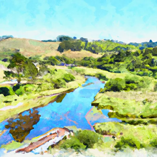
One of the most notable rapids along this stretch is the "Chicken Chute," which is a Class III rapid that requires skill and experience to navigate safely. Other notable obstacles on the river include several boulder gardens and strainers, which require careful attention and navigation.
Specific regulations to this area include the requirement for all river users to wear a personal flotation device (PFD) at all times while on the river. Additionally, all river users must adhere to Leave No Trace principles and pack out all trash and waste.
In conclusion, the Whitewater River Run from Olema Ranch Campground to Caltrans Corporation Yard at Point Reyes Station is an exhilarating and scenic stretch of river with an ideal streamflow range between 100 and 400 cfs, Class II ratings with some Class III rapids, a total segment mileage of approximately 5 miles, and specific regulations to ensure the safety and protection of the area.
Plan your run down to the hour
Same weather feed Snoflo's iOS app uses -- updated continuously from NOAA / yr.no. Watch the precipitation column on the meteogram; rain ahead of a run typically lifts flows 12-48 hours later depending on the basin.
Next 5 days, hour by hour
Temperature line with weather symbols on top, snow + rain accumulation as columns, humidity as a dotted line.
5-day forecast table
Every 3 hours, broken out across temperature, snow, rain, humidity, and wind. Each cell is colour-coded relative to the column min/max.
| Time | Condition | Temp (°F) | Snow (in) | Rain (in) | Humidity (%) | Wind (mps) | Wind dir |
|---|---|---|---|---|---|---|---|
| Loading detailed forecast… | |||||||
15-day temperature & precipitation
Daily temperatures, snow, and rain projected over the next two weeks -- the upstream story that drives next week's flows.
Regional streamflow levels
USGS streamgauges around Olema Ranch Campground To Caltrans Corporation Yard At Point Reyes Station -- useful for spotting upstream pulses and gauging which tributary is contributing what.
| Streamgauge | Discharge | View |
|---|---|---|
| Olema C A Vedanta Bridge A Olema Ca | 1 cfs | → |
| Lagunitas C Nr Pt Reyes Station Ca | 8 cfs | → |
| Lagunitas C A Sp Taylor State Pk Ca | 8 cfs | → |
| Walker C Nr Marshall Ca | 5 cfs | → |
| Novato C A Novato Ca | 1 cfs | → |
| Corte Madera C A Ross Ca | 0 cfs | → |
Plan a longer trip
The closest boat launches, other paddle runs, and campgrounds so a day on the water can grow into a full weekend.
Boat launches
- Tomales Bay Resort
- Miller Park
- Steven Way 98, Marin County
- Calypso Shores 23, Marin County
- Buck's Landing
- Petaluma Marina
Other river runs
- Headwaters To Ends One Quarter Mile South Of Bear Valley Road Bridge Segment 1: Ends 1/4 Mile South Of Bear Valley Road Bridge Segment 2: Caltrans Corporation Yard At Point Reyes Staton.
- Headwaters To Mouth
- Cache Creek
Campgrounds
- Olema Campground
- Sky Campground
- Five Brooks Horse Camp
- Orchard Hill Campground
- Madrone Group Camp
- Glen Campground
Fishing spots
Whitewater safety
- Check the flow before you run
- Use the linked-gauge card and Regional Flow panel above. Class ratings change with flow -- a Class III at low water can become Class IV+ at high water.
- Know your skill ceiling
- Pick runs comfortably below your ceiling. Cold-water and big-water runs raise the consequences of any mistake.
- Wear the right gear
- Helmet, PFD, drysuit / wetsuit when water is below 60°F. Throw bag, knife, and whistle on your person, not in the boat.
- Scout, set safety, and run with a team
- Scout new rapids on foot, set safety with throw bags above the consequence pool, and run with at least one other competent paddler.
- Respect the river
- Strainers, undercuts, low-head dams, and wood can kill at any class rating. When in doubt, portage.
Set push alerts in the Snoflo app
Save Olema Ranch Campground To Caltrans Corporation Yard At Point Reyes Station as a favorite, set a discharge threshold (e.g. "alert me when flow hits 600 cfs"), and the iOS app pushes the moment the linked gauge crosses.
About Olema Ranch Campground To Caltrans Corporation Yard At Point Reyes Station
What's the optimal flow for Olema Ranch Campground To Caltrans Corporation Yard At Point Reyes Station?
The optimal flow depends on the section and the craft. Check the Run Details panel for the linked gauge and current status.
How fresh is the cfs reading on this page?
The linked USGS streamgauge reports continuously (every 15 minutes); Snoflo refreshes throughout the day. Hover the streamflow sparkline to read individual datapoints.
What's the whitewater class?
See the Run Details panel for the class rating Snoflo tracks for this run. Class ratings change with flow -- a Class III at low water can become Class IV in high water.
Where do I put in / take out?
Tap Directions in the hero above to open driving directions to the put-in. For shuttle planning, check the Nearby Boat Launches panel and the river run operator's site.
Can I get alerts when flows hit the optimal range?
Yes -- alerts are managed in the Snoflo iOS app. Favorite this run, set a discharge threshold, and you'll get a push the moment the gauge crosses.
Other runs near here
Snoflo-tracked paddle runs within driving distance of Olema Ranch Campground To Caltrans Corporation Yard At Point Reyes Station.