Southern Boundary Of Wsr To Nf Boundary River Run
Community Reviews
Been here? Share the conditions.
Reviews, ratings & photos are added in the free Snoflo iOS app — rate a spot, tag the conditions, and your visit is verified by location. Add or manage your reviews from the app.
Southern Boundary Of Wsr To Nf Boundary
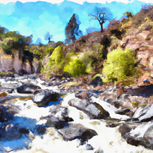
The rapids on this section of the river are varied and challenging, featuring large drops, tight turns, and technical maneuvers. Highlights include rapids such as "House Rock," "Staircase," and "The Chute." There are also several significant obstacles to navigate, including boulders, trees, and narrow channels.
In terms of regulations, it is important to note that permits are required for all visitors to the San Gorgonio Wilderness Area, and overnight camping is not allowed in the Whitewater Preserve section of the river. Additionally, all visitors are required to follow Leave No Trace principles and respect the natural environment.
Overall, the Whitewater River Run is a thrilling and challenging route for experienced paddlers. It is essential to check water levels and weather conditions before attempting this run, and to follow all regulations and safety guidelines in order to ensure a safe and enjoyable experience.
Plan your run down to the hour
Same weather feed Snoflo's iOS app uses -- updated continuously from NOAA / yr.no. Watch the precipitation column on the meteogram; rain ahead of a run typically lifts flows 12-48 hours later depending on the basin.
Next 5 days, hour by hour
Temperature line with weather symbols on top, snow + rain accumulation as columns, humidity as a dotted line.
5-day forecast table
Every 3 hours, broken out across temperature, snow, rain, humidity, and wind. Each cell is colour-coded relative to the column min/max.
| Time | Condition | Temp (°F) | Snow (in) | Rain (in) | Humidity (%) | Wind (mps) | Wind dir |
|---|---|---|---|---|---|---|---|
| Loading detailed forecast… | |||||||
15-day temperature & precipitation
Daily temperatures, snow, and rain projected over the next two weeks -- the upstream story that drives next week's flows.
Regional streamflow levels
USGS streamgauges around Southern Boundary Of Wsr To Nf Boundary -- useful for spotting upstream pulses and gauging which tributary is contributing what.
| Streamgauge | Discharge | View |
|---|---|---|
| Sf Kern R Nr Onyx Ca | 21 cfs | → |
| Sf Tule R Nr Cholollo Campground Nr Porterville Ca | 8 cfs | → |
| Deer C Nr Fountain Springs Ca | 5 cfs | → |
| Sf Tule R Nr Reservation Bndry Nr Porterville Ca | 10 cfs | → |
| Marble Fork Kaweah R Ab Horse C Nr Lodgepole Ca | 1 cfs | → |
| Piru C Ab Frenchmans Flat Ca | 16 cfs | → |
Plan a longer trip
The closest boat launches, other paddle runs, and campgrounds so a day on the water can grow into a full weekend.
Boat launches
- Kern County
- Dean's North Fork Marina
- Highway 178 10716-10726, Lake Isabella
- French Gulch Marina
- Lake Isabella (Engineers Point )
Other river runs
- Isabella Lake Dam To 7 Miles Downstream
- Sandy Flat Camp To Democrat Picnic Area
- 7 Miles From Isabella Dam To 20.2 Miles From Isabella Dam
- Table Meadow Creek To Kern River
- 20.2 Miles Downstream Of Isabella Dam To Western Nf Boundary
Campgrounds
- Long Valley
- Walker Pass
- Walker Pass Campground
- Chimney Creek
- Chimney Peak Campground
- Isabella Lake Dispersed Camping
Fishing spots
- Hanning Flat Dispersed Area
- Isabella Lake
- Lake Isabella
- South Fork Kern River
- Dry Meadow Creek
- Bone Creek
Whitewater safety
- Check the flow before you run
- Use the linked-gauge card and Regional Flow panel above. Class ratings change with flow -- a Class III at low water can become Class IV+ at high water.
- Know your skill ceiling
- Pick runs comfortably below your ceiling. Cold-water and big-water runs raise the consequences of any mistake.
- Wear the right gear
- Helmet, PFD, drysuit / wetsuit when water is below 60°F. Throw bag, knife, and whistle on your person, not in the boat.
- Scout, set safety, and run with a team
- Scout new rapids on foot, set safety with throw bags above the consequence pool, and run with at least one other competent paddler.
- Respect the river
- Strainers, undercuts, low-head dams, and wood can kill at any class rating. When in doubt, portage.
Set push alerts in the Snoflo app
Save Southern Boundary Of Wsr To Nf Boundary as a favorite, set a discharge threshold (e.g. "alert me when flow hits 600 cfs"), and the iOS app pushes the moment the linked gauge crosses.
About Southern Boundary Of Wsr To Nf Boundary
What's the optimal flow for Southern Boundary Of Wsr To Nf Boundary?
The optimal flow depends on the section and the craft. Check the Run Details panel for the linked gauge and current status.
How fresh is the cfs reading on this page?
The linked USGS streamgauge reports continuously (every 15 minutes); Snoflo refreshes throughout the day. Hover the streamflow sparkline to read individual datapoints.
What's the whitewater class?
See the Run Details panel for the class rating Snoflo tracks for this run. Class ratings change with flow -- a Class III at low water can become Class IV in high water.
Where do I put in / take out?
Tap Directions in the hero above to open driving directions to the put-in. For shuttle planning, check the Nearby Boat Launches panel and the river run operator's site.
Can I get alerts when flows hit the optimal range?
Yes -- alerts are managed in the Snoflo iOS app. Favorite this run, set a discharge threshold, and you'll get a push the moment the gauge crosses.
Other runs near here
Snoflo-tracked paddle runs within driving distance of Southern Boundary Of Wsr To Nf Boundary.