Pond In Sec 35, T26n, R9e To Confluence With Spanish Creek River Run
Community Reviews
Been here? Share the conditions.
Reviews, ratings & photos are added in the free Snoflo iOS app — rate a spot, tag the conditions, and your visit is verified by location. Add or manage your reviews from the app.
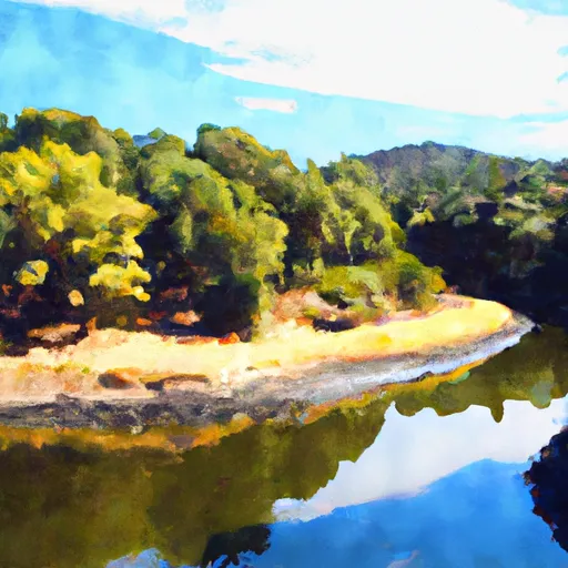
Pond In Sec 35, T26n, R9e To Confluence With Spanish Creek
The Whitewater River run has several challenging rapids and obstacles, such as the "Entrance Rapid," "The Maze," and "Souse Hole." At "Entrance Rapid," paddlers need to navigate through a boulder garden with several surfing opportunities. "The Maze" is a technical section that requires precise maneuvering through a series of boulders. "Souse Hole" is another challenging rapid that requires avoiding the recirculating water at the bottom of the drop.
Specific regulations to the area include a requirement for life jackets and helmets, which are mandatory for all paddlers. Additionally, there are restrictions on camping and fires along the riverbank. Paddlers are advised to check with local authorities before embarking on the Whitewater River run for any updates or changes in regulations.
In conclusion, the Whitewater River run from Pond in Sec 35, T26N, R9E to Confluence with Spanish Creek in California is a challenging whitewater adventure suitable for intermediate and advanced paddlers. The ideal streamflow range is between 300 and 800 cfs, and the run is rated as Class III-IV. Paddlers should be aware of specific regulations to the area, including mandatory life jackets and helmets and restrictions on camping and fires.
Plan your run down to the hour
Same weather feed Snoflo's iOS app uses -- updated continuously from NOAA / yr.no. Watch the precipitation column on the meteogram; rain ahead of a run typically lifts flows 12-48 hours later depending on the basin.
Next 5 days, hour by hour
Temperature line with weather symbols on top, snow + rain accumulation as columns, humidity as a dotted line.
5-day forecast table
Every 3 hours, broken out across temperature, snow, rain, humidity, and wind. Each cell is colour-coded relative to the column min/max.
| Time | Condition | Temp (°F) | Snow (in) | Rain (in) | Humidity (%) | Wind (mps) | Wind dir |
|---|---|---|---|---|---|---|---|
| Loading detailed forecast… | |||||||
15-day temperature & precipitation
Daily temperatures, snow, and rain projected over the next two weeks -- the upstream story that drives next week's flows.
Regional streamflow levels
USGS streamgauges around Pond In Sec 35, T26n, R9e To Confluence With Spanish Creek -- useful for spotting upstream pulses and gauging which tributary is contributing what.
| Streamgauge | Discharge | View |
|---|---|---|
| Spanish C Ab Blackhawk C At Keddie Ca | 20 cfs | → |
| Spanish C A Quincy Ca | 13 cfs | → |
| N Yuba R Bl Goodyears Bar Ca | 139 cfs | → |
| Butte C Nr Chico Ca | 170 cfs | → |
| Hat C Nr Hat Creek Ca | 126 cfs | → |
| Deer C Nr Vina Ca | 94 cfs | → |
Plan a longer trip
The closest boat launches, other paddle runs, and campgrounds so a day on the water can grow into a full weekend.
Boat launches
- Volcanic Legacy Scenic Byway, California
- Lake Cove Resort & Marina
- Plumas County
- Bucks Lakeshore Resort
- Bucks Lake Marina
- Plumas Pines Resort
Other river runs
- Silver Lake To Meadow Valley
- Confluence Of Spanish Creek And Indian Creek To Confluence With North Fork Feather River
- Headwaters To Bucks Lake
- Caribou Reservoir To Beldon
- Nf Boundary To Confluence With North Fork Feather River
Campgrounds
- Spanish Creek Campground
- Spanish Creek Group Campground
- Spanish Creek (Family )
- Snake Lake Campground
- Snake Lake (Family )
- Snake Lake Campground And Equestrian Camp
Fishing spots
Whitewater safety
- Check the flow before you run
- Use the linked-gauge card and Regional Flow panel above. Class ratings change with flow -- a Class III at low water can become Class IV+ at high water.
- Know your skill ceiling
- Pick runs comfortably below your ceiling. Cold-water and big-water runs raise the consequences of any mistake.
- Wear the right gear
- Helmet, PFD, drysuit / wetsuit when water is below 60°F. Throw bag, knife, and whistle on your person, not in the boat.
- Scout, set safety, and run with a team
- Scout new rapids on foot, set safety with throw bags above the consequence pool, and run with at least one other competent paddler.
- Respect the river
- Strainers, undercuts, low-head dams, and wood can kill at any class rating. When in doubt, portage.
Set push alerts in the Snoflo app
Save Pond In Sec 35, T26n, R9e To Confluence With Spanish Creek as a favorite, set a discharge threshold (e.g. "alert me when flow hits 600 cfs"), and the iOS app pushes the moment the linked gauge crosses.
About Pond In Sec 35, T26n, R9e To Confluence With Spanish Creek
What's the optimal flow for Pond In Sec 35, T26n, R9e To Confluence With Spanish Creek?
The optimal flow depends on the section and the craft. Check the Run Details panel for the linked gauge and current status.
How fresh is the cfs reading on this page?
The linked USGS streamgauge reports continuously (every 15 minutes); Snoflo refreshes throughout the day. Hover the streamflow sparkline to read individual datapoints.
What's the whitewater class?
See the Run Details panel for the class rating Snoflo tracks for this run. Class ratings change with flow -- a Class III at low water can become Class IV in high water.
Where do I put in / take out?
Tap Directions in the hero above to open driving directions to the put-in. For shuttle planning, check the Nearby Boat Launches panel and the river run operator's site.
Can I get alerts when flows hit the optimal range?
Yes -- alerts are managed in the Snoflo iOS app. Favorite this run, set a discharge threshold, and you'll get a push the moment the gauge crosses.
Other runs near here
Snoflo-tracked paddle runs within driving distance of Pond In Sec 35, T26n, R9e To Confluence With Spanish Creek.