Butte Creek Trib River Run
Community Reviews
Been here? Share the conditions.
Reviews, ratings & photos are added in the free Snoflo iOS app — rate a spot, tag the conditions, and your visit is verified by location. Add or manage your reviews from the app.
Butte Creek Trib
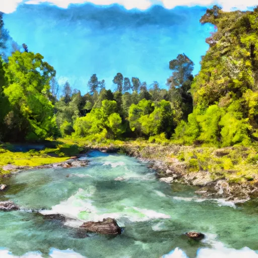
This river is rated as a class III-IV, with some portions reaching class V during high water. The segment mileage is around 9.5 miles, starting at the Butte Creek Picnic Grounds and ending at the covered bridge in the town of Chico.
The river features several rapids and obstacles, including the Entrance Rapid, Son of Entrance Rapid, and the infamous Hell Hole. The Entrance Rapid is a class IV rapid that requires precise navigation, while the Hell Hole is a class V rapid that requires advanced skills and experience.
In terms of regulations, there are no specific regulations for this area. However, it is important to note that the river runs through private property, so it is important to respect the rights of the landowners and obtain permission before accessing the river.
Overall, the Butte Creek Tributary is a challenging and exciting river run that requires skill and experience. It is important to be aware of the ideal streamflow range, class rating, segment mileage, obstacles, and regulations before embarking on this adventure.
Plan your run down to the hour
Same weather feed Snoflo's iOS app uses -- updated continuously from NOAA / yr.no. Watch the precipitation column on the meteogram; rain ahead of a run typically lifts flows 12-48 hours later depending on the basin.
Next 5 days, hour by hour
Temperature line with weather symbols on top, snow + rain accumulation as columns, humidity as a dotted line.
5-day forecast table
Every 3 hours, broken out across temperature, snow, rain, humidity, and wind. Each cell is colour-coded relative to the column min/max.
| Time | Condition | Temp (°F) | Snow (in) | Rain (in) | Humidity (%) | Wind (mps) | Wind dir |
|---|---|---|---|---|---|---|---|
| Loading detailed forecast… | |||||||
15-day temperature & precipitation
Daily temperatures, snow, and rain projected over the next two weeks -- the upstream story that drives next week's flows.
Regional streamflow levels
USGS streamgauges around Butte Creek Trib -- useful for spotting upstream pulses and gauging which tributary is contributing what.
| Streamgauge | Discharge | View |
|---|---|---|
| Van Duzen R Nr Bridgeville Ca | 11 cfs | → |
| Eel R A Fort Seward Ca | 62 cfs | → |
| Sf Eel R Nr Miranda Ca | 37 cfs | → |
| Bull C Nr Weott Ca | 1 cfs | → |
| Mad R Ab Ruth Res Nr Forest Glen Ca | 2 cfs | → |
| Sf Trinity R Bl Hyampom Ca | 90 cfs | → |
Plan a longer trip
The closest boat launches, other paddle runs, and campgrounds so a day on the water can grow into a full weekend.
Campgrounds
- Mad River Campground
- Mad River
- Miller Spring
- Hidden Springs Campground
- Free Overnight Forrest Parking, Tents Possible
- Hike And Bike Campsite
Whitewater safety
- Check the flow before you run
- Use the linked-gauge card and Regional Flow panel above. Class ratings change with flow -- a Class III at low water can become Class IV+ at high water.
- Know your skill ceiling
- Pick runs comfortably below your ceiling. Cold-water and big-water runs raise the consequences of any mistake.
- Wear the right gear
- Helmet, PFD, drysuit / wetsuit when water is below 60°F. Throw bag, knife, and whistle on your person, not in the boat.
- Scout, set safety, and run with a team
- Scout new rapids on foot, set safety with throw bags above the consequence pool, and run with at least one other competent paddler.
- Respect the river
- Strainers, undercuts, low-head dams, and wood can kill at any class rating. When in doubt, portage.
Set push alerts in the Snoflo app
Save Butte Creek Trib as a favorite, set a discharge threshold (e.g. "alert me when flow hits 600 cfs"), and the iOS app pushes the moment the linked gauge crosses.
About Butte Creek Trib
What's the optimal flow for Butte Creek Trib?
The optimal flow depends on the section and the craft. Check the Run Details panel for the linked gauge and current status.
How fresh is the cfs reading on this page?
The linked USGS streamgauge reports continuously (every 15 minutes); Snoflo refreshes throughout the day. Hover the streamflow sparkline to read individual datapoints.
What's the whitewater class?
See the Run Details panel for the class rating Snoflo tracks for this run. Class ratings change with flow -- a Class III at low water can become Class IV in high water.
Where do I put in / take out?
Tap Directions in the hero above to open driving directions to the put-in. For shuttle planning, check the Nearby Boat Launches panel and the river run operator's site.
Can I get alerts when flows hit the optimal range?
Yes -- alerts are managed in the Snoflo iOS app. Favorite this run, set a discharge threshold, and you'll get a push the moment the gauge crosses.
Other runs near here
Snoflo-tracked paddle runs within driving distance of Butte Creek Trib.