Lacks Creek River Run
Community Reviews
Been here? Share the conditions.
Reviews, ratings & photos are added in the free Snoflo iOS app — rate a spot, tag the conditions, and your visit is verified by location. Add or manage your reviews from the app.
Lacks Creek
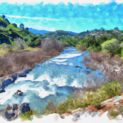
The Lacks Creek section of the Whitewater River in California is an exciting Class III-IV run that is best experienced during the spring and early summer months. The ideal streamflow range for this run is between 500 and 1,500 cubic feet per second (cfs) with peak flows often occurring in May or June. The segment mileage for the Lacks Creek section is approximately 6 miles and features a number of thrilling rapids, including the popular "Toilet Bowl" and "Rock Crusher."
It is important to note that this section of the Whitewater River is located on private property and requires a permit from the landowner, which can be obtained through California Whitewater. Additionally, all boaters are required to wear a personal flotation device (PFD) and helmets are strongly recommended due to the nature of the rapids.
Overall, the Lacks Creek section of the Whitewater River offers a challenging and exhilarating experience for intermediate to advanced boaters. As with any river run, it is important to check current streamflow conditions and any potential hazards before embarking on the trip.
Plan your run down to the hour
Same weather feed Snoflo's iOS app uses -- updated continuously from NOAA / yr.no. Watch the precipitation column on the meteogram; rain ahead of a run typically lifts flows 12-48 hours later depending on the basin.
Next 5 days, hour by hour
Temperature line with weather symbols on top, snow + rain accumulation as columns, humidity as a dotted line.
5-day forecast table
Every 3 hours, broken out across temperature, snow, rain, humidity, and wind. Each cell is colour-coded relative to the column min/max.
| Time | Condition | Temp (°F) | Snow (in) | Rain (in) | Humidity (%) | Wind (mps) | Wind dir |
|---|---|---|---|---|---|---|---|
| Loading detailed forecast… | |||||||
15-day temperature & precipitation
Daily temperatures, snow, and rain projected over the next two weeks -- the upstream story that drives next week's flows.
Regional streamflow levels
USGS streamgauges around Lacks Creek -- useful for spotting upstream pulses and gauging which tributary is contributing what.
| Streamgauge | Discharge | View |
|---|---|---|
| Trinity R A Hoopa Ca | 714 cfs | → |
| Redwood C Nr Blue Lake Ca | 7 cfs | → |
| Little R Nr Trinidad Ca | 6 cfs | → |
| Mad R Nr Arcata Ca | 50 cfs | → |
| Redwood C A Orick Ca | 46 cfs | → |
| Klamath R A Orleans | 1,000 cfs | → |
Plan a longer trip
The closest boat launches, other paddle runs, and campgrounds so a day on the water can grow into a full weekend.
Boat launches
Other river runs
- Sounthern Boundary Of Redwood National And State Parks To Northern Boundary Of Redwood National And State Parks
- Headwaters To Confluence With New River
- Mad River (Segment 2)
- Mad River (Segment 1)
- From The Reserve Boundary Just Downstream Of The Elk River Trailhead In Sec. 35 T4n, R1w, Humboldt Meridian (H.M.) To To The Old Town Site At Falk In Sec. 36, T4n, R1w, H.M.
Campgrounds
- Tish Tang
- Boise Creek
- Boise Creek Campground
- Kimtu Camping
- Clam Beach County Park
- Aikens Creek West Campground
Whitewater safety
- Check the flow before you run
- Use the linked-gauge card and Regional Flow panel above. Class ratings change with flow -- a Class III at low water can become Class IV+ at high water.
- Know your skill ceiling
- Pick runs comfortably below your ceiling. Cold-water and big-water runs raise the consequences of any mistake.
- Wear the right gear
- Helmet, PFD, drysuit / wetsuit when water is below 60°F. Throw bag, knife, and whistle on your person, not in the boat.
- Scout, set safety, and run with a team
- Scout new rapids on foot, set safety with throw bags above the consequence pool, and run with at least one other competent paddler.
- Respect the river
- Strainers, undercuts, low-head dams, and wood can kill at any class rating. When in doubt, portage.
Set push alerts in the Snoflo app
Save Lacks Creek as a favorite, set a discharge threshold (e.g. "alert me when flow hits 600 cfs"), and the iOS app pushes the moment the linked gauge crosses.
About Lacks Creek
What's the optimal flow for Lacks Creek?
The optimal flow depends on the section and the craft. Check the Run Details panel for the linked gauge and current status.
How fresh is the cfs reading on this page?
The linked USGS streamgauge reports continuously (every 15 minutes); Snoflo refreshes throughout the day. Hover the streamflow sparkline to read individual datapoints.
What's the whitewater class?
See the Run Details panel for the class rating Snoflo tracks for this run. Class ratings change with flow -- a Class III at low water can become Class IV in high water.
Where do I put in / take out?
Tap Directions in the hero above to open driving directions to the put-in. For shuttle planning, check the Nearby Boat Launches panel and the river run operator's site.
Can I get alerts when flows hit the optimal range?
Yes -- alerts are managed in the Snoflo iOS app. Favorite this run, set a discharge threshold, and you'll get a push the moment the gauge crosses.
Other runs near here
Snoflo-tracked paddle runs within driving distance of Lacks Creek.