Headwaters To Wilderness Boundary river run
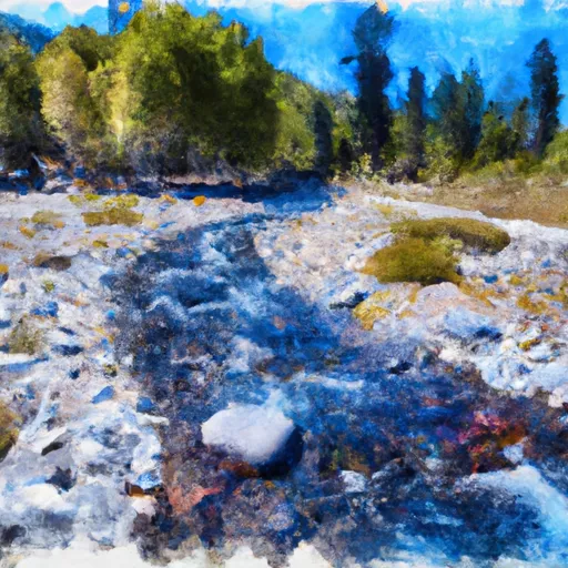
Headwaters To Wilderness Boundary
The specific river rapids and obstacles on this run include House Rock, Raft Rapid, and Ledges. House Rock is a large rock that creates a dangerous hydraulic that kayakers and rafters must avoid. Raft Rapid is a technical rapid that requires precise maneuvering to navigate safely. Ledges is a series of rapids that require quick thinking and fast paddling to make it through unscathed.
There are several regulations that must be followed when kayaking or rafting on the Whitewater River. Kayakers and rafters must wear personal flotation devices (PFDs) at all times while on the river. They also must have a whistle, a throw rope, and a first aid kit. Additionally, there are restrictions on the use of motorized watercraft on this section of the river.
Overall, the Whitewater River run from Headwaters to Wilderness Boundary is a challenging yet rewarding experience for experienced kayakers and rafters. It is essential to follow all regulations and safety guidelines to ensure a safe and enjoyable trip.
Plan your run down to the hour
Same weather feed Snoflo's iOS app uses -- updated continuously from NOAA / yr.no. Watch the precipitation column on the meteogram; rain ahead of a run typically lifts flows 12-48 hours later depending on the basin.
Next 5 days, hour by hour
Temperature line with weather symbols on top, snow + rain accumulation as columns, humidity as a dotted line.
5-day forecast table
Every 3 hours, broken out across temperature, snow, rain, humidity, and wind. Each cell is colour-coded relative to the column min/max.
| Time | Condition | Temp (°F) | Snow (in) | Rain (in) | Humidity (%) | Wind (mps) | Wind dir |
|---|---|---|---|---|---|---|---|
| Loading detailed forecast… | |||||||
15-day temperature & precipitation
Daily temperatures, snow, and rain projected over the next two weeks -- the upstream story that drives next week's flows.
Regional streamflow levels
USGS streamgauges around Headwaters To Wilderness Boundary -- useful for spotting upstream pulses and gauging which tributary is contributing what.
| Streamgauge | Discharge | View |
|---|---|---|
| Green Creek Near Bridgeport | 60 cfs | → |
| Robinson C At Twin Lks Outlet Nr Bridgeport | 124 cfs | → |
| Buckeye C Nr Bridgeport | 192 cfs | → |
| E Walker R Nr Bridgeport | 178 cfs | → |
| Tuolumne R A Grand Cyn Of Tuolumne Ab Hetch Hetchy | 2,670 cfs | → |
| Deadman C A Big Springs Nr Crestview Ca | 37 cfs | → |
Plan a longer trip
The closest boat launches, other paddle runs, and campgrounds so a day on the water can grow into a full weekend.
Boat launches
Other river runs
- Wilderness Boundary To Confluence With Mill Creek
- Wilderness Boundary To Private Property
- Private Property To Lundy Lake
- Headwaters Tributaries To Research Natural Area Boundary
Campgrounds
- Saddlebag Lake Campground
- Saddlebag Lake
- Saddlebag Lake Trailhead Group Campground
- Lundy Canyon Campground
- Sawmill Walk-In Campground
- Lundy Lake Park
Fishing spots
Whitewater safety
- Check the flow before you run
- Use the linked-gauge card and Regional Flow panel above. Class ratings change with flow -- a Class III at low water can become Class IV+ at high water.
- Know your skill ceiling
- Pick runs comfortably below your ceiling. Cold-water and big-water runs raise the consequences of any mistake.
- Wear the right gear
- Helmet, PFD, drysuit / wetsuit when water is below 60°F. Throw bag, knife, and whistle on your person, not in the boat.
- Scout, set safety, and run with a team
- Scout new rapids on foot, set safety with throw bags above the consequence pool, and run with at least one other competent paddler.
- Respect the river
- Strainers, undercuts, low-head dams, and wood can kill at any class rating. When in doubt, portage.
Set push alerts in the Snoflo app
Save Headwaters To Wilderness Boundary as a favorite, set a discharge threshold (e.g. "alert me when flow hits 600 cfs"), and the iOS app pushes the moment the linked gauge crosses.
About Headwaters To Wilderness Boundary
What's the optimal flow for Headwaters To Wilderness Boundary?
The optimal flow depends on the section and the craft. Check the Run Details panel for the linked gauge and current status.
How fresh is the cfs reading on this page?
The linked USGS streamgauge reports continuously (every 15 minutes); Snoflo refreshes throughout the day. Hover the streamflow sparkline to read individual datapoints.
What's the whitewater class?
See the Run Details panel for the class rating Snoflo tracks for this run. Class ratings change with flow -- a Class III at low water can become Class IV in high water.
Where do I put in / take out?
Tap Directions in the hero above to open driving directions to the put-in. For shuttle planning, check the Nearby Boat Launches panel and the river run operator's site.
Can I get alerts when flows hit the optimal range?
Yes -- alerts are managed in the Snoflo iOS app. Favorite this run, set a discharge threshold, and you'll get a push the moment the gauge crosses.
Other runs near here
Snoflo-tracked paddle runs within driving distance of Headwaters To Wilderness Boundary.