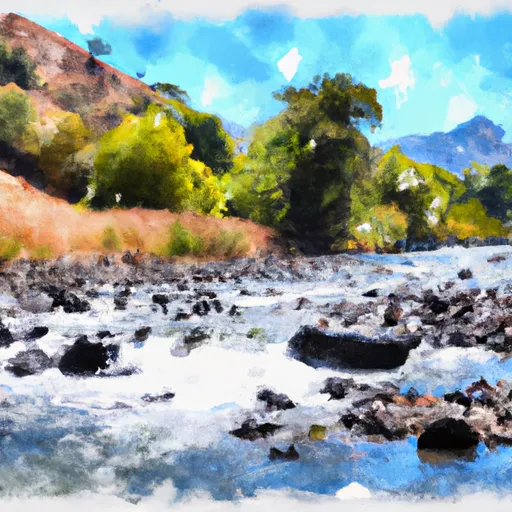
Cache Creek river run
Cache Creek
The Cache Creek is rated as a Class III-IV river, which is suitable for experienced paddlers and beginners with a guide. The river is well-known for its technical rapids, including tight turns and steep drops, and obstacles like rocks and boulders. The river is also home to diverse wildlife, including bald eagles, river otters, and black bears.
To ensure the safety of paddlers and preserve the river's natural beauty, there are specific regulations in place for the Cache Creek. These include mandatory life jackets, no glass containers, and no littering. Additionally, a permit is required to raft the river during peak season, which is from Memorial Day Weekend to Labor Day Weekend.
Overall, the Cache Creek is an exciting and challenging whitewater rafting destination that offers beautiful scenery and thrilling rapids. With the right equipment and guides, paddlers can safely navigate the river and enjoy an unforgettable adventure.
Plan your run down to the hour
Same weather feed Snoflo's iOS app uses -- updated continuously from NOAA / yr.no. Watch the precipitation column on the meteogram; rain ahead of a run typically lifts flows 12-48 hours later depending on the basin.
Next 5 days, hour by hour
Temperature line with weather symbols on top, snow + rain accumulation as columns, humidity as a dotted line.
5-day forecast table
Every 3 hours, broken out across temperature, snow, rain, humidity, and wind. Each cell is colour-coded relative to the column min/max.
| Time | Condition | Temp (°F) | Snow (in) | Rain (in) | Humidity (%) | Wind (mps) | Wind dir |
|---|---|---|---|---|---|---|---|
| Loading detailed forecast… | |||||||
15-day temperature & precipitation
Daily temperatures, snow, and rain projected over the next two weeks -- the upstream story that drives next week's flows.
Regional streamflow levels
USGS streamgauges around Cache Creek -- useful for spotting upstream pulses and gauging which tributary is contributing what.
| Streamgauge | Discharge | View |
|---|---|---|
| Bear C Ab Holsten Chimney Cyn Nr Rumsey Ca | 20 cfs | → |
| Cache C A Rumsey Ca | 686 cfs | → |
| Cache C Nr Lower Lake Ca | 638 cfs | → |
| Putah C Nr Guenoc Ca | 42 cfs | → |
| Nf Cache C Nr Clearlake Oaks Ca | 73 cfs | → |
| Nf Cache C A Hough Spring Nr Clearlake Oaks Ca | 31 cfs | → |
Plan a longer trip
The closest boat launches, other paddle runs, and campgrounds so a day on the water can grow into a full weekend.
Boat launches
Other river runs
- North Fork Cache Creek
- Headwaters In Sec 28, T18n, R8w To One-Third Mile Beyond Snow Mt. Wilderness Boundary At Private Property Boundary Near Paradise Creek
Campgrounds
- Buck Island Campground
- Cache Creek Canyon County Park
- Cedar Creek Ohv Dispersed - Knoxville Ra
- Hunting Creek Camp
- Lower Hunting Creek - Knoxville Rec Area
- Pond
Fishing spots
Whitewater safety
- Check the flow before you run
- Use the linked-gauge card and Regional Flow panel above. Class ratings change with flow -- a Class III at low water can become Class IV+ at high water.
- Know your skill ceiling
- Pick runs comfortably below your ceiling. Cold-water and big-water runs raise the consequences of any mistake.
- Wear the right gear
- Helmet, PFD, drysuit / wetsuit when water is below 60°F. Throw bag, knife, and whistle on your person, not in the boat.
- Scout, set safety, and run with a team
- Scout new rapids on foot, set safety with throw bags above the consequence pool, and run with at least one other competent paddler.
- Respect the river
- Strainers, undercuts, low-head dams, and wood can kill at any class rating. When in doubt, portage.
Set push alerts in the Snoflo app
Save Cache Creek as a favorite, set a discharge threshold (e.g. "alert me when flow hits 600 cfs"), and the iOS app pushes the moment the linked gauge crosses.
About Cache Creek
What's the optimal flow for Cache Creek?
The optimal flow depends on the section and the craft. Check the Run Details panel for the linked gauge and current status.
How fresh is the cfs reading on this page?
The linked USGS streamgauge reports continuously (every 15 minutes); Snoflo refreshes throughout the day. Hover the streamflow sparkline to read individual datapoints.
What's the whitewater class?
See the Run Details panel for the class rating Snoflo tracks for this run. Class ratings change with flow -- a Class III at low water can become Class IV in high water.
Where do I put in / take out?
Tap Directions in the hero above to open driving directions to the put-in. For shuttle planning, check the Nearby Boat Launches panel and the river run operator's site.
Can I get alerts when flows hit the optimal range?
Yes -- alerts are managed in the Snoflo iOS app. Favorite this run, set a discharge threshold, and you'll get a push the moment the gauge crosses.
Other runs near here
Snoflo-tracked paddle runs within driving distance of Cache Creek.