West Dolores---Source To Confluence With Mainstem river run
Community Reviews
Been here? Share the conditions.
Reviews, ratings & photos are added in the free Snoflo iOS app — rate a spot, tag the conditions, and your visit is verified by location. Add or manage your reviews from the app.
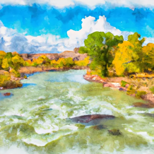
West Dolores---Source To Confluence With Mainstem
This run is classified as a Class III-IV, with challenging rapids and obstacles throughout its segment mileage of 18 miles. Specific rapids include the S-turn, Ledges, and Smelter, while obstacles such as log jams and strainers can also pose a hazard to paddlers.
Regulations for this area include a permit system for overnight camping, as well as restrictions on campfires and human waste disposal. Paddlers are also required to have proper safety equipment, including a personal flotation device and helmet, when on the river.
Plan your run down to the hour
Same weather feed Snoflo's iOS app uses -- updated continuously from NOAA / yr.no. Watch the precipitation column on the meteogram; rain ahead of a run typically lifts flows 12-48 hours later depending on the basin.
Next 5 days, hour by hour
Temperature line with weather symbols on top, snow + rain accumulation as columns, humidity as a dotted line.
5-day forecast table
Every 3 hours, broken out across temperature, snow, rain, humidity, and wind. Each cell is colour-coded relative to the column min/max.
| Time | Condition | Temp (°F) | Snow (in) | Rain (in) | Humidity (%) | Wind (mps) | Wind dir |
|---|---|---|---|---|---|---|---|
| Loading detailed forecast… | |||||||
15-day temperature & precipitation
Daily temperatures, snow, and rain projected over the next two weeks -- the upstream story that drives next week's flows.
Regional streamflow levels
USGS streamgauges around West Dolores---Source To Confluence With Mainstem -- useful for spotting upstream pulses and gauging which tributary is contributing what.
| Streamgauge | Discharge | View |
|---|---|---|
| Dolores River At Dolores | 101 cfs | → |
| Lost Canyon Creek Near Dolores | · | → |
| Dolores River Below Rico | 18 cfs | → |
| Mud Creek At State Highway 32 | 11 cfs | → |
| Mcelmo Creek Above Trail Canyon Near Cortez | 21 cfs | → |
| La Plata River At Hesperus | 5 cfs | → |
Plan a longer trip
The closest boat launches, other paddle runs, and campgrounds so a day on the water can grow into a full weekend.
Boat launches
- Groundhog Reservoir State Wildlife Area
- Summit Reservoir State Wildlife Area
- Joe Moore Reservoir State Wildlife Area
- Puett Reservoir State Wildlife Area
- Mancos State Park
- Colorado Street Montezuma County
Other river runs
- Dolores River - Mcphee To Bedrock Segment In Tres Rios Field Office
- West Section Line Sec 2, T38n, R16w (Below Mcphee Reservoir) To Bradfield Ranch Bridge
- Dolores Canyon (Bradfield To Slickrock)
- Beaver Creek
Campgrounds
- Mavreeso Campground
- Mavreeso
- West Dolores
- West Dolores Campground
- Jersey Jim Lookout
- House Creek Campground
Whitewater safety
- Check the flow before you run
- Use the linked-gauge card and Regional Flow panel above. Class ratings change with flow -- a Class III at low water can become Class IV+ at high water.
- Know your skill ceiling
- Pick runs comfortably below your ceiling. Cold-water and big-water runs raise the consequences of any mistake.
- Wear the right gear
- Helmet, PFD, drysuit / wetsuit when water is below 60°F. Throw bag, knife, and whistle on your person, not in the boat.
- Scout, set safety, and run with a team
- Scout new rapids on foot, set safety with throw bags above the consequence pool, and run with at least one other competent paddler.
- Respect the river
- Strainers, undercuts, low-head dams, and wood can kill at any class rating. When in doubt, portage.
Set push alerts in the Snoflo app
Save West Dolores---Source To Confluence With Mainstem as a favorite, set a discharge threshold (e.g. "alert me when flow hits 600 cfs"), and the iOS app pushes the moment the linked gauge crosses.
About West Dolores---Source To Confluence With Mainstem
What's the optimal flow for West Dolores---Source To Confluence With Mainstem?
The optimal flow depends on the section and the craft. Check the Run Details panel for the linked gauge and current status.
How fresh is the cfs reading on this page?
The linked USGS streamgauge reports continuously (every 15 minutes); Snoflo refreshes throughout the day. Hover the streamflow sparkline to read individual datapoints.
What's the whitewater class?
See the Run Details panel for the class rating Snoflo tracks for this run. Class ratings change with flow -- a Class III at low water can become Class IV in high water.
Where do I put in / take out?
Tap Directions in the hero above to open driving directions to the put-in. For shuttle planning, check the Nearby Boat Launches panel and the river run operator's site.
Can I get alerts when flows hit the optimal range?
Yes -- alerts are managed in the Snoflo iOS app. Favorite this run, set a discharge threshold, and you'll get a push the moment the gauge crosses.
Other runs near here
Snoflo-tracked paddle runs within driving distance of West Dolores---Source To Confluence With Mainstem.