Confluence With Rincon La Vaca And North Fork To Northern Line Of Granite Peak Ranch River Run
Community Reviews
Been here? Share the conditions.
Reviews, ratings & photos are added in the free Snoflo iOS app — rate a spot, tag the conditions, and your visit is verified by location. Add or manage your reviews from the app.
Confluence With Rincon La Vaca And North Fork To Northern Line Of Granite Peak Ranch
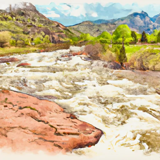
This 15-mile long run has some notable river rapids and obstacles, including the "Hole in the Wall" rapid, which is a class IV rapid with a large hole in the center that can flip rafts and kayaks. Another notable feature is "S-Bend," a long and technical rapid with multiple drops and twists. There are also some challenging portages, such as the "Granite Peak Falls," which is a class V rapid that requires a portage.
There are specific regulations to the area that paddlers must follow. The Whitewater River Run is located on private property, and a permit is required to access the river. Additionally, camping is not allowed on the riverbank or within the river corridor. Paddlers must also respect the natural environment and pack out all trash and personal waste.
In conclusion, the Whitewater River Run Confluence with Rincon La Vaca and North Fork to Northern Line of Granite Peak Ranch is a challenging and exciting run with some notable rapids and obstacles. Paddlers must be experienced and follow specific regulations to access the river.
Plan your run down to the hour
Same weather feed Snoflo's iOS app uses -- updated continuously from NOAA / yr.no. Watch the precipitation column on the meteogram; rain ahead of a run typically lifts flows 12-48 hours later depending on the basin.
Next 5 days, hour by hour
Temperature line with weather symbols on top, snow + rain accumulation as columns, humidity as a dotted line.
5-day forecast table
Every 3 hours, broken out across temperature, snow, rain, humidity, and wind. Each cell is colour-coded relative to the column min/max.
| Time | Condition | Temp (°F) | Snow (in) | Rain (in) | Humidity (%) | Wind (mps) | Wind dir |
|---|---|---|---|---|---|---|---|
| Loading detailed forecast… | |||||||
15-day temperature & precipitation
Daily temperatures, snow, and rain projected over the next two weeks -- the upstream story that drives next week's flows.
Regional streamflow levels
USGS streamgauges around Confluence With Rincon La Vaca And North Fork To Northern Line Of Granite Peak Ranch -- useful for spotting upstream pulses and gauging which tributary is contributing what.
| Streamgauge | Discharge | View |
|---|---|---|
| Vallecito Creek Near Bayfield | 37 cfs | → |
| Animas River Above Tacoma | 218 cfs | → |
| Rio Grande At Thirtymile Bridge | 70 cfs | → |
| Florida R Bl Flor Farmers Ditch | 9 cfs | → |
| Los Pinos River Near Ignacio | 0 cfs | → |
| Animas River Below Silverton | 133 cfs | → |
Plan a longer trip
The closest boat launches, other paddle runs, and campgrounds so a day on the water can grow into a full weekend.
Boat launches
Other river runs
- Lake Creek--Headwaters To Confluence With Los Pinos
- Flint Creek--Headwaters To Confluence With Los Pinos
- Sierra Vandera--Headwaters To Confluence With Los Pinos
- Rincon La Osa--Headwaters To Confluence With Los Pinos
- Fdr 631 To Indian Creek
Campgrounds
- Pine River
- Vallecito Campground
- Vallecito
- Middle Mountain Campground
- Middle Mountain - Vallecito Reservoir
- Pine Point - Vallecito Reservoir
Fishing spots
Points of interest
Whitewater safety
- Check the flow before you run
- Use the linked-gauge card and Regional Flow panel above. Class ratings change with flow -- a Class III at low water can become Class IV+ at high water.
- Know your skill ceiling
- Pick runs comfortably below your ceiling. Cold-water and big-water runs raise the consequences of any mistake.
- Wear the right gear
- Helmet, PFD, drysuit / wetsuit when water is below 60°F. Throw bag, knife, and whistle on your person, not in the boat.
- Scout, set safety, and run with a team
- Scout new rapids on foot, set safety with throw bags above the consequence pool, and run with at least one other competent paddler.
- Respect the river
- Strainers, undercuts, low-head dams, and wood can kill at any class rating. When in doubt, portage.
Set push alerts in the Snoflo app
Save Confluence With Rincon La Vaca And North Fork To Northern Line Of Granite Peak Ranch as a favorite, set a discharge threshold (e.g. "alert me when flow hits 600 cfs"), and the iOS app pushes the moment the linked gauge crosses.
About Confluence With Rincon La Vaca And North Fork To Northern Line Of Granite Peak Ranch
What's the optimal flow for Confluence With Rincon La Vaca And North Fork To Northern Line Of Granite Peak Ranch?
The optimal flow depends on the section and the craft. Check the Run Details panel for the linked gauge and current status.
How fresh is the cfs reading on this page?
The linked USGS streamgauge reports continuously (every 15 minutes); Snoflo refreshes throughout the day. Hover the streamflow sparkline to read individual datapoints.
What's the whitewater class?
See the Run Details panel for the class rating Snoflo tracks for this run. Class ratings change with flow -- a Class III at low water can become Class IV in high water.
Where do I put in / take out?
Tap Directions in the hero above to open driving directions to the put-in. For shuttle planning, check the Nearby Boat Launches panel and the river run operator's site.
Can I get alerts when flows hit the optimal range?
Yes -- alerts are managed in the Snoflo iOS app. Favorite this run, set a discharge threshold, and you'll get a push the moment the gauge crosses.
Other runs near here
Snoflo-tracked paddle runs within driving distance of Confluence With Rincon La Vaca And North Fork To Northern Line Of Granite Peak Ranch.