Colorado River Segment 6 river run
Community Reviews
Been here? Share the conditions.
Reviews, ratings & photos are added in the free Snoflo iOS app — rate a spot, tag the conditions, and your visit is verified by location. Add or manage your reviews from the app.
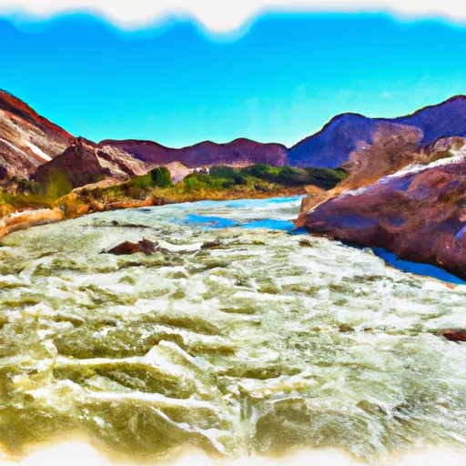
Colorado River Segment 6
The segment covers a total of 10 miles, from the town of State Bridge to the Two Bridges put-in. Along the way, rafters will encounter several notable rapids and obstacles, including the infamous "Needles Eye" rapid, which is a Class IV rapid that requires expert maneuvering to navigate safely. Other notable rapids include Trestle, Eye of the Needle, and Yarmony.
Specific regulations to the area include the requirement of wearing personal flotation devices (PFDs) at all times while on the river. There are also designated take-out spots where rafters must exit the river to avoid trespassing on private property. Additionally, commercial outfitters operating on this segment must possess the appropriate permits and adhere to specific safety guidelines.
Overall, the Whitewater River Run Colorado River Segment 6 is a thrilling and challenging whitewater experience that requires skill and experience to navigate safely. Rafters should always check the streamflow conditions and be aware of the specific regulations governing the area before embarking on this exciting adventure.
Plan your run down to the hour
Same weather feed Snoflo's iOS app uses -- updated continuously from NOAA / yr.no. Watch the precipitation column on the meteogram; rain ahead of a run typically lifts flows 12-48 hours later depending on the basin.
Next 5 days, hour by hour
Temperature line with weather symbols on top, snow + rain accumulation as columns, humidity as a dotted line.
5-day forecast table
Every 3 hours, broken out across temperature, snow, rain, humidity, and wind. Each cell is colour-coded relative to the column min/max.
| Time | Condition | Temp (°F) | Snow (in) | Rain (in) | Humidity (%) | Wind (mps) | Wind dir |
|---|---|---|---|---|---|---|---|
| Loading detailed forecast… | |||||||
15-day temperature & precipitation
Daily temperatures, snow, and rain projected over the next two weeks -- the upstream story that drives next week's flows.
Regional streamflow levels
USGS streamgauges around Colorado River Segment 6 -- useful for spotting upstream pulses and gauging which tributary is contributing what.
| Streamgauge | Discharge | View |
|---|---|---|
| Piney River Near State Bridge | 9 cfs | → |
| Lake Creek Near Edwards | 11 cfs | → |
| Piney River Below Piney Lake | 4 cfs | → |
| Eagle R Bl Wastewater Treatment Plant At Avon | 72 cfs | → |
| Colorado River Near Kremmling | 1,140 cfs | → |
| Blue River Below Green Mountain Reservoir | 444 cfs | → |
Plan a longer trip
The closest boat launches, other paddle runs, and campgrounds so a day on the water can grow into a full weekend.
Boat launches
- State Bridge Boat Ramp
- State Bridge River Access
- Two Bridges Boat Ramp
- Radium Rec Site Boat Ramp
- Catamount Bridge Boat Ramp
- Wolcott Boat Ramp
Other river runs
- State Bridge To Burns
- State Bridge To Two Bridges
- South Section Line Sec 34, T1n, R83w To Confluence With Decker Creek
- Pumphouse
- Colorado River Segment 5
Campgrounds
- Piney Campsite
- Ponderosa Campsite
- Willow Campsite
- Cable Campsite
- Beaver Island Campsite
- Lester's Ledge Campsite
Whitewater safety
- Check the flow before you run
- Use the linked-gauge card and Regional Flow panel above. Class ratings change with flow -- a Class III at low water can become Class IV+ at high water.
- Know your skill ceiling
- Pick runs comfortably below your ceiling. Cold-water and big-water runs raise the consequences of any mistake.
- Wear the right gear
- Helmet, PFD, drysuit / wetsuit when water is below 60°F. Throw bag, knife, and whistle on your person, not in the boat.
- Scout, set safety, and run with a team
- Scout new rapids on foot, set safety with throw bags above the consequence pool, and run with at least one other competent paddler.
- Respect the river
- Strainers, undercuts, low-head dams, and wood can kill at any class rating. When in doubt, portage.
Set push alerts in the Snoflo app
Save Colorado River Segment 6 as a favorite, set a discharge threshold (e.g. "alert me when flow hits 600 cfs"), and the iOS app pushes the moment the linked gauge crosses.
About Colorado River Segment 6
What's the optimal flow for Colorado River Segment 6?
The optimal flow depends on the section and the craft. Check the Run Details panel for the linked gauge and current status.
How fresh is the cfs reading on this page?
The linked USGS streamgauge reports continuously (every 15 minutes); Snoflo refreshes throughout the day. Hover the streamflow sparkline to read individual datapoints.
What's the whitewater class?
See the Run Details panel for the class rating Snoflo tracks for this run. Class ratings change with flow -- a Class III at low water can become Class IV in high water.
Where do I put in / take out?
Tap Directions in the hero above to open driving directions to the put-in. For shuttle planning, check the Nearby Boat Launches panel and the river run operator's site.
Can I get alerts when flows hit the optimal range?
Yes -- alerts are managed in the Snoflo iOS app. Favorite this run, set a discharge threshold, and you'll get a push the moment the gauge crosses.
Other runs near here
Snoflo-tracked paddle runs within driving distance of Colorado River Segment 6.