Make an Announcement

Communicate warnings, disperse advice, and share.


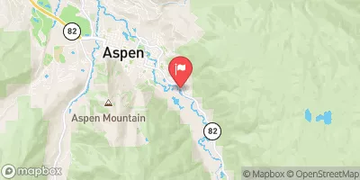
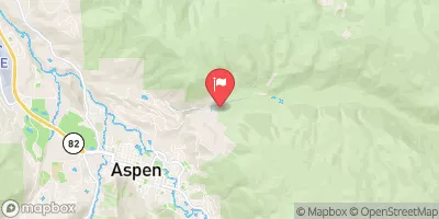
CASTLE CREEK

Whitewater River Run


Colorado Castle Creek

Castle Creek

Class IV+ TO V-

STREAMFLOW: 1,020 CFS

Too High
70°, Slight Chance T-Storms Then Showers Likely

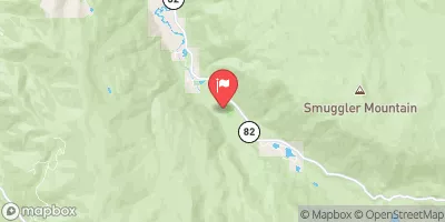
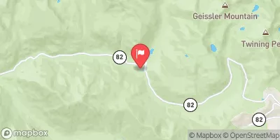
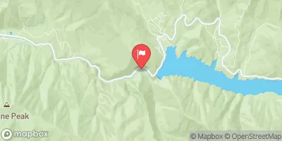
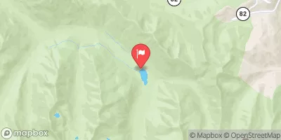
Castle Creek River Run on the Taylor River in Colorado is a Class III to IV river run, with a few Class V rapids. The best time to float is from late May to early July when the water is high enough. The river features challenging drops, steep chutes, and technical boulder gardens. The obstacles on this section of the river include S-Turn, Sieve City, and The Waterfall. The recommended CFS range for this section is between 500-1500 CFS. Castle Creek River Run is a thrilling adventure for experienced paddlers seeking a challenging run.

Weather today, A chance of showers and thunderstorms, then showers likely and possibly a thunderstorm after 3pm. Increasing clouds, with a high near 70. Northeast wind 5 to 15 mph becoming southwest in the afternoon. Chance of precipitation is 60%.

Status Too High
Class Level IV+ to V-
Elevation 8,018 ft
Run Length 2.0 Mi
Streamflow Discharge 1020 cfs
Gauge Height 3.3 ft
Reporting Streamgage Taylor River At Almont
USGS 09110000

Nearby Snowpack and Streamflow Levels

Gauge Streamflow Stage
Wurtz Ditch Near Tenneessee Pass
USGS 09062500
27 cfs 1.1 ft
Fryingpan River At Meredith
USGS 09080100
360 cfs 3.0 ft
Tomichi Creek At Sargents
USGS 09115500
288 cfs 2.2 ft
North Fork Fryingpan River Near Norrie
USGS 09078500
125 cfs 3.8 ft
Tomichi Creek At Gunnison
USGS 09119000
661 cfs 3.7 ft
Fryingpan River Near Thomasville
USGS 09078600
270 cfs 2.9 ft
Roaring Fork River Ab Difficult C Nr Aspen
USGS 09073300
130 cfs 2.0 ft
Fryingpan River Near Ruedi
USGS 09080400
232 cfs 2.0 ft
Ewing Ditch At Tennessee Pass
USGS 09062000
9 cfs 0.7 ft
Snotel Site Snowpack 24hr Change
Rabbit Ears
SNOTEL 709
1" 0"
Middle Creek
SNOTEL 624
1" -1"
Mccoy Park
SNOTEL 1040
3" 0"
Elliot Ridge
SNOTEL 1120
2" 1"
Park Cone
SNOTEL 680
2" 0"
Bison Lake
SNOTEL 345
56" -2"
Zirkel
SNOTEL 1033
1" -1"
Vail Mountain
SNOTEL 842
1" 1"
Elk River
SNOTEL 467
1" 0"
Schofield Pass
SNOTEL 737
39" -3"
North Lost Trail
SNOTEL 669
11" 1"
Columbine
SNOTEL 408
1" 0"
Ripple Creek
SNOTEL 717
36" -1"
Arapaho Ridge
SNOTEL 1030
23" 0"
Butte
SNOTEL 380
31" -3"
Tower
SNOTEL 825
53" -1"

Popular Destinations

Campground Campsites Reservations Toilets Showers Elevation
Sylvan Lake State Park 44 8,535 ft
Lodgepole - Almont 16 8,905 ft
Wolcott None 6,979 ft
Silver Bell 14 8,520 ft
Dearhamer 13 7,792 ft
Rosy Lane 20 8,460 ft
Lincoln Gulch 7 9,606 ft
Taylor Canyon 7 8,373 ft
Lost Man 10 10,513 ft
Palisades Senior RV Park 59 7,680 ft
Little Mattie 22 7,911 ft
Mollie B 27 7,895 ft
One Mile 25 8,411 ft
Little Maud 20 7,808 ft
North Bank 17 8,433 ft
Almont 10 7,990 ft
Cold Spring 6 8,954 ft
Weller 11 9,393 ft
Pinball Point None 6,457 ft
Fulford Cave 7 9,422 ft
Silver Queen 6 8,682 ft
Silver Bar 4 8,312 ft
Chapman 84 8,598 ft
Mosca 16 9,986 ft
Lottis Creek 27 9,068 ft
Difficult 47 8,139 ft
Cement Creek 13 8,967 ft
Dorchester 10 9,925 ft
Gypsum None 6,286 ft
Catamount None 6,563 ft
Yeoman Park 24 9,062 ft
Spring Creek 12 8,544 ft
Gothic 4 9,657 ft
Ski Area Snowpack Air Temperature 5 Day Forecast
Crested Butte Mountain Resort 31" 58° 0.1"
Steamboat Ski Resort 0" 66° 0"
Aspen Highlands -1" 56° 3.02"
Vail 1" 59° 0"
Buttermilk Mountain -1" 56° 3.02"
Snowmass -1" 56° 3.02"
Aspen Mountain 0" 56° 4.34"
Beaver Creek Resort 3" 68° 0"
River Run Streamflow Length Class
Bogan Canyon 1540.0cfs 6.85 Mi III to III+
Lower Fish Creek 486.0cfs 2.5 Mi IV+ to V
Lower (Bottom Four) 704.0cfs 1.0 Mi V to V+
Shoshone (Power Plant to Grizzly Creek) 5020.0cfs 1.7 Mi III- to IV
Clear Creek of the Arkansas 364.0cfs 2.5 Mi IV+ to V-
Catherine Store Section 1720.0cfs 4.0 Mi II to II+
State Bridge to Burns 1460.0cfs 20.0 Mi I to II+
Crystal Mill Falls 1540.0cfs None Mi V- to V
Gore Canyon 1460.0cfs 9.0 Mi IV to V+
Oh Be Joyful 2650.0cfs 1.0 Mi V
The Upper 704.0cfs 8.0 Mi V to V+
Avalanche Down 1540.0cfs 12.0 Mi III
Carbondale to Westbank (Pink to Black) 3690.0cfs 7.0 Mi II
State Bridge to Two Bridges 1460.0cfs 4.8 Mi I to II+
Barrel Springs 5020.0cfs 4.0 Mi IV+ to V+
Lower Eagle (Edwards Water Plant to Eagle) 1690.0cfs 17.0 Mi III- to III+
Castle Creek 1020.0cfs 2.0 Mi IV+ to V-
Pumphouse 1460.0cfs 14.0 Mi II- to III+
Burns to Dotsero 5020.0cfs 29.0 Mi I to IV
Cemetery 3690.0cfs 12.0 Mi II+ to III+
Shoshone (Power Plant to Grizzly Creek) 5020.0cfs 1.7 Mi III- to IV
Waterfall to Confluence 1720.0cfs 1.0 Mi V-
Lower Eagle (Edwards Water Plant to Eagle) 1690.0cfs 17.0 Mi III- to III+
Dowd Chute 476.0cfs 1.0 Mi III+ to IV+
Barrel Springs 5020.0cfs 4.0 Mi IV+ to V+

Log Your Visit

When was your last visit to Castle Creek?

Add a Photo

How was it? How were conditions?

Rate the paddle


Submit

Leave A Review

Castle Creek

Submit

Upload an Image

Castle Creek
Login

Need an Account?

Forgot Your Password?

Delete User Account

Welcome to Snoflo


Continue with a free account

Already Have an Account?


Snoflo Premium

Your first week's free. Cancel anytime

Have a Promo Code?


Already Have an Account?

Signup for Basic Access


Welcome to Snoflo


Continue with a free account

Add Snoflo Premium


Already Have an Account?


Please Verify Your Account

Favorite Limit Reached
Signup for a Free Account

Already Have an Account?