2026-02-21T07:00:00-05:00
* WHAT...Mixed precipitation expected. Total snow accumulations between 2 and 6 inches and/or ice accumulations between a glaze and two tenths of an inch. * WHERE...Litchfield Hills, Berkshires, Taconics, and Lake George-Saratoga region. * WHEN...From 10 AM this morning to 7 AM EST Saturday. * IMPACTS...Plan on slippery road conditions. The hazardous conditions could impact this evening's commute.
Summary
The ideal streamflow range for this section of the river is between 200-400 cubic feet per second (cfs), which typically occurs in the spring and early summer months. The class rating for this section of the river ranges from II to III, with several rapids and obstacles along the way.
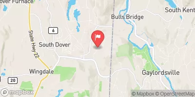
The segment mileage for the Whitewater River Run is approximately 5 miles, beginning downstream of the Borough of Bantam at the Stoddard Road Bridge and ending at the confluence with the Shepaug River. Some noteworthy rapids include the "Washing Machine," "Zoom Flume," and "Pencil Sharpener." There are also several smaller rapids and wave trains throughout the run.
There are specific regulations for the Whitewater River Run, including a permit requirement for commercial outfitters and a prohibition on alcohol and glass containers. Additionally, all participants must wear a personal flotation device (PFD) and helmets are recommended. It is important to note that water levels can fluctuate rapidly and unexpectedly, so it is recommended to check local conditions before embarking on a trip.
°F
°F
mph
Wind
%
Humidity
15-Day Weather Outlook
River Run Details
| Last Updated | 2026-02-07 |
| River Levels | 20 cfs (1.79 ft) |
| Percent of Normal | 53% |
| Status | |
| Class Level | None |
| Elevation | ft |
| Run Length | 5.0 Mi |
| Streamflow Discharge | cfs |
| Gauge Height | ft |
| Reporting Streamgage | USGS 01202501 |
5-Day Hourly Forecast Detail
Nearby Streamflow Levels
Area Campgrounds
| Location | Reservations | Toilets |
|---|---|---|
 Cozy Hill Campground
|
||
 Point Folly - White Memorial
|
||
 Windmill Hill - White Memorial
|
||
 Lake Waramaug State Park
|
||
 SR1
SR1
|
||
 SR2
SR2
|


 Begins Downstream Of The Borough Of Bantam, At Stoddard Road Bridge To The Confluence With The Shepaug River
 Pond Downstream Of Shepaug Reservoir Dam, Marked By Service Road Bridge To Ends In Backwaters Of Lake Lillinonah, Near Roxbury Falls
 Kent Bridge To Boardman Bridge
 Litchfield Green
 Topsmead State Forest
 Mohawk State Forest
 Bellamy-Ferriday House And Garden
 Above All State Park