Kettletown State Park Campground
Community Reviews
Been here? Share the conditions.
Reviews, ratings & photos are added in the free Snoflo iOS app — rate a spot, tag the conditions, and your visit is verified by location. Add or manage your reviews from the app.
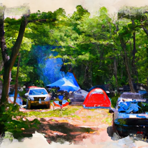
Kettletown State Park
What's on-site at Kettletown State Park
Key facilities Snoflo tracks for this campground. Confirm with the operator before booking -- amenities can change seasonally.
Plan your trip down to the hour
Same weather feed Snoflo's iOS app uses -- updated continuously from NOAA / yr.no.
Next 5 days, hour by hour
Temperature line with weather symbols on top, snow + rain accumulation as columns, humidity as a dotted line.
5-day forecast table
Every 3 hours, broken out across temperature, snow, rain, humidity, and wind. Each cell is colour-coded relative to the column min/max so trends jump out at a glance.
| Time | Condition | Temp (°F) | Snow (in) | Rain (in) | Humidity (%) | Wind (mps) | Wind dir |
|---|---|---|---|---|---|---|---|
| Loading detailed forecast… | |||||||
15-day temperature & precipitation
Daily temperatures, snow, and rain projected over the next two weeks. Hover any point for the full breakdown.
Other campgrounds in the area
Snoflo-tracked campsites within driving distance of Kettletown State Park, with reservations status.
| Campground | Reservations | Toilets | View |
|---|---|---|---|
| Youth Camp Iii | ✗ | ✗ | → |
| Youth Camp I | ✗ | ✗ | → |
| Youth Camp Ii | ✗ | ✗ | → |
| Sr3 | ✗ | ✗ | → |
| Sr1 | ✗ | ✗ | → |
Nearby streamflow
USGS streamgauges within reach of Kettletown State Park -- pulled live from the National Water Information System.
| Streamgauge | Discharge | View |
|---|---|---|
| Housatonic River At Stevenson | 4,150 cfs | → |
| Pootatuck R At Sandy Hook | 83 cfs | → |
| Pomperaug River At Southbury | 105 cfs | → |
| Naugatuck River At Beacon Falls | 224 cfs | → |
| Weekeepeemee River At Hotchkissville | 19 cfs | → |
| Still River At Route 7 At Brookfield Center | 117 cfs | → |
Nearby snow depths
NRCS SNOTEL stations within reach of Kettletown State Park -- relevant when planning a shoulder-season or alpine trip.
| SNOTEL station | Snowpack | 24h Snowfall | View |
|---|---|---|---|
| Seymour 1.5 Ne | 0.0 in | 0.0 in | → |
| Shelton 1.3 W | 0.0 in | 0.0 in | → |
| Brookfield 3.3 Sse | 0.0 in | 0.0 in | → |
| Bethel 3.5 Nne | 0.0 in | 0.0 in | → |
| Naugatuck 1.7 Nne | 0.0 in | 0.0 in | → |
| New Milford 5.3 Ssw | 0.0 in | 0.0 in | → |
Plan a longer trip
The closest parks, lakes, boat launches, and paddle runs so a camping night can grow into a full weekend.
Parks
- Kettletown State Park
- Jackson Cove Park
- Paugussett State Forest
- Southford Falls State Park
- Treadwell Memorial Park
- Rocky Glen State Park
Boat launches
- Lake Zoar
- Lake Lillinonah (Pond Brook)
- Lake Housatonic
- Lake Lillinonah
- Huntington Street Shelton
- Candlewood Lake (Lattins Cove)
Fishing spots
- Lake Zoar
- Papermill Pond
- Lake Lillinonah
- Carrington Pond
- Seymour Reservoir Number 2
- Reservoir Number 1
Points of interest
- Millstone
- Everwonder Childrens Museum
- Monroe Center Historic District
- Seymour Historical Society Museum
- Depot Street Bridge
- Quassy Amusement Park
Paddle runs
- Begins Downstream Of The Borough Of Bantam, At Stoddard Road Bridge To The Confluence With The Shepaug River
- Pond Downstream Of Shepaug Reservoir Dam, Marked By Service Road Bridge To Ends In Backwaters Of Lake Lillinonah, Near Roxbury Falls
- Kent Bridge To Boardman Bridge
- Begins Below The Tailrace Of The Lower Collinsville Dam To The Route 187 Bridge
- The Confluence With The Nepaug River To A Point 0.2 Miles Below The Lower Collinsville Dam Tailrace
- New Hartford/Canton Town Line To The Confluence With The Nepaug River
Camping essentials & Leave No Trace
- Pack it in, pack it out
- Take all trash, food scraps, and gear back with you to keep campsites clean and protect wildlife.
- Respect wildlife
- Observe animals from a distance, store food securely, and never feed wildlife to maintain natural behavior and safety.
- Know before you go
- Check weather, fire restrictions, trail conditions, and permit requirements to ensure a safe and well-planned trip.
- Minimize campfire impact
- Use established fire rings, keep fires small, fully extinguish them, or opt for a camp stove when fires are restricted.
- Leave what you find
- Preserve natural and cultural features by avoiding removal of plants, rocks, artifacts, or other elements of the environment.
Set push alerts in the Snoflo app
Save Kettletown State Park as a favorite, set a custom threshold (precipitation, snowpack, freezing temperatures), and the iOS app will push the moment conditions cross.
About Kettletown State Park
Can I make reservations at Kettletown State Park?
Yes -- this campground accepts reservations. Snoflo recommends booking early for peak season; check the operator (Recreation.gov / state park system / private operator) for the booking window and cancellation policy.
How fresh is the weather data on this page?
The hourly forecast updates throughout the day from the NOAA / yr.no public feeds. Streamflow data is pulled live from USGS streamgauges and snowpack from the NRCS SNOTEL network.
What's the best time of year to visit?
Use the 15-day temperature & precipitation outlook on this page to plan -- pick a window with comfortable temperatures and low precipitation. For longer trips, the 5-day hourly meteogram shows snow + rain accumulation hour-by-hour.
How do I get to Kettletown State Park?
Tap Directions in the hero above to open driving directions in Google Maps, or Open in map to center the Snoflo interactive map on the campground.
Can I get alerts when conditions change?
Yes -- alerts are managed through the Snoflo iOS app. Favorite this campground, set a threshold (temperature, snowpack, precipitation), and you'll get a push the moment it crosses.
Other campgrounds near here
Snoflo-tracked campgrounds within driving distance of Kettletown State Park.