Begins Approximately 1 Mile Downstream Of U.S. 301 Crossing To Ends Approximately 1 Mile Upstream Of Flea Hill, Georgia River Run
Community Reviews
Been here? Share the conditions.
Reviews, ratings & photos are added in the free Snoflo iOS app — rate a spot, tag the conditions, and your visit is verified by location. Add or manage your reviews from the app.
Begins Approximately 1 Mile Downstream Of U.S. 301 Crossing To Ends Approximately 1 Mile Upstream Of Flea Hill, Georgia
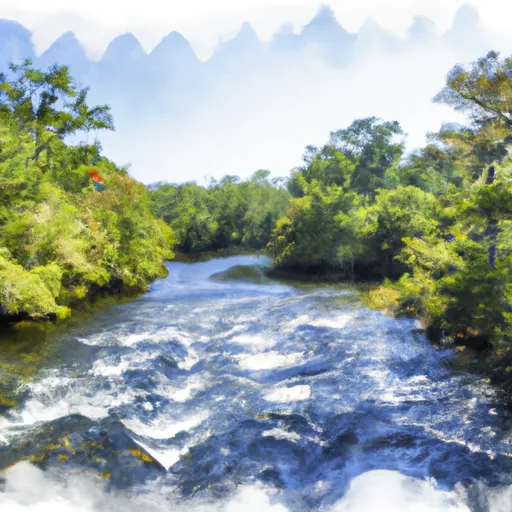
The segment of the river that is commonly rafted is approximately 7 miles long, beginning approximately 1 mile downstream of the U.S. 301 crossing and ending approximately 1 mile upstream of Flea Hill, Georgia. This segment features a variety of rapids and obstacles, including Big Shoals, Little Shoals, and Mims Grade. The most challenging rapids, such as Big Shoals, are typically avoided by beginner rafters.
There are specific regulations that must be followed when rafting on the Whitewater River Run. All rafters are required to wear personal flotation devices (PFDs) at all times, and helmets are recommended for Class III and IV rapids. Rafting is only permitted during daylight hours, and alcohol consumption is prohibited while on the river.
In conclusion, the Whitewater River Run is an exciting rafting destination in Florida, with Class II and III rapids and a variety of obstacles. Rafting is only permitted during daylight hours, and safety regulations must be followed at all times to ensure a safe and enjoyable experience.
Plan your run down to the hour
Same weather feed Snoflo's iOS app uses -- updated continuously from NOAA / yr.no. Watch the precipitation column on the meteogram; rain ahead of a run typically lifts flows 12-48 hours later depending on the basin.
Next 5 days, hour by hour
Temperature line with weather symbols on top, snow + rain accumulation as columns, humidity as a dotted line.
5-day forecast table
Every 3 hours, broken out across temperature, snow, rain, humidity, and wind. Each cell is colour-coded relative to the column min/max.
| Time | Condition | Temp (°F) | Snow (in) | Rain (in) | Humidity (%) | Wind (mps) | Wind dir |
|---|---|---|---|---|---|---|---|
| Loading detailed forecast… | |||||||
15-day temperature & precipitation
Daily temperatures, snow, and rain projected over the next two weeks -- the upstream story that drives next week's flows.
Regional streamflow levels
USGS streamgauges around Begins Approximately 1 Mile Downstream Of U.S. 301 Crossing To Ends Approximately 1 Mile Upstream Of Flea Hill, Georgia -- useful for spotting upstream pulses and gauging which tributary is contributing what.
| Streamgauge | Discharge | View |
|---|---|---|
| North Prong St. Marys River At Moniac | · | → |
| St. Marys River Nr Macclenny | 26 cfs | → |
| Satilla River At Atkinson | 510 cfs | → |
| Suwannee River At Us 441 | 43 cfs | → |
| St. Johns River At Jacksonville | 69,000 cfs | → |
| Cedar River At San Juan Ave At Jacksonville | 349 cfs | → |
Plan a longer trip
The closest boat launches, other paddle runs, and campgrounds so a day on the water can grow into a full weekend.
Boat launches
- Walker Landing (Scott's Landing)
- Buchannon Drive Charlton County
- Camp Pinckney Landing
- Trader's Hill Boat Ramp
- Bill Johnson Road 2378, Hilliard
- Temple Landing
Other river runs
- Trader's Hill To Ends Approximately 1 Mile Downstream Of U.S. 301 Crossing
- Begins Approximately 1 Mile Upstream Of Flea Hill, Georgia To The Bells River Confluence
- The Headwaters To The Suwannee River Sill At River Mile 238
- The Suwannee River Sill At River Mile 238 To The Little River Springs At River Mile 81
- The Confluence Of The North Prong And Middle Prong To Trader's Hill
Campgrounds
Whitewater safety
- Check the flow before you run
- Use the linked-gauge card and Regional Flow panel above. Class ratings change with flow -- a Class III at low water can become Class IV+ at high water.
- Know your skill ceiling
- Pick runs comfortably below your ceiling. Cold-water and big-water runs raise the consequences of any mistake.
- Wear the right gear
- Helmet, PFD, drysuit / wetsuit when water is below 60°F. Throw bag, knife, and whistle on your person, not in the boat.
- Scout, set safety, and run with a team
- Scout new rapids on foot, set safety with throw bags above the consequence pool, and run with at least one other competent paddler.
- Respect the river
- Strainers, undercuts, low-head dams, and wood can kill at any class rating. When in doubt, portage.
Set push alerts in the Snoflo app
Save Begins Approximately 1 Mile Downstream Of U.S. 301 Crossing To Ends Approximately 1 Mile Upstream Of Flea Hill, Georgia as a favorite, set a discharge threshold (e.g. "alert me when flow hits 600 cfs"), and the iOS app pushes the moment the linked gauge crosses.
About Begins Approximately 1 Mile Downstream Of U.S. 301 Crossing To Ends Approximately 1 Mile Upstream Of Flea Hill, Georgia
What's the optimal flow for Begins Approximately 1 Mile Downstream Of U.S. 301 Crossing To Ends Approximately 1 Mile Upstream Of Flea Hill, Georgia?
The optimal flow depends on the section and the craft. Check the Run Details panel for the linked gauge and current status.
How fresh is the cfs reading on this page?
The linked USGS streamgauge reports continuously (every 15 minutes); Snoflo refreshes throughout the day. Hover the streamflow sparkline to read individual datapoints.
What's the whitewater class?
See the Run Details panel for the class rating Snoflo tracks for this run. Class ratings change with flow -- a Class III at low water can become Class IV in high water.
Where do I put in / take out?
Tap Directions in the hero above to open driving directions to the put-in. For shuttle planning, check the Nearby Boat Launches panel and the river run operator's site.
Can I get alerts when flows hit the optimal range?
Yes -- alerts are managed in the Snoflo iOS app. Favorite this run, set a discharge threshold, and you'll get a push the moment the gauge crosses.
Other runs near here
Snoflo-tracked paddle runs within driving distance of Begins Approximately 1 Mile Downstream Of U.S. 301 Crossing To Ends Approximately 1 Mile Upstream Of Flea Hill, Georgia.