West Fork Morgan Creek River Run
Community Reviews
Been here? Share the conditions.
Reviews, ratings & photos are added in the free Snoflo iOS app — rate a spot, tag the conditions, and your visit is verified by location. Add or manage your reviews from the app.
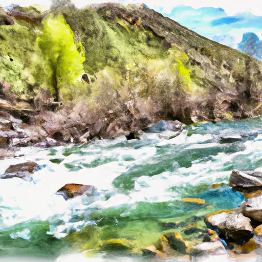
West Fork Morgan Creek
The river features several obstacles and rapids, including the Canyon Creek Rapid, where the water flows through a tight, narrow canyon, and the Flipper Rapid, where a large boulder creates a powerful wave that can flip rafts if not navigated correctly. Additionally, there are several technical sections of the river that require advanced maneuvering skills.
To preserve the natural habitat and ensure safety, there are specific regulations in place for the West Fork Morgan Creek. The use of motorized boats is prohibited, and all boaters are required to wear a personal flotation device (PFD) at all times. Additionally, there are strict guidelines for camping and waste disposal to minimize the impact on the environment.
In summary, the West Fork Morgan Creek offers an exhilarating whitewater experience for advanced kayakers and rafters seeking a challenge. With its ideal streamflow range, Class III-IV rating, and unique obstacles, it is a popular destination for outdoor enthusiasts. However, it is important to follow the specific regulations set forth to ensure safety and preserve the natural beauty of the area.
Plan your run down to the hour
Same weather feed Snoflo's iOS app uses -- updated continuously from NOAA / yr.no. Watch the precipitation column on the meteogram; rain ahead of a run typically lifts flows 12-48 hours later depending on the basin.
Next 5 days, hour by hour
Temperature line with weather symbols on top, snow + rain accumulation as columns, humidity as a dotted line.
5-day forecast table
Every 3 hours, broken out across temperature, snow, rain, humidity, and wind. Each cell is colour-coded relative to the column min/max.
| Time | Condition | Temp (°F) | Snow (in) | Rain (in) | Humidity (%) | Wind (mps) | Wind dir |
|---|---|---|---|---|---|---|---|
| Loading detailed forecast… | |||||||
15-day temperature & precipitation
Daily temperatures, snow, and rain projected over the next two weeks -- the upstream story that drives next week's flows.
Regional streamflow levels
USGS streamgauges around West Fork Morgan Creek -- useful for spotting upstream pulses and gauging which tributary is contributing what.
| Streamgauge | Discharge | View |
|---|---|---|
| Pahsimeroi River At Ellis Id | 111 cfs | → |
| Blackbird Creek Near Cobalt | 12 cfs | → |
| Squaw Creek Bl Bruno Creek Nr Clayton Id | 10 cfs | → |
| Thompson Creek Nr Clayton Id | 5 cfs | → |
| Yankee Fork Salmon River Nr Clayton Id | 94 cfs | → |
| Mf Salmon River At Mf Lodge Nr Yellow Pine Id | 759 cfs | → |
Plan a longer trip
The closest boat launches, other paddle runs, and campgrounds so a day on the water can grow into a full weekend.
Boat launches
Other river runs
- Pahsimeroi To Royal Gorge
- Headwaters To Nf Boundary
- Colston To The Town Of Salmon
- Challis Bridge To Deer Gulch
- Headwaters To Confluence With Pole Creek
Whitewater safety
- Check the flow before you run
- Use the linked-gauge card and Regional Flow panel above. Class ratings change with flow -- a Class III at low water can become Class IV+ at high water.
- Know your skill ceiling
- Pick runs comfortably below your ceiling. Cold-water and big-water runs raise the consequences of any mistake.
- Wear the right gear
- Helmet, PFD, drysuit / wetsuit when water is below 60°F. Throw bag, knife, and whistle on your person, not in the boat.
- Scout, set safety, and run with a team
- Scout new rapids on foot, set safety with throw bags above the consequence pool, and run with at least one other competent paddler.
- Respect the river
- Strainers, undercuts, low-head dams, and wood can kill at any class rating. When in doubt, portage.
Set push alerts in the Snoflo app
Save West Fork Morgan Creek as a favorite, set a discharge threshold (e.g. "alert me when flow hits 600 cfs"), and the iOS app pushes the moment the linked gauge crosses.
About West Fork Morgan Creek
What's the optimal flow for West Fork Morgan Creek?
The optimal flow depends on the section and the craft. Check the Run Details panel for the linked gauge and current status.
How fresh is the cfs reading on this page?
The linked USGS streamgauge reports continuously (every 15 minutes); Snoflo refreshes throughout the day. Hover the streamflow sparkline to read individual datapoints.
What's the whitewater class?
See the Run Details panel for the class rating Snoflo tracks for this run. Class ratings change with flow -- a Class III at low water can become Class IV in high water.
Where do I put in / take out?
Tap Directions in the hero above to open driving directions to the put-in. For shuttle planning, check the Nearby Boat Launches panel and the river run operator's site.
Can I get alerts when flows hit the optimal range?
Yes -- alerts are managed in the Snoflo iOS app. Favorite this run, set a discharge threshold, and you'll get a push the moment the gauge crosses.
Other runs near here
Snoflo-tracked paddle runs within driving distance of West Fork Morgan Creek.