Bear Creek River Run
Community Reviews
Been here? Share the conditions.
Reviews, ratings & photos are added in the free Snoflo iOS app — rate a spot, tag the conditions, and your visit is verified by location. Add or manage your reviews from the app.
Bear Creek
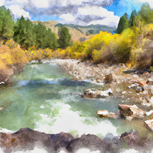
Bear Creek is a popular whitewater river run located in the state of Idaho. The ideal streamflow range for this river is between 400-800 cfs, although it can be run at lower and higher levels. It is rated as a class III-IV river, which means it has moderate to difficult rapids and obstacles that require some technical skill and experience to navigate safely. The segment mileage for Bear Creek is approximately 5 miles, which takes about 2-3 hours to complete, depending on the water level and how many stops are made along the way.
Some of the specific river rapids and obstacles on Bear Creek include the Notch, Pinball, S-Turn, and the infamous Toilet Bowl. These rapids are known for their steep drops, tight chutes, and powerful hydraulics, which can create challenging and exciting runs for experienced whitewater enthusiasts. It is important to note that these rapids can be dangerous and should only be attempted by those with proper training and equipment.
There are also specific regulations to the area that must be followed to ensure the safety and preservation of the river. These regulations include obtaining a permit from the forest service, practicing Leave No Trace principles, and respecting private property along the river banks. It is also important to be aware of any seasonal closures or restrictions due to water levels or wildlife activity.
In conclusion, Bear Creek is a thrilling and challenging whitewater river run in Idaho with a class III-IV rating and an ideal streamflow range of 400-800 cfs. It is approximately 5 miles in length and features several notable rapids and obstacles, including the Notch, Pinball, S-Turn, and Toilet Bowl. It is important to follow specific regulations and safety guidelines when navigating this river to ensure a safe and enjoyable experience.
Plan your run down to the hour
Same weather feed Snoflo's iOS app uses -- updated continuously from NOAA / yr.no. Watch the precipitation column on the meteogram; rain ahead of a run typically lifts flows 12-48 hours later depending on the basin.
Next 5 days, hour by hour
Temperature line with weather symbols on top, snow + rain accumulation as columns, humidity as a dotted line.
5-day forecast table
Every 3 hours, broken out across temperature, snow, rain, humidity, and wind. Each cell is colour-coded relative to the column min/max.
| Time | Condition | Temp (°F) | Snow (in) | Rain (in) | Humidity (%) | Wind (mps) | Wind dir |
|---|---|---|---|---|---|---|---|
| Loading detailed forecast… | |||||||
15-day temperature & precipitation
Daily temperatures, snow, and rain projected over the next two weeks -- the upstream story that drives next week's flows.
Regional streamflow levels
USGS streamgauges around Bear Creek -- useful for spotting upstream pulses and gauging which tributary is contributing what.
| Streamgauge | Discharge | View |
|---|---|---|
| Beaver Creek At Spencer Id 12n-36e-23a | 22 cfs | → |
| Red Rock Cr Ab Lakes Nr Lakeview Mt | 32 cfs | → |
| Red Rock R Bl Lima Reservoir Nr Monida Mt | 44 cfs | → |
| Medicine Lodge Creek Nr Small Id | 26 cfs | → |
| Henrys Fork Blw Coffee Pot Rapids Nr Macks Inn Id | 372 cfs | → |
| Henrys Fork Nr Island Park Id | 1,350 cfs | → |
Plan a longer trip
The closest boat launches, other paddle runs, and campgrounds so a day on the water can grow into a full weekend.
Other river runs
- Fossil Ck & Wf Madison, Sec. 27, T12s, R2w To Miner Creek, Sec. 30 T12s, R2w
- 1/4 Mi West Landon Camp, Sec. 31, T12s, R1w To Fossil Creek, Sec. 27, T12s, R2w
- 1/2 Below Landon Camp, Sec. 32, T12s, R1w To Up River 3/4 Mi, Sec. 31, T12s, R1w
- Shakelford Homestead, Sec. 26, T12s, R1w To 1/2 Mi Below Landon Camp, Sec. 32, T12s, R1w
- Dirty Ck To Elk River & Gravelly Range Road #290, Sec. 15 T11s R2w
Campgrounds
- Steel Creek Group Campground
- Al Taylor Cabin
- Upper Lake
- Upper Lake Campground
- Stoddard Creek
- Stoddard Creek Campground
Fishing spots
Whitewater safety
- Check the flow before you run
- Use the linked-gauge card and Regional Flow panel above. Class ratings change with flow -- a Class III at low water can become Class IV+ at high water.
- Know your skill ceiling
- Pick runs comfortably below your ceiling. Cold-water and big-water runs raise the consequences of any mistake.
- Wear the right gear
- Helmet, PFD, drysuit / wetsuit when water is below 60°F. Throw bag, knife, and whistle on your person, not in the boat.
- Scout, set safety, and run with a team
- Scout new rapids on foot, set safety with throw bags above the consequence pool, and run with at least one other competent paddler.
- Respect the river
- Strainers, undercuts, low-head dams, and wood can kill at any class rating. When in doubt, portage.
Set push alerts in the Snoflo app
Save Bear Creek as a favorite, set a discharge threshold (e.g. "alert me when flow hits 600 cfs"), and the iOS app pushes the moment the linked gauge crosses.
About Bear Creek
What's the optimal flow for Bear Creek?
The optimal flow depends on the section and the craft. Check the Run Details panel for the linked gauge and current status.
How fresh is the cfs reading on this page?
The linked USGS streamgauge reports continuously (every 15 minutes); Snoflo refreshes throughout the day. Hover the streamflow sparkline to read individual datapoints.
What's the whitewater class?
See the Run Details panel for the class rating Snoflo tracks for this run. Class ratings change with flow -- a Class III at low water can become Class IV in high water.
Where do I put in / take out?
Tap Directions in the hero above to open driving directions to the put-in. For shuttle planning, check the Nearby Boat Launches panel and the river run operator's site.
Can I get alerts when flows hit the optimal range?
Yes -- alerts are managed in the Snoflo iOS app. Favorite this run, set a discharge threshold, and you'll get a push the moment the gauge crosses.
Other runs near here
Snoflo-tracked paddle runs within driving distance of Bear Creek.