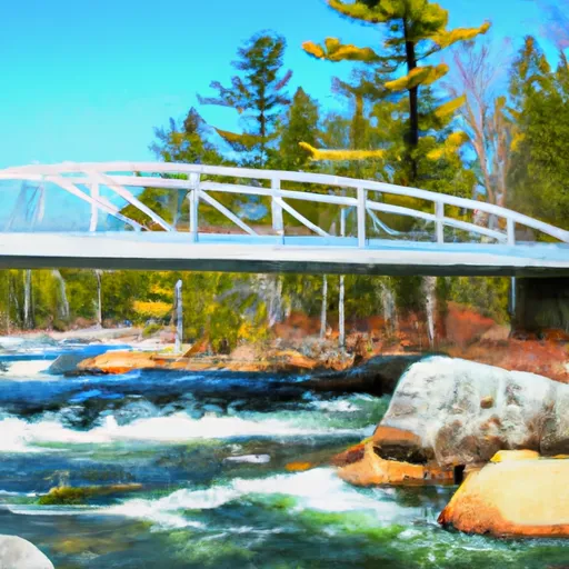
Golden Road Bridge (Approx. 2 Miles Below Lobster Stream) To Confluence With Pine Stream River Run
Community Reviews
Been here? Share the conditions.
Reviews, ratings & photos are added in the free Snoflo iOS app — rate a spot, tag the conditions, and your visit is verified by location. Add or manage your reviews from the app.
Golden Road Bridge (Approx. 2 Miles Below Lobster Stream) To Confluence With Pine Stream
The class rating for this section of the river is Class III to IV. This means that experienced paddlers with proper equipment and knowledge of the area can navigate the rapids safely. The segment mileage is approximately 5 miles long, with a mix of calm sections and challenging rapids.
There are several notable rapids and obstacles in this section of the river, including the "Green Bridge" rapid and the "Monkey Wrench" rapid. These rapids require skill and precision to navigate and can provide an exciting challenge for experienced whitewater enthusiasts.
It is important to note that there are specific regulations for this area, including a permit requirement. The Maine Department of Environmental Protection manages the area and has regulations in place to protect the natural resources and ensure safe recreation. Visitors should familiarize themselves with these regulations and obtain the necessary permits before entering the area.
Overall, the Whitewater River Run from Golden Road Bridge to Confluence with Pine Stream in Maine offers a challenging and exciting whitewater experience for experienced paddlers. It is important to respect the regulations and natural resources of the area to ensure its preservation for future generations.
Plan your run down to the hour
Same weather feed Snoflo's iOS app uses -- updated continuously from NOAA / yr.no. Watch the precipitation column on the meteogram; rain ahead of a run typically lifts flows 12-48 hours later depending on the basin.
Next 5 days, hour by hour
Temperature line with weather symbols on top, snow + rain accumulation as columns, humidity as a dotted line.
5-day forecast table
Every 3 hours, broken out across temperature, snow, rain, humidity, and wind. Each cell is colour-coded relative to the column min/max.
| Time | Condition | Temp (°F) | Snow (in) | Rain (in) | Humidity (%) | Wind (mps) | Wind dir |
|---|---|---|---|---|---|---|---|
| Loading detailed forecast… | |||||||
15-day temperature & precipitation
Daily temperatures, snow, and rain projected over the next two weeks -- the upstream story that drives next week's flows.
Regional streamflow levels
USGS streamgauges around Golden Road Bridge (Approx. 2 Miles Below Lobster Stream) To Confluence With Pine Stream -- useful for spotting upstream pulses and gauging which tributary is contributing what.
| Streamgauge | Discharge | View |
|---|---|---|
| North Branch Penobscot River Nr Pittston Farm | 45 cfs | → |
| Kennebec River At The Forks | 438 cfs | → |
| Piscataquis River At Blanchard | 12 cfs | → |
| Seboeis River Near Shin Pond | 21 cfs | → |
| East Branch Penobscot River At Grindstone | 521 cfs | → |
| Kingsbury Stream At Abbot Village | 15 cfs | → |
Plan a longer trip
The closest boat launches, other paddle runs, and campgrounds so a day on the water can grow into a full weekend.
Boat launches
- Poulin Road Maine
- Moosehead Lake (Norcross Brook)
- Moosehead Lake
- Maine
- Ragged Lake
- Moosehead Lake (Spencer Bay)
Other river runs
- Lobster Lake To Confluence With West Branch
- Pittston Farm To Golden Road Bridge (Approx. 2 Miles Below Lobster Stream)
- The North Branch Headwater From Canal Cut Approximately 1.25 Miles Upstream Of Big Bog To Pittston Farm
- Headwaters To Confluence With Penobscot River, East Branch
- Headwaters To Confluence With Penobscot River, East Branch
Whitewater safety
- Check the flow before you run
- Use the linked-gauge card and Regional Flow panel above. Class ratings change with flow -- a Class III at low water can become Class IV+ at high water.
- Know your skill ceiling
- Pick runs comfortably below your ceiling. Cold-water and big-water runs raise the consequences of any mistake.
- Wear the right gear
- Helmet, PFD, drysuit / wetsuit when water is below 60°F. Throw bag, knife, and whistle on your person, not in the boat.
- Scout, set safety, and run with a team
- Scout new rapids on foot, set safety with throw bags above the consequence pool, and run with at least one other competent paddler.
- Respect the river
- Strainers, undercuts, low-head dams, and wood can kill at any class rating. When in doubt, portage.
Set push alerts in the Snoflo app
Save Golden Road Bridge (Approx. 2 Miles Below Lobster Stream) To Confluence With Pine Stream as a favorite, set a discharge threshold (e.g. "alert me when flow hits 600 cfs"), and the iOS app pushes the moment the linked gauge crosses.
About Golden Road Bridge (Approx. 2 Miles Below Lobster Stream) To Confluence With Pine Stream
What's the optimal flow for Golden Road Bridge (Approx. 2 Miles Below Lobster Stream) To Confluence With Pine Stream ?
The optimal flow depends on the section and the craft. Check the Run Details panel for the linked gauge and current status.
How fresh is the cfs reading on this page?
The linked USGS streamgauge reports continuously (every 15 minutes); Snoflo refreshes throughout the day. Hover the streamflow sparkline to read individual datapoints.
What's the whitewater class?
See the Run Details panel for the class rating Snoflo tracks for this run. Class ratings change with flow -- a Class III at low water can become Class IV in high water.
Where do I put in / take out?
Tap Directions in the hero above to open driving directions to the put-in. For shuttle planning, check the Nearby Boat Launches panel and the river run operator's site.
Can I get alerts when flows hit the optimal range?
Yes -- alerts are managed in the Snoflo iOS app. Favorite this run, set a discharge threshold, and you'll get a push the moment the gauge crosses.
Other runs near here
Snoflo-tracked paddle runs within driving distance of Golden Road Bridge (Approx. 2 Miles Below Lobster Stream) To Confluence With Pine Stream .