Source In Sec 21, T47n, R12w To Mouth At Whitefish Bay River Run
Community Reviews
Been here? Share the conditions.
Reviews, ratings & photos are added in the free Snoflo iOS app — rate a spot, tag the conditions, and your visit is verified by location. Add or manage your reviews from the app.
Source In Sec 21, T47n, R12w To Mouth At Whitefish Bay
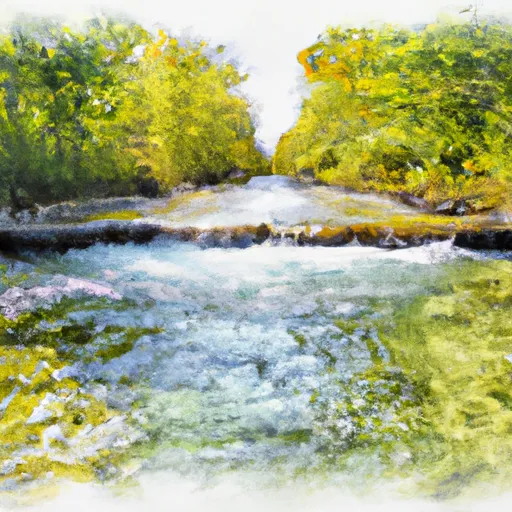
The river run from Section 21, T47N, R12W to the mouth at Whitefish Bay covers a distance of approximately 5 miles, with several rapids and obstacles along the way. One of the notable rapids is the "Seven Sisters" which is a series of seven drops in quick succession, providing a thrilling ride for paddlers. Another challenge is the "Three Bears" rapid, which requires precise maneuvering to navigate successfully.
Regulations to the area include mandatory use of personal flotation devices (PFDs) for all boaters, and a limit on the number of boats allowed on the river to prevent overcrowding. Additionally, there are restrictions on camping and fires along the riverbanks to preserve the natural beauty of the area.
Overall, the Whitewater River run on the Whitefish River offers a thrilling and challenging experience for whitewater enthusiasts. It is important to adhere to safety regulations and guidelines to ensure a safe and enjoyable experience for all.
Plan your run down to the hour
Same weather feed Snoflo's iOS app uses -- updated continuously from NOAA / yr.no. Watch the precipitation column on the meteogram; rain ahead of a run typically lifts flows 12-48 hours later depending on the basin.
Next 5 days, hour by hour
Temperature line with weather symbols on top, snow + rain accumulation as columns, humidity as a dotted line.
5-day forecast table
Every 3 hours, broken out across temperature, snow, rain, humidity, and wind. Each cell is colour-coded relative to the column min/max.
| Time | Condition | Temp (°F) | Snow (in) | Rain (in) | Humidity (%) | Wind (mps) | Wind dir |
|---|---|---|---|---|---|---|---|
| Loading detailed forecast… | |||||||
15-day temperature & precipitation
Daily temperatures, snow, and rain projected over the next two weeks -- the upstream story that drives next week's flows.
Regional streamflow levels
USGS streamgauges around Source In Sec 21, T47n, R12w To Mouth At Whitefish Bay -- useful for spotting upstream pulses and gauging which tributary is contributing what.
| Streamgauge | Discharge | View |
|---|---|---|
| Tahquamenon River Near Paradise | 400 cfs | → |
| Black River Near Garnet | 8 cfs | → |
| Manistique River Near Manistique | 776 cfs | → |
| Au Train River At Forest Lake | 137 cfs | → |
| Sturgeon River Near Nahma Junction | 81 cfs | → |
| Sturgeon River At Wolverine | 214 cfs | → |
Plan a longer trip
The closest boat launches, other paddle runs, and campgrounds so a day on the water can grow into a full weekend.
Boat launches
- Lone Pine Road
- Lone Pine Road Whitefish Township
- M 123 Whitefish Township
- West Vermillion Road Whitefish Township
- Shelldrake Road Whitefish Township
- South Fish Hatchery Road Chippewa Township
Other river runs
- East Branch From Western Forest Boundary (Sec 19, T46n, R6w) To Confluence With Mainstem
- Origin At Confluence Of Outlets Of Frenchman Lake And Carp Lake (Sec 26, T44n, R6w) To West Section Line Of Sec 30, T43n, R5w
- Section 17, T48n, R17w (Boundary Of Pictured Rocks National Lakeshore Lands) To Mouth At Lake Superior
- County Road H-58 (Aka. Adams Trail/ Munising-Van Meer-Shingleton Rd.) To Mouth At Lake Superior
- From Sixteen Mile Lake To North Line Of Sec 26, T43n, R19w
Campgrounds
- Tahquamenon Falls 1 State Park
- Tahquamenon Falls State Park Rivermouth Modern
- Old Stove
- Lower Falls Campground
- Tahquamenon Falls 2 State Park
- Naomikong Pond Campsite
Fishing spots
Points of interest
Whitewater safety
- Check the flow before you run
- Use the linked-gauge card and Regional Flow panel above. Class ratings change with flow -- a Class III at low water can become Class IV+ at high water.
- Know your skill ceiling
- Pick runs comfortably below your ceiling. Cold-water and big-water runs raise the consequences of any mistake.
- Wear the right gear
- Helmet, PFD, drysuit / wetsuit when water is below 60°F. Throw bag, knife, and whistle on your person, not in the boat.
- Scout, set safety, and run with a team
- Scout new rapids on foot, set safety with throw bags above the consequence pool, and run with at least one other competent paddler.
- Respect the river
- Strainers, undercuts, low-head dams, and wood can kill at any class rating. When in doubt, portage.
Set push alerts in the Snoflo app
Save Source In Sec 21, T47n, R12w To Mouth At Whitefish Bay as a favorite, set a discharge threshold (e.g. "alert me when flow hits 600 cfs"), and the iOS app pushes the moment the linked gauge crosses.
About Source In Sec 21, T47n, R12w To Mouth At Whitefish Bay
What's the optimal flow for Source In Sec 21, T47n, R12w To Mouth At Whitefish Bay?
The optimal flow depends on the section and the craft. Check the Run Details panel for the linked gauge and current status.
How fresh is the cfs reading on this page?
The linked USGS streamgauge reports continuously (every 15 minutes); Snoflo refreshes throughout the day. Hover the streamflow sparkline to read individual datapoints.
What's the whitewater class?
See the Run Details panel for the class rating Snoflo tracks for this run. Class ratings change with flow -- a Class III at low water can become Class IV in high water.
Where do I put in / take out?
Tap Directions in the hero above to open driving directions to the put-in. For shuttle planning, check the Nearby Boat Launches panel and the river run operator's site.
Can I get alerts when flows hit the optimal range?
Yes -- alerts are managed in the Snoflo iOS app. Favorite this run, set a discharge threshold, and you'll get a push the moment the gauge crosses.
Other runs near here
Snoflo-tracked paddle runs within driving distance of Source In Sec 21, T47n, R12w To Mouth At Whitefish Bay.