West Branch, Mi State Highway 28 To Cascade Falls River Run
Community Reviews
Been here? Share the conditions.
Reviews, ratings & photos are added in the free Snoflo iOS app — rate a spot, tag the conditions, and your visit is verified by location. Add or manage your reviews from the app.
West Branch, Mi State Highway 28 To Cascade Falls
While there are no specific regulations for this section of the river, it is important for paddlers to respect private property and obtain permission before accessing the river from private land. Additionally, paddlers should take care to minimize their impact on the environment by packing out all trash and avoiding disturbing wildlife.
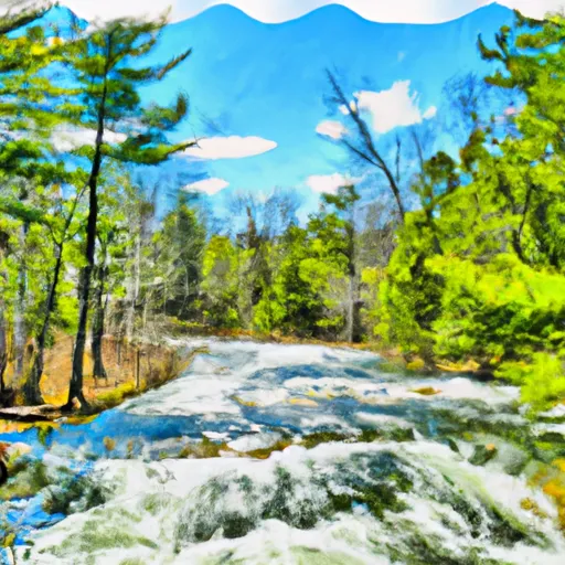
Overall, the West Branch of the Whitewater River offers a challenging and scenic paddle for experienced paddlers, with plenty of opportunities to test their skills and enjoy the natural beauty of the area. As with any river run, it is important to check current conditions and safety information before embarking on a trip, and to follow all necessary precautions to ensure a safe and enjoyable experience.
Plan your run down to the hour
Same weather feed Snoflo's iOS app uses -- updated continuously from NOAA / yr.no. Watch the precipitation column on the meteogram; rain ahead of a run typically lifts flows 12-48 hours later depending on the basin.
Next 5 days, hour by hour
Temperature line with weather symbols on top, snow + rain accumulation as columns, humidity as a dotted line.
5-day forecast table
Every 3 hours, broken out across temperature, snow, rain, humidity, and wind. Each cell is colour-coded relative to the column min/max.
| Time | Condition | Temp (°F) | Snow (in) | Rain (in) | Humidity (%) | Wind (mps) | Wind dir |
|---|---|---|---|---|---|---|---|
| Loading detailed forecast… | |||||||
15-day temperature & precipitation
Daily temperatures, snow, and rain projected over the next two weeks -- the upstream story that drives next week's flows.
Regional streamflow levels
USGS streamgauges around West Branch, Mi State Highway 28 To Cascade Falls -- useful for spotting upstream pulses and gauging which tributary is contributing what.
| Streamgauge | Discharge | View |
|---|---|---|
| West Branch Ontonagon River Near Bergland | 42 cfs | → |
| Presque Isle River Near Tula | 66 cfs | → |
| Ontonagon River Near Rockland | 696 cfs | → |
| Bond Falls Canal Near Paulding | 91 cfs | → |
| Cisco Branch Ontonagon R At Cisco Lake Outlet | 12 cfs | → |
| Middle Branch Ontonagon River Near Paulding | 147 cfs | → |
Plan a longer trip
The closest boat launches, other paddle runs, and campgrounds so a day on the water can grow into a full weekend.
Boat launches
- Railroad Street Bergland
- M 64 Bergland Township
- Lake Gogebic (East)
- Lake Gogebic State Park
- Big Iron River
- Steusser Lake
Other river runs
- South Branch,Confluence Of Cisco Branch And Tenmile Creek To Confluence With West Branch
- Minnewawa Falls To Lake Superior
- From Wagner Lake In Sec 13, T49n, R31w To Eastern Boundary Of The Ottawa Nf In Sec 12, T48n, R35@
- West Branch Net River, From Its Source In Sec 35, T48n, R34w To Confluence With Mainstem Net River In Sec 24, T46n, R34w
- Net River Mainstem, Confluence With East/West Branches To Confluence With The Mainstem Paint River
Campgrounds
- Bergland Town Park
- Ontonagon County Park
- Lake Gogebic State Park
- Lost Creek Outpost Campground
- Lake Gogebic County Park
- Union River Outpost Campground
Fishing spots
Whitewater safety
- Check the flow before you run
- Use the linked-gauge card and Regional Flow panel above. Class ratings change with flow -- a Class III at low water can become Class IV+ at high water.
- Know your skill ceiling
- Pick runs comfortably below your ceiling. Cold-water and big-water runs raise the consequences of any mistake.
- Wear the right gear
- Helmet, PFD, drysuit / wetsuit when water is below 60°F. Throw bag, knife, and whistle on your person, not in the boat.
- Scout, set safety, and run with a team
- Scout new rapids on foot, set safety with throw bags above the consequence pool, and run with at least one other competent paddler.
- Respect the river
- Strainers, undercuts, low-head dams, and wood can kill at any class rating. When in doubt, portage.
Set push alerts in the Snoflo app
Save West Branch, Mi State Highway 28 To Cascade Falls as a favorite, set a discharge threshold (e.g. "alert me when flow hits 600 cfs"), and the iOS app pushes the moment the linked gauge crosses.
About West Branch, Mi State Highway 28 To Cascade Falls
What's the optimal flow for West Branch, Mi State Highway 28 To Cascade Falls?
The optimal flow depends on the section and the craft. Check the Run Details panel for the linked gauge and current status.
How fresh is the cfs reading on this page?
The linked USGS streamgauge reports continuously (every 15 minutes); Snoflo refreshes throughout the day. Hover the streamflow sparkline to read individual datapoints.
What's the whitewater class?
See the Run Details panel for the class rating Snoflo tracks for this run. Class ratings change with flow -- a Class III at low water can become Class IV in high water.
Where do I put in / take out?
Tap Directions in the hero above to open driving directions to the put-in. For shuttle planning, check the Nearby Boat Launches panel and the river run operator's site.
Can I get alerts when flows hit the optimal range?
Yes -- alerts are managed in the Snoflo iOS app. Favorite this run, set a discharge threshold, and you'll get a push the moment the gauge crosses.
Other runs near here
Snoflo-tracked paddle runs within driving distance of West Branch, Mi State Highway 28 To Cascade Falls.