Lake Winnigigoshish To Blackwater Lake River Run
Community Reviews
Been here? Share the conditions.
Reviews, ratings & photos are added in the free Snoflo iOS app — rate a spot, tag the conditions, and your visit is verified by location. Add or manage your reviews from the app.
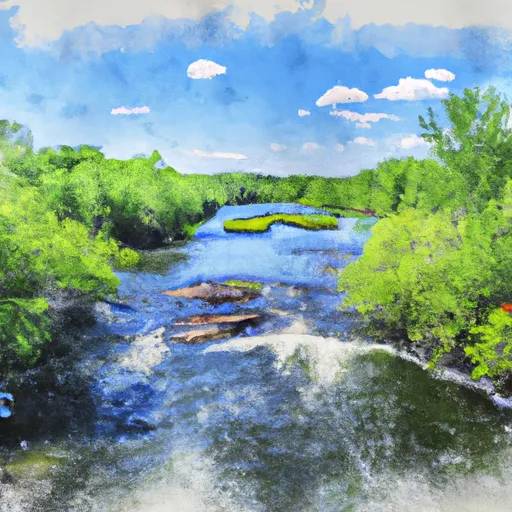
Lake Winnigigoshish To Blackwater Lake
The total segment mileage for this run is approximately 18 miles, with several rapids and obstacles along the way. Some notable rapids include the "Fishhook Rapids," "Boulder Garden Rapids," and "Dragon's Tooth Rapids." These rapids range from Class I to Class III in difficulty and require proper skill and experience to navigate safely.
There are several regulations in place for this area, including a permit requirement for overnight camping. Additionally, motorized watercraft are not allowed on this section of the river, and all boaters must wear a personal flotation device at all times.
Plan your run down to the hour
Same weather feed Snoflo's iOS app uses -- updated continuously from NOAA / yr.no. Watch the precipitation column on the meteogram; rain ahead of a run typically lifts flows 12-48 hours later depending on the basin.
Next 5 days, hour by hour
Temperature line with weather symbols on top, snow + rain accumulation as columns, humidity as a dotted line.
5-day forecast table
Every 3 hours, broken out across temperature, snow, rain, humidity, and wind. Each cell is colour-coded relative to the column min/max.
| Time | Condition | Temp (°F) | Snow (in) | Rain (in) | Humidity (%) | Wind (mps) | Wind dir |
|---|---|---|---|---|---|---|---|
| Loading detailed forecast… | |||||||
15-day temperature & precipitation
Daily temperatures, snow, and rain projected over the next two weeks -- the upstream story that drives next week's flows.
Regional streamflow levels
USGS streamgauges around Lake Winnigigoshish To Blackwater Lake -- useful for spotting upstream pulses and gauging which tributary is contributing what.
| Streamgauge | Discharge | View |
|---|---|---|
| Mississippi River At Grand Rapids | 192 cfs | → |
| Prairie River Near Taconite | 41 cfs | → |
| Mississippi River Near Bemidji | 217 cfs | → |
| Big Fork River At Big Falls | 88 cfs | → |
| Straight River Near Park Rapids | 27 cfs | → |
| Mississippi River At Aitkin | 567 cfs | → |
Plan a longer trip
The closest boat launches, other paddle runs, and campgrounds so a day on the water can grow into a full weekend.
Boat launches
- Mississippi River, Lake Winnibigoshish Rec Area
- Northland Lodge Resort And Campground
- Starck's Tamarack Lodge
- Plughat Point
- Little Winnie Lake
- Sunset Trail
Other river runs
- Cass Lake To Lake Winnibigoshish
- Dora Lake To State Highway 6
- The Confluence Of The Prairie River To The Boundary Of Logan And Workman Townships
- The Otter Tail Powerplant To Allen's Bay
- The Iron Bridge Of County Road 7 To Lake Bemidji
Campgrounds
Fishing spots
Whitewater safety
- Check the flow before you run
- Use the linked-gauge card and Regional Flow panel above. Class ratings change with flow -- a Class III at low water can become Class IV+ at high water.
- Know your skill ceiling
- Pick runs comfortably below your ceiling. Cold-water and big-water runs raise the consequences of any mistake.
- Wear the right gear
- Helmet, PFD, drysuit / wetsuit when water is below 60°F. Throw bag, knife, and whistle on your person, not in the boat.
- Scout, set safety, and run with a team
- Scout new rapids on foot, set safety with throw bags above the consequence pool, and run with at least one other competent paddler.
- Respect the river
- Strainers, undercuts, low-head dams, and wood can kill at any class rating. When in doubt, portage.
Set push alerts in the Snoflo app
Save Lake Winnigigoshish To Blackwater Lake as a favorite, set a discharge threshold (e.g. "alert me when flow hits 600 cfs"), and the iOS app pushes the moment the linked gauge crosses.
About Lake Winnigigoshish To Blackwater Lake
What's the optimal flow for Lake Winnigigoshish To Blackwater Lake?
The optimal flow depends on the section and the craft. Check the Run Details panel for the linked gauge and current status.
How fresh is the cfs reading on this page?
The linked USGS streamgauge reports continuously (every 15 minutes); Snoflo refreshes throughout the day. Hover the streamflow sparkline to read individual datapoints.
What's the whitewater class?
See the Run Details panel for the class rating Snoflo tracks for this run. Class ratings change with flow -- a Class III at low water can become Class IV in high water.
Where do I put in / take out?
Tap Directions in the hero above to open driving directions to the put-in. For shuttle planning, check the Nearby Boat Launches panel and the river run operator's site.
Can I get alerts when flows hit the optimal range?
Yes -- alerts are managed in the Snoflo iOS app. Favorite this run, set a discharge threshold, and you'll get a push the moment the gauge crosses.
Other runs near here
Snoflo-tracked paddle runs within driving distance of Lake Winnigigoshish To Blackwater Lake.