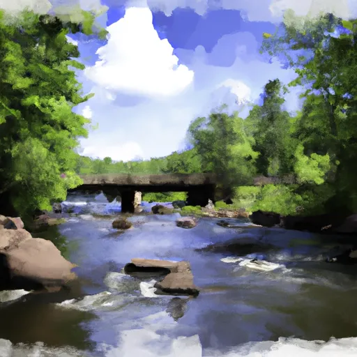
The Outlet Of Lake Itasca To The Iron Bridge Of County Road 7 River Run
Community Reviews
Been here? Share the conditions.
Reviews, ratings & photos are added in the free Snoflo iOS app — rate a spot, tag the conditions, and your visit is verified by location. Add or manage your reviews from the app.
The Outlet Of Lake Itasca To The Iron Bridge Of County Road 7
The Whitewater River Run is rated as a class I to III river, making it suitable for intermediate and advanced paddlers. The run is divided into three segments - the upper, middle, and lower sections - with each section offering unique rapids and obstacles. The upper section is the most challenging, with several class III rapids, including Pinball and Island Rapids. The middle section is less challenging but still offers exciting class II rapids, such as Cutoff and Peterson Rapids. The lower section is the easiest and most suitable for beginners.
There are specific regulations that need to be followed while paddling in the Whitewater River Run. These include wearing a personal flotation device and respecting private property. Additionally, camping is only permitted in designated sites, and fires are only allowed in established fire rings.
In conclusion, the Whitewater River Run is a thrilling destination for paddlers of all skill levels. With its ideal streamflow range, class rating, unique rapids and obstacles, and specific regulations, it offers a fantastic experience for anyone seeking an adventure on the water.
Plan your run down to the hour
Same weather feed Snoflo's iOS app uses -- updated continuously from NOAA / yr.no. Watch the precipitation column on the meteogram; rain ahead of a run typically lifts flows 12-48 hours later depending on the basin.
Next 5 days, hour by hour
Temperature line with weather symbols on top, snow + rain accumulation as columns, humidity as a dotted line.
5-day forecast table
Every 3 hours, broken out across temperature, snow, rain, humidity, and wind. Each cell is colour-coded relative to the column min/max.
| Time | Condition | Temp (°F) | Snow (in) | Rain (in) | Humidity (%) | Wind (mps) | Wind dir |
|---|---|---|---|---|---|---|---|
| Loading detailed forecast… | |||||||
15-day temperature & precipitation
Daily temperatures, snow, and rain projected over the next two weeks -- the upstream story that drives next week's flows.
Regional streamflow levels
USGS streamgauges around The Outlet Of Lake Itasca To The Iron Bridge Of County Road 7 -- useful for spotting upstream pulses and gauging which tributary is contributing what.
| Streamgauge | Discharge | View |
|---|---|---|
| Straight River Near Park Rapids | 27 cfs | → |
| Mississippi River Near Bemidji | 217 cfs | → |
| Crow Wing River At Nimrod | 144 cfs | → |
| Wild Rice River At Twin Valley | 54 cfs | → |
| Red Lake River Near Red Lake | 125 cfs | → |
| Lost River At Oklee | 14 cfs | → |
Plan a longer trip
The closest boat launches, other paddle runs, and campgrounds so a day on the water can grow into a full weekend.
Boat launches
- Brower Trail Clearwater County
- Main Park Drive Clearwater County
- Elk Lake
- Douglas Lodge
- State Highway 200 Clearwater County
- Mary Lake
Other river runs
- The Iron Bridge Of County Road 7 To Lake Bemidji
- The Otter Tail Powerplant To Allen's Bay
- Cass Lake To Lake Winnibigoshish
- Lake Winnigigoshish To Blackwater Lake
- Dora Lake To State Highway 6
Campgrounds
- Itasca State Park
- Camp Itasca
- Deer Park Lake Camp Site B10
- Wanagan Watercraft Campsite
- Long Lake County Campground
- La Salle Lake State Recreation Area Campground
Whitewater safety
- Check the flow before you run
- Use the linked-gauge card and Regional Flow panel above. Class ratings change with flow -- a Class III at low water can become Class IV+ at high water.
- Know your skill ceiling
- Pick runs comfortably below your ceiling. Cold-water and big-water runs raise the consequences of any mistake.
- Wear the right gear
- Helmet, PFD, drysuit / wetsuit when water is below 60°F. Throw bag, knife, and whistle on your person, not in the boat.
- Scout, set safety, and run with a team
- Scout new rapids on foot, set safety with throw bags above the consequence pool, and run with at least one other competent paddler.
- Respect the river
- Strainers, undercuts, low-head dams, and wood can kill at any class rating. When in doubt, portage.
Set push alerts in the Snoflo app
Save The Outlet Of Lake Itasca To The Iron Bridge Of County Road 7 as a favorite, set a discharge threshold (e.g. "alert me when flow hits 600 cfs"), and the iOS app pushes the moment the linked gauge crosses.
About The Outlet Of Lake Itasca To The Iron Bridge Of County Road 7
What's the optimal flow for The Outlet Of Lake Itasca To The Iron Bridge Of County Road 7 ?
The optimal flow depends on the section and the craft. Check the Run Details panel for the linked gauge and current status.
How fresh is the cfs reading on this page?
The linked USGS streamgauge reports continuously (every 15 minutes); Snoflo refreshes throughout the day. Hover the streamflow sparkline to read individual datapoints.
What's the whitewater class?
See the Run Details panel for the class rating Snoflo tracks for this run. Class ratings change with flow -- a Class III at low water can become Class IV in high water.
Where do I put in / take out?
Tap Directions in the hero above to open driving directions to the put-in. For shuttle planning, check the Nearby Boat Launches panel and the river run operator's site.
Can I get alerts when flows hit the optimal range?
Yes -- alerts are managed in the Snoflo iOS app. Favorite this run, set a discharge threshold, and you'll get a push the moment the gauge crosses.
Other runs near here
Snoflo-tracked paddle runs within driving distance of The Outlet Of Lake Itasca To The Iron Bridge Of County Road 7 .